Marker Logo HMdb.org THE HISTORICAL
MARKER DATABASE
“Bite-Size Bits of Local, National, and Global History”
Bar Harbor in Hancock County, Maine — The American Northeast (New England)
 

The Village Burying Ground


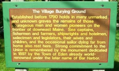
The Village Burying Ground Marker image. Click for full size.
Photographed By William Fischer, Jr., September 21, 2011
1. The Village Burying Ground Marker
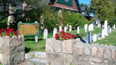
Inscription. Established before 1790 holds in many unmarked and unknown graves the remains of those courageous men and women pioneers on the frontier of downeast Maine. Sea captains, fishermen and farmers, shipwrights and hotelmen, selectmen and legislators, their wives and children, and the occasional sailor dying far from home also rest here. Strong commitment to the Union is remembered by the monument dedicated in 1897 by the Town of Eden already world-renowned under the later name of Bar Harbor.
 
Topics. This historical marker is listed in these topic lists: AgricultureCemeteries & Burial SitesIndustry & CommerceWar, US CivilWaterways & Vessels. A significant historical year for this entry is 1790.
 
Location. 44° 23.23′ N, 68° 12.395′ W. Marker is in Bar Harbor, Maine, in Hancock County. Marker is at the intersection of Mt. Desert Street (Maine Route 3) and School Street, on the right when traveling west on Mt. Desert Street. Touch for map. Marker is in this post office area: Bar Harbor ME 04609, United States of America. Touch for directions.
 
Other nearby markers. At least 8 other markers are within walking distance of this marker. St. Saviour's Episcopal Parish Welcomes You (a few steps from this marker); Civil War Memorial (a few steps from this marker); The Abbe Museum & Congregational Church / Le Musée Abbe et L'Élise Congrégationaliste (within shouting
Paid Advertisement
Click on the ad for more information.
Please report objectionable advertising to the Editor.
Click or scan to see
this page online
distance of this marker); The YWCA and Jesup Memorial Library / La YWCA et la bibliothèque Jesup (within shouting distance of this marker); Village Green (about 300 feet away, measured in a direct line); Holy Redeemer / Église de Holy Redeemer (about 500 feet away); Donald A. Wood Band Stand (about 500 feet away); Veterans Memorial (about 500 feet away). Touch for a list and map of all markers in Bar Harbor.
 
Also see . . .  Village Burying Ground at Find-A-Grave. (Submitted on April 13, 2012, by William Fischer, Jr. of Scranton, Pennsylvania.)
 
The Village Burying Ground and Marker image. Click for full size.
Photographed By William Fischer, Jr., September 21, 2011
2. The Village Burying Ground and Marker
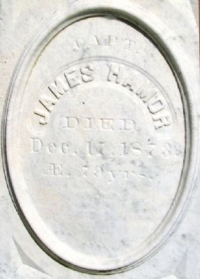
James Hamor Gravestone in Village Burying Ground image. Click for full size.
Photographed By William Fischer, Jr., September 21, 2011
3. James Hamor Gravestone in Village Burying Ground
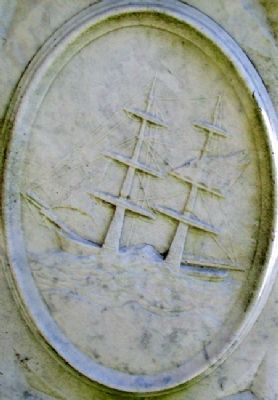
Ship's Captain
Ship Engraving on Hamor Gravestone in Village Burying Ground image. Click for full size.
Photographed By William Fischer, Jr., September 21, 2011
4. Ship Engraving on Hamor Gravestone in Village Burying Ground
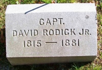
Rodick Gravestone in Village Burying Ground image. Click for full size.
Photographed By William Fischer, Jr., September 21, 2011
5. Rodick Gravestone in Village Burying Ground
Ship's Captain
 
 
Credits. This page was last revised on February 5, 2020. It was originally submitted on April 13, 2012, by William Fischer, Jr. of Scranton, Pennsylvania. This page has been viewed 837 times since then and 27 times this year. Photos:   1, 2, 3, 4, 5. submitted on April 13, 2012, by William Fischer, Jr. of Scranton, Pennsylvania.
Share this page.  
Share on Tumblr
m=54389

CeraNet Cloud Computing sponsors the Historical Marker Database.
This website earns income from purchases you make after using our links to Amazon.com. We appreciate your support.
Paid Advertisement
Apr. 26, 2024