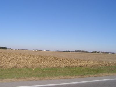
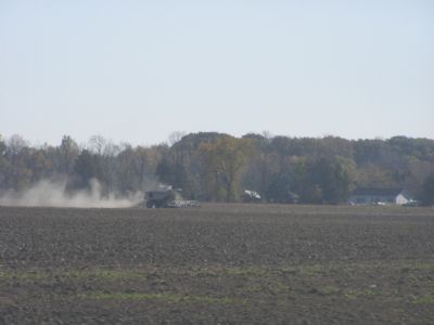
Near Ridgeville Corners in Henry County, Ohio — The American Midwest (Great Lakes)
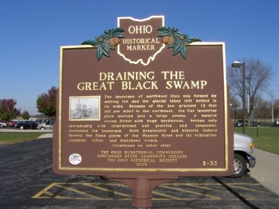
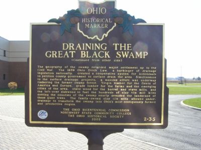
Draining the Great Black Swamp
The landscape of northwest Ohio was formed by melting ice and glacial lakes left behind in its wake. Because of the low gradient (3 feet fall per mile) to the northeast, the flat lacustrine plain evolved into a large swamp. A massive swamp forest with huge hardwoods, broken only sporadically with intermittent wet prairies and savannas, dominated the landscape. Both prehistoric and historic Indians farmed the flood plains of the Maumee River and its tributaries: Auglaize, Tiffin, and Blanchard rivers.
The geography of the swamp retarded major settlement up to the Civil war. The 1859 Ohio Ditch Law, a harbinger of drainage legislation nationally, created a cooperative system for individuals to petition county government to surface drain the area. Simultaneous to the surface drainage projects, a massive effort was underway timbering the former swamp forest. Virgin timber for the fleets of America and Europe, grade lumber for the farms and the emerging cities of the area, stave wood for the barrel and stave mills, and the left-over slabwood to fuel the hundreds of clay tile mill kilns dotting the counties of the swamp nearly denuded the landscape of these giant trees. The family-owned clay tile mills allowed under-drainage to transform the swamp into Ohio's most contiguously farmed and productive region.
Erected 2003 by The Ohio Bicentennial Commission, Northwest State Community College, The Ohio Historical Society. (Marker Number 2-35.)
Topics and series. This historical marker is listed in these topic lists: Agriculture • Environment • Natural Features • Settlements & Settlers. In addition, it is included in the Ohio Historical Society / The Ohio History Connection series list. A significant historical year for this entry is 1859.
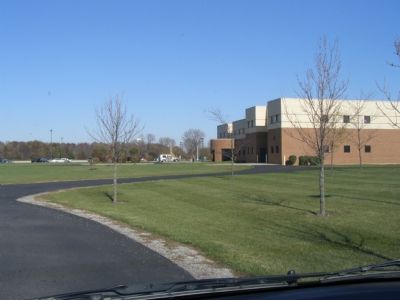
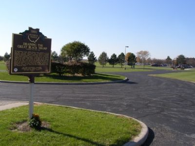
Location. 41° 27.079′ N, 84° 18.022′ W. Marker is near Ridgeville Corners, Ohio, in Henry County. Marker can be reached from Ohio Route 34, 0.4 miles east of Ohio Route 66. The marker is located in front of the main doors to the Northwest State Community College. Use the west driveway. The second road to the right is a drop-off at the front doors. The marker is on the left as you approach. To park, continue around to the back and park. You'll have to walk a little or a lot, depending on the time of day and day of the week. Touch for map. Marker is at or near this postal address: 22600 State Route 34, Archbold OH 43502, United States of America. Touch for directions.
Other nearby markers. At least 8 other markers are within 5 miles of this marker, measured as the crow flies. Giffey Hall (approx. 2.4 miles away); Ridgeville Corners War Memorial (approx. 2˝ miles away); Archbold (approx. 2.6 miles away); American Legion Post 454 Veterans Memorial (approx. 4 miles away); Veterans Memorial (approx. 4 miles away); David K. Aeschliman Memorial (approx. 4.3 miles away); Village Of Archbold (approx. 4.8 miles away); The Ohio Art Company (approx. 4.8 miles away). Touch for a list and map of all markers in Ridgeville Corners.
Related marker. Click here for another marker that is related to this marker.
Also see . . . The Great Black Swamp. The Paragraph website entry (Submitted on June 11, 2022, by Larry Gertner of New York, New York.)
Credits. This page was last revised on June 11, 2022. It was originally submitted on November 6, 2007, by Christopher Light of Valparaiso, Indiana. This page has been viewed 7,783 times since then and 76 times this year. Last updated on October 25, 2020, by Craig Doda of Napoleon, Ohio. Photos: 1, 2, 3, 4, 5, 6. submitted on November 6, 2007, by Christopher Light of Valparaiso, Indiana. • Devry Becker Jones was the editor who published this page.
