Caret in Essex County, Virginia — The American South (Mid-Atlantic)
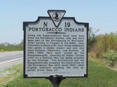
Portobacco Indians
Erected 2001 by Department of Historic Resources. (Marker Number N-19.)
Topics and series. This historical marker is listed in these topic lists: Colonial Era • Native Americans • Notable Events • Settlements & Settlers • Waterways & Vessels. In addition, it is included in the Virginia Department of Historic Resources (DHR) series list. A significant historical year for this entry is 1683.
Location. 38° 5.921′ N, 77° 4.944′ W. Marker is in Caret, Virginia, in Essex County. Marker is at the intersection of US 17 and Quarter Hill Road, on the right when traveling north on US 17. Touch for map. Marker is in this post office area: Caret VA 22436, United States of America. Touch for directions.
Other nearby markers. At least 8 other markers are within 5 miles of this marker, measured as the crow flies. Vauter's Church (approx. 1.1 miles away); Essex County / Caroline County (approx. 2˝ miles away); Saunders’s Wharf (approx. 2.8 miles away); Pissaseck Indians (approx. 4.3 miles away); Leedstown (approx. 4.3 miles away); John Pratt Hungerford (approx. 4.3 miles away); Layton’s Landing Wharf and Ferry (approx. 4˝ miles away); Early Settlement (approx. 4˝ miles away).
Also see . . . On the Road in Essex County - N-19 Portobacco Indians. 2020 article by Zorine Shirley in the River Country News.Excerpt:
The “refuge area” — referred to in the marker — is now known as Portabago Bay near Port Royal. The Rappahannocks and the Nanzaticos, also forced out by the colonists, moved to that safe haven where they stayed until about 1704. In the years following though, they were forced to disband when the governor of Virginia decided that he would no longer protect them. After 1704, there are scant references in the history pages to the Portobacco Indians. It is believed; however, that they — along with several other tribes — integrated with the more dominant Rappahannocks as their numbers dwindled.(Submitted on September 17, 2020.)
Credits. This page was last revised on September 17, 2020. It was originally submitted on April 27, 2008, by Bill Pfingsten of Bel Air, Maryland. This page has been viewed 1,770 times since then and 47 times this year. Photo 1. submitted on April 27, 2008, by Bill Pfingsten of Bel Air, Maryland.
Editor’s want-list for this marker. A wide shot of the marker and its surroundings. • Can you help?
