Near Williamsburg in James City County, Virginia — The American South (Mid-Atlantic)
Palisades
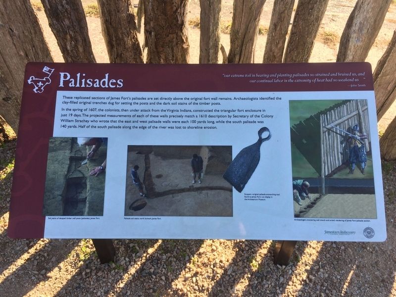
“our extreme toil in bearing and planting palisades so strained and bruised us, and our continual labor in the extremity of heat had so weakened us” – John Smith
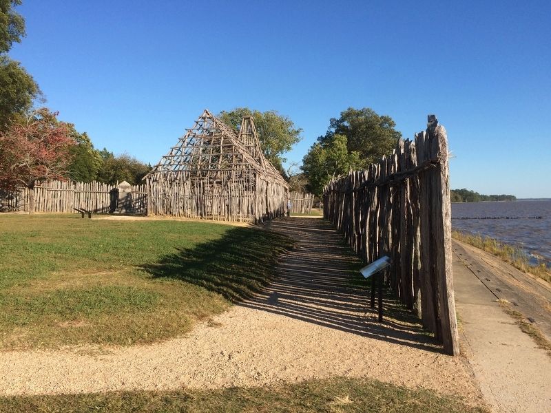
These replicated sections of James Fortís palisades are set directly above the original fort wall remains. Archaeologists identified the clay-filled original trenches dug for setting the posts and the dark soil stains of the timber posts.
In the spring of 1607, the colonists, then under attack from the Virginia Indians, constructed the triangular fort enclosure in just 19 days. The projected measurements of each of these walls precisely match a 1610 description by Secretary of the Colony William Strachey who wrote that the east and west palisade walls were each 100 yards long, while the south palisade was 140 yards. Half of the south palisade along the edge of the river was lost to shoreline erosion.
Captions:
Soil stains of decayed timber wall posts (palisades), James Fort.
Palisade soil stains, north bulwark, James Fort.
Scuppet – original palisade entrenching tool found at James Fort - on display in the Archaearium Museum.
Archaeologist uncovering wall trench and artistís rendering of James Fort palisade section.
Erected by Jamestown Rediscovery Project.
Topics. This historical marker is listed in these topic lists: Colonial Era • Forts and Castles • Man-Made Features • Settlements & Settlers. A significant historical year for this entry is 1607.
Location. 37° 12.493′ N, 76° 46.724′ W. Marker is near Williamsburg, Virginia, in James City County. Marker can be reached from Colonial Parkway. The marker is at the Jamestown National Historic Site, a few steps west of the reconstructed barracks. Touch for map. Marker is in this post office area: Jamestown VA 23081, United States of America. Touch for directions.
Other nearby markers. At least 8 other markers are within walking distance of this marker. Captain John Smith (a few steps from this marker); a different marker also named Captain John Smith (a few steps from this marker); The Barracks (within shouting distance of this marker); Church Tower (within shouting distance of this marker); 1608 Church (within shouting distance of this marker); Storehouse & First Well (within shouting distance of this marker); a different marker also named Barracks (within shouting distance of this marker); The First General Assembly of Virginia (within shouting distance of this marker). Touch for a list and map of all markers in Williamsburg.
Credits. This page was last revised on December 1, 2016. It was originally submitted on December 1, 2016, by J. Makali Bruton of Accra, Ghana. This page has been viewed 512 times since then and 27 times this year. Photos: 1, 2. submitted on December 1, 2016, by J. Makali Bruton of Accra, Ghana.

