Near Williamsburg in James City County, Virginia — The American South (Mid-Atlantic)
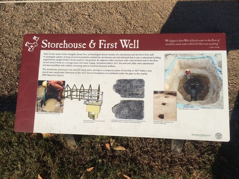
Storehouse & First Well
“We digged a faire Well of fresh water in the Fort of excellent, sweet water which till then was wanting.” - John Smith
Here, at the center of the triangular James Fort, archaeologists found remains of a storehouse and the fort’s first well. A rectangular pattern of large structural postholes marked the storehouse site and indicated that it was a substantial building supported by upright timbers firmly seated in the ground. An adjacent cellar structure with a barrel-lined well in the floor served concurrently, as a storage space and water supply. Sometime before 1611 the well and cellar were abandoned and then backfilled with rubbish containing several hundred thousand artifacts.
The storehouse continued to be used for many years, serving as a temporary place of worship in 1617 while a new church was constructed. Remnants of the 1617 church foundations are exhibited under the glass in the nearby 1907 Memorial Church.
Captions:
Archaeologist examining the wooden barrel well liner
Artist’s partial reconstruction of the storehouse and attached cellar/well
Archaeologists discovered words and drawings on both sides of this slate tablet found in the well – on display in the Archaearium Museum.
Three timber support postholes from the storehouse’s western wall
Open cellar/well at the water table level
Erected by Jamestown Rediscovery Project.
Topics. This historical marker is listed in these topic lists: Colonial Era • Man-Made Features • Settlements & Settlers. A significant historical year for this entry is 1611.
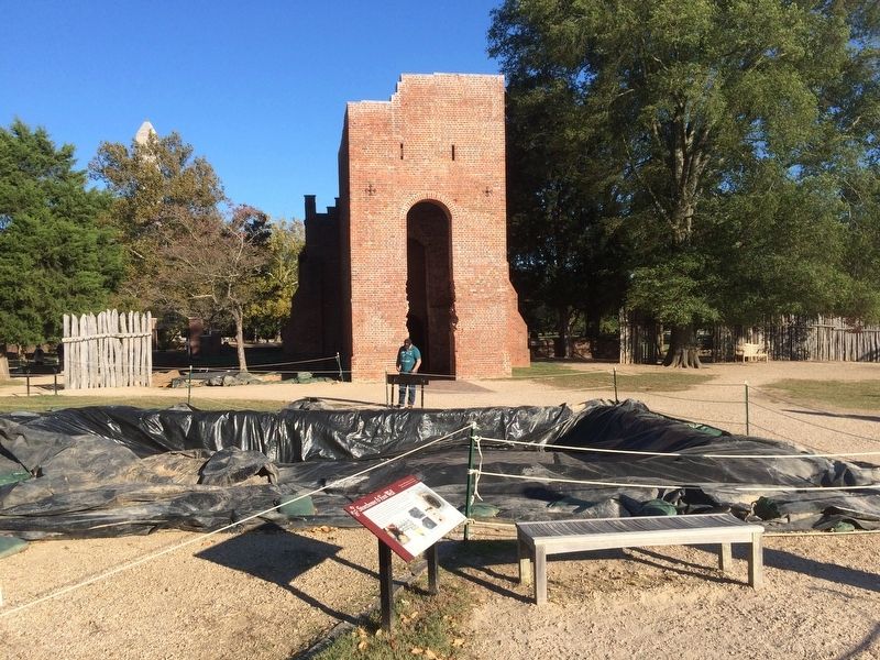
Location. 37° 12.512′ N, 76° 46.723′ W. Marker is near Williamsburg, Virginia, in James City County. Marker can be reached from Colonial Parkway. The marker is at the Jamestown National Historic Site, some few steps west of the entrance to the Memorial Church. Touch for map. Marker is in this post office area: Jamestown VA 23081, United States of America. Touch for directions.
Other nearby markers. At least 8 other markers are within walking distance of this marker. 1608 Church (a few steps from this marker); Church Tower (a few steps from this marker); Jamestown’s Churches (a few steps from this marker); Captain John Smith (a few steps from this marker); a different marker also named Captain John Smith (within shouting distance of this marker); James Fort Site 1607 – 1624 (within shouting distance of this marker); Palisades (within shouting distance of this marker); Pocahontas (within shouting distance of this marker). Touch for a list and map of all markers in Williamsburg.
Credits. This page was last revised on December 2, 2016. It was originally submitted on December 1, 2016, by J. Makali Bruton of Accra, Ghana. This page has been viewed 401 times since then and 22 times this year. Photos: 1, 2. submitted on December 2, 2016, by J. Makali Bruton of Accra, Ghana.

