Pisté in Tinum, Yucatán, Mexico — The Southeast (Yucatan Peninsula)
The Church
La Iglesia
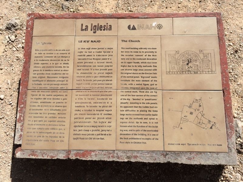
Este pequeño edificio de un solo cuarto debe su nombre a su cercania al supuesto “convento” de Las Monjas y a la exuberante decoración de su fachada superior a la que se añade, ademas, una cresteria volante. En las grecas de la moldura central se observan grandes áreas recubiertas del estuco original. Mascarones narigudos constituyen el elemento principal de la fachada, con un personaje sentado - dios o ancestro - integrado sobre la nariz del mascarón central, asi como figuras de los cuatro cargadores de las esquinas del cielo - bacabes o pauahtunes - , arrodillados en paneles laterales. En la cresteria se observa que el constructor tuvo dificultades para acomodar los tres grandes mascarones rescatados de edificios anteriores y que optó por suprimir detalles. Hasta el momento se desconoce la función que cumplía este edificio que, a pesar de lo sobrecargada de su decoración, es uno de los logrados de la arquitectura del estilo Puuc en Chichén Itzá.
Maya-Yucateco:
Le K’u’ Najo’
Le chan najil chéen juntúul u mejen najile’ku taal u k’aaba’ tyo’olal u naats’ilil yéetel le k’aba’ata’an je’ex “convento”il Las Monjaso’ yéetel ti’ u seten jats’utsil u ka’anal táanil, ka’analkinsa’an xan tumen jump’éel xóot’ ka’anal. Ti’ u táas ja’atsilil yaan tu chúumukile’ ku yila’al nojoch xóot’o’ob yéetel u yáax chichkunta’an luuk’il. Tu táanile’ jach yaan pix icho’ob nojoch u ni’ob, yéetel juntúul kula’an máak k’uj wa chi’ija’an chi’i’ibal, tak’a’an yóok’ol u ni’ le chúumukil pix icho’ yéetel boono’obil le jantúul jkuucho’obil u ti’its la ka’ano’, bacabo’ob wa pawajtuuno’ob, xola’ano’ob ti’ u tséelilo’ob. Tu ka’anlile’ ku yila’al chichchaj u ts’a’abal le óoxp’éel nojoch pix icho’ob kaxta’abo’ob ti’ úuchben pak’ilo’ob yéetel ma’ jts’a’ab uláak’ jats’utskino’obi’. Tak bejla’e’ ma’ ojéelta’an ba’ax u meyaj ka’ach le naja’ kex, jach chuup u ja’atsile’, jump’éel u chiikulil maas jats’uts u pak’ilo’ob u betpajlil Pu’uk ich Chi’ ch’e’en itsa’.
English:
The Church
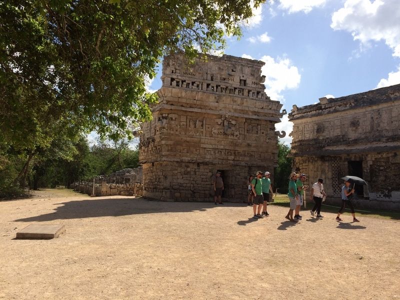
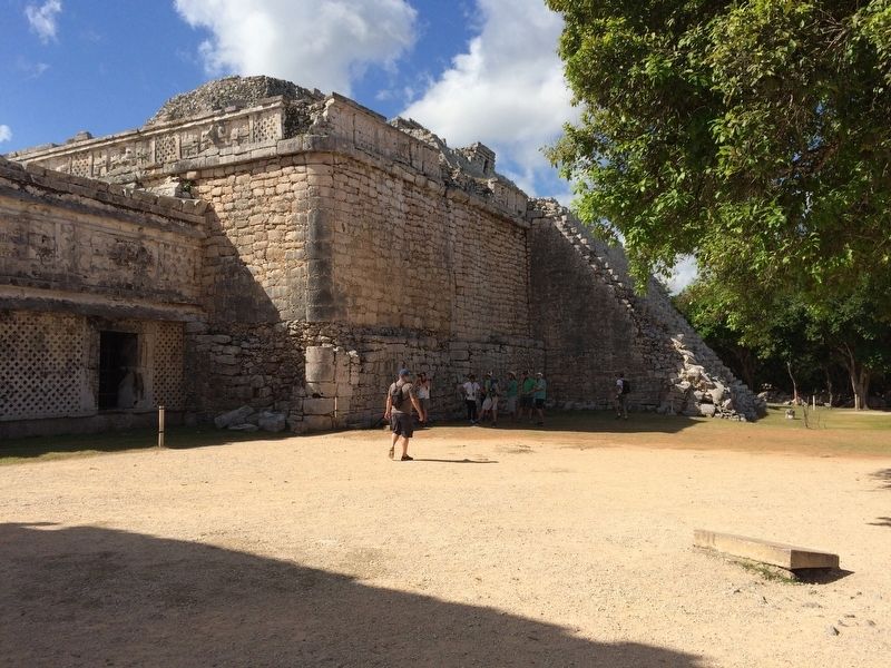
This small building with only one chamber owes its name to its proximity to the so-called “convent” of the Nunnery and to the exuberant decoration on its upper facade, which rises even higher due to its lofty roofcomb. One can observe large areas covered with the original stucco on the Grecian frets or the central panel. “Bignosed” masks constitute the main element of the facade, with a seated figure, god or ancestor integrated upon the nose of the central mask. There also are figures of the four carriers of the corners of the sky, “bacabes” or “pauahtunes” (dwarfs)- kneeling in the side panels. Its appearent that the builder had
certain difficulties in placing the three large masks rescued from earlier buildings on the roofcomb and opted to supress detail. Up to now, it is not known what the function of this building was, and in spite of the overloaded decoration of the building, it is one of the best architectural examples of the Puuc style in Chichén Itzá.
Erected by Instituto Nacional de Antropología e Historia (INAH).
Topics. This historical marker is listed in these topic lists: Anthropology & Archaeology • Architecture • Man-Made Features • Native Americans.
Location. 20° 40.701′ N, 88° 34.264′ W. Marker is in Pisté, Yucatán, in Tinum. Marker can be reached from Carretera Costera de Golfo (Route 180). The marker is just north of "The Church" and "Las Monjas" complex at Chichén Itzá Archaeological Site. Touch for map. Marker is in this post office area: Pisté YU 97751, Mexico. Touch for directions.
Other nearby markers. At least 8 other markers are within walking distance of this marker. The Nunnery Patios and Ball Court (within shouting distance of this marker); The Observatory (about 120 meters away, measured in a direct line); House of the Grinding Stones & House of the “Mestizas” (approx. 0.3 kilometers away); Platform of the Tombs (approx. 0.3 kilometers away); Platform of Venus and Round Platform
(approx. 0.3 kilometers away); The Ossuary or Tomb of the Great Priest (approx. 0.3 kilometers away); Temple of Xtoloc (approx. 0.4 kilometers away); Sacbeob 5 & 15 (approx. 0.4 kilometers away). Touch for a list and map of all markers in Pisté.
Credits. This page was last revised on March 14, 2017. It was originally submitted on March 14, 2017, by J. Makali Bruton of Accra, Ghana. This page has been viewed 285 times since then and 7 times this year. Photos: 1, 2, 3, 4. submitted on March 14, 2017, by J. Makali Bruton of Accra, Ghana.


