Zona Sin Asignación de Nombre in San Francisco de Campeche in Campeche, Mexico — The Southeast (Yucatan Peninsula)
The Redoubt of San Miguel
Photographed by J. Makali Bruton, January 21, 2017
1. The Redoubt of San Miguel Marker
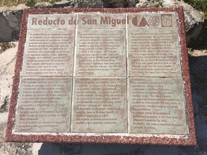
Reducto de San Miguel
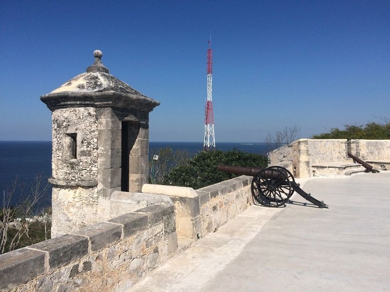
La protección de la ciudad de Campeche se completó con la construcción de seis fortificaciones en su exterior: tres al poniente de puerto y tres al oriente. El Reducto de San Miguel, cuya obra fue concluida en 1801, se encuentra al poniente. Fue proyectado, en 1779, por el Ingeniero Agustín Crame. Dos años después se le hicieron mejoras por orden del Gobernador Rivas Betancour: los trabajos estuvieron a cargo del Ingeniero Juan José de León.
Finalmente, se efectuaron algunas modificaciones en el año de 1801, bajo la dirección de don Leandro Poblaciones. El inmueble contiene un puente levadizo, cuerpo de guardia, cuarto de oficial, alojamiento del comandante, cuartel, almacén de pólvora y otros almacenes. El pasillo de acceso, de forma ondulada, formó parte del sistema defensivo: evitaba la entrada franca de los proyectiles y dificultaba, así, el ataque del enemigo.
En este bastión, el Presidente Santa Anna instaló un cuartel cuando, en 1842, atacó Campeche.
En la actualidad su espacio se encuentra destinado a albergar actividades culturales.
French:
La protection de la ville de Campeche fut complétée avec
this page online
L’immeuble contient un pont levis, un corps de garde, une chambre pour l’officier, le logement du commandant, la caserne, l’entrepôt de poudre et autres entrepôts. Le couloir d’acces, de forme ondulée, faisait partie du système de défense: il évitait l’entrée directé des projectils et de cette facon rendait difficile l’attaque de l’ennemi.
Le Président Santa Anna a installé un quartier dans ce Bastion quand il a ataqué Campeched en 1842.
Cet espace se trouve actuellement destiné à des activités culturelles.
English:
The protection of the city of Campeche was completed with the construction of six fortifications around its exterior. Three were to the west of the port and three to the east.
Photographed by J. Makali Bruton, January 21, 2017
2. The Redoubt of San Miguel Marker
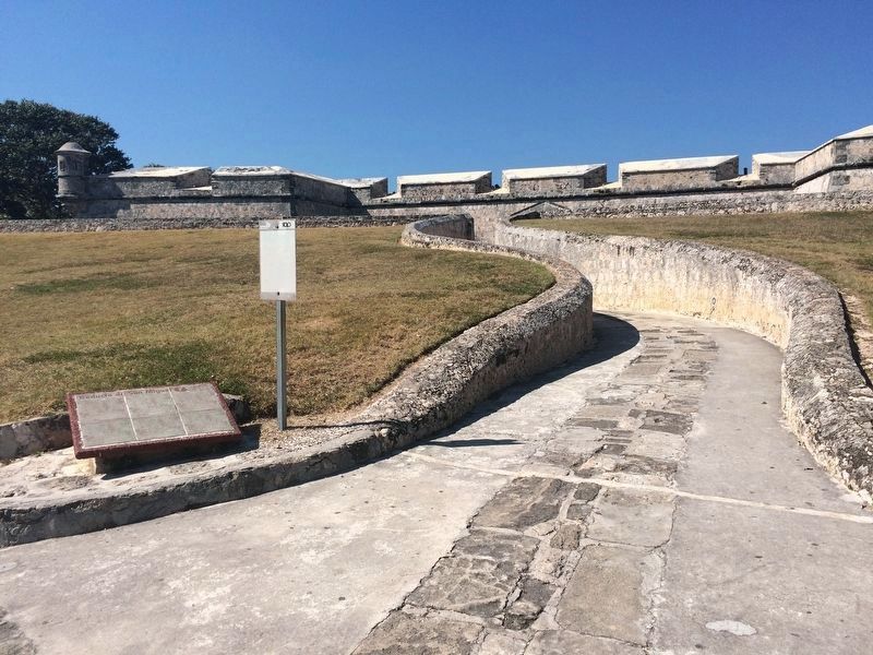
Note the "oval entrance passageway" to the right mentioned in the marker text.
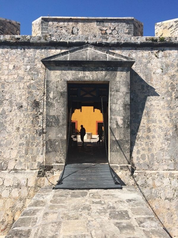
The structure contains a drawbridge, guardhouse, officer’s room, commander’s quarters, barracks, warehouse for gunpowder and other storage areas. The oval entrance passageway formed part of the defense system as it prevented the free entry of proyectiles, thereby making an enemy attack difficult.
President Santa Anna installed provisional quarters in this fort when he attacked Campeche in 1842.
Presently, the area is destined to house cultural activities.
Erected by Consejo Nacional para la Cultura y las Artes de México (CONACULTA)-INAH.
Topics. This historical marker is listed in these topic lists: Colonial Era • Forts and Castles • Man-Made Features • Wars, Non-US. A significant historical year for this entry is 1801.
Location. 19° 49.459′ N, 90° 34.102′ W.
Photographed by J. Makali Bruton, January 21, 2017
3. The Redoubt of San Miguel Marker

Regionally, this marker is in the Mexican Gulf Coast, in the Maya Heartland, and on the Yucatán Peninsula. Globally, it is in North America, Mesoamerica, a Gulf of Mexico state, and the Western Hemisphere. Historically, it finds itself in what was once New Spain and also a Spanish colony.
Other nearby markers. At least 8 other markers are within 5 kilometers of this marker, measured as the crow flies: 100th Anniversary of the Birth of Justo Sierra (approx. 2.4 kilometers away); The Bastion of San Carlos (approx. 3.7 kilometers away); Governor's Palace (approx. 3.8 kilometers away); House of Pablo García y Montilla (approx. 3.8 kilometers away); “Tukulná” Handicrafts House (approx. 3.9
Photographed by J. Makali Bruton, January 21, 2017
4. The drawbridge of the Redoubt of San Miguel, mentioned in the marker text.
Photographed by J. Makali Bruton, January 21, 2017
5. The Redoubt of San Miguel Marker
Photographed by J. Makali Bruton, January 21, 2017
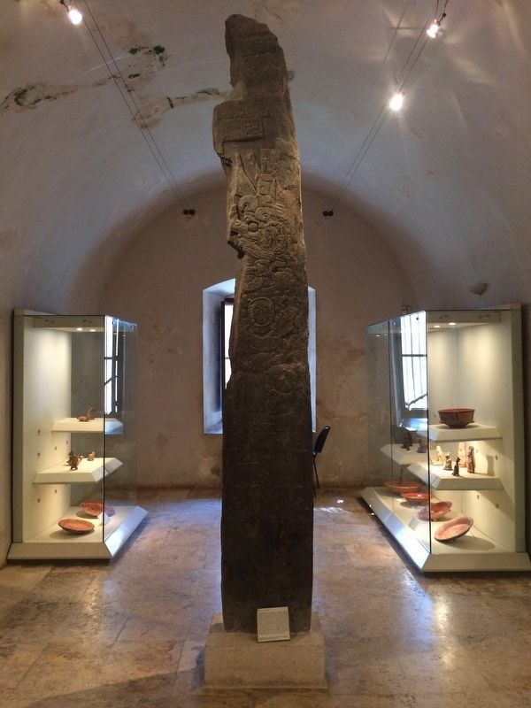
6. Stela 9 from Calakmul at the Archaeological Museum of the Redoubt of San Miguel
The museum at the Redoubt of San Miguel holds many important pieces from Campeche Maya sites such as Calakmul and Edzná.
Credits. This page was last revised on April 29, 2017. It was originally submitted on April 29, 2017, by J. Makali Bruton of Washington, District of Columbia. This page has been viewed 248 times since then and 15 times this year. Photos: 1, 2, 3, 4, 5, 6. submitted on April 29, 2017, by J. Makali Bruton of Washington, District of Columbia.
