Near Lawrence in Douglas County, Kansas — The American Midwest (Upper Plains)
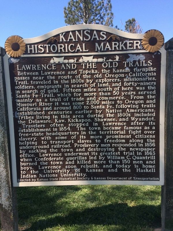
Lawrence and the Old Trails
Photographed by William J. Toman, May 6, 2017
1. Lawrence and the Old Trails Marker
Travelers often stopped in Lawrence after its establishment in 1854. The town became famous as a free-state headquarters in the territorial fight over slavery, with some of its more prominent citizens helping to transport slaves to freedom along the underground railroad. Proslavery men responded in 1856 by sacking the town and destroying the newspaper office. Lawrence underwent its greatest trial in 1863 when Confederate guerillas led by William C. Quantrill burned the town and killed more than 150
this page online
Erected by Kansas State Historical Society & Kansas Department of Transportation. (Marker Number 9.)
Topics. This historical marker is listed in these topic lists: Abolition & Underground RR • Indigenous Peoples and Communities • Settlements & Settlers • War, US Civil. A significant historical year for this entry is 1854.
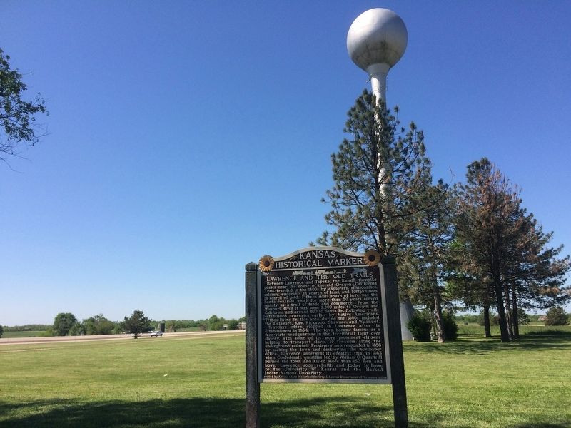
Location. 39° 1.138′ N, 95° 8.242′ W. Marker is near Lawrence, Kansas, in Douglas County. It is on Interstate 70 at milepost 209, in the median. The marker is in the Lawrence turnpike service area. Touch for map. Marker is in this post office area: Lawrence KS 66044, United States of America. Touch for directions.

Regionally, this marker is in Eastern Kansas and specifically in Bleeding Kansas Border War Country. It is also in the American Midwest, in the Corn Belt, on the prairies, on the Southern Plains, and on the Santa Fe Trail Corridor. Globally, it is in North America, the Western Hemisphere, the Western World, and the Anglosphere. Historically, it finds itself
Photographed by William J. Toman, May 6, 2017
2. Lawrence and the Old Trails Marker
Other nearby markers. At least 8 other markers are within 6 miles of this marker, measured as the crow flies: Kansas River Flood Levels (approx. 5.2 miles away); 4 East 7th Street (approx. 5.4 miles away); Eudora's First Bell (approx. 5.4 miles away); 701 Main Street (approx. 5.4 miles away); 700 Main Street (approx. 5.4 miles away); 707 Main Street (approx. 5.4 miles away); 711 Main Street (approx. 5.4 miles away); 715 Main Street (approx. 5½ miles away).
Credits. This page was last revised on May 6, 2017. It was originally submitted on May 6, 2017, by William J. Toman of Green Lake, Wisconsin. This page has been viewed 844 times since then and 61 times this year. Photos: 1, 2. submitted on May 6, 2017, by William J. Toman of Green Lake, Wisconsin.
