Near San Miguel de Allende, Guanajuato, Mexico — The Central Highlands (North America)
Layout and Architecture
Traza y arquitectura
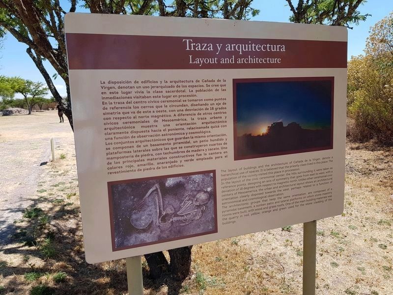
La disposición de los edificios y la arquitectura de Cañada de la Virgen denotan un uso jerarquizados de los espacios. Se cree que en este lugar vivía la clase sacerdotal. La población de las inmediaciones visitaban este lugar en procesión.
En la traza del centro cívico ceremonial se tomaron como puntos de referencia los cerros que le circundan, diseñando un eje de simetría que va de este a oeste, con una desviación de 18 grados con respecto al norte magnético. A diferencia de otros centros cívicos ceremoniales de Mesoamérica, la traza urbana y arquitectónica muestra una orientación arquitectónica claramente dispuesta hacia el poniente, relacionada quizá con una función de observación astronómica y cosmológica.
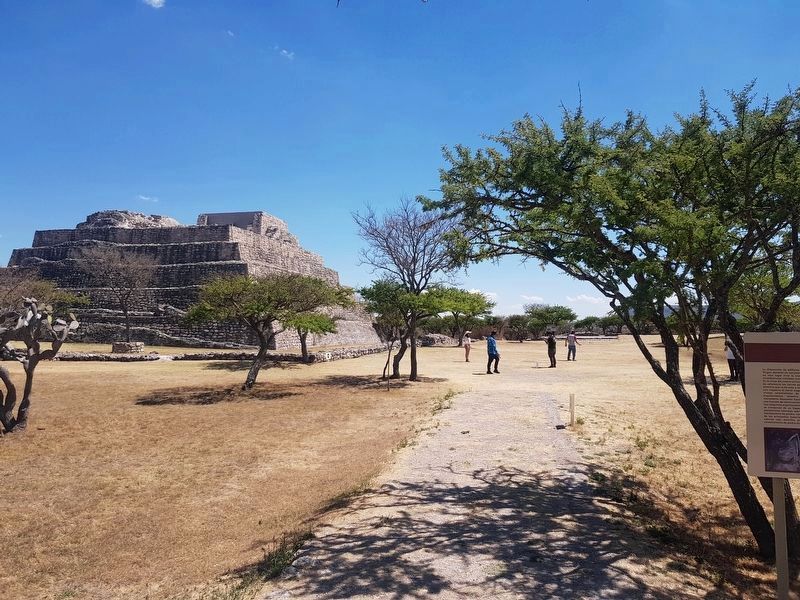
Los conjuntos arquitectónicos, que guardan la misma orientación, se componen de un basamento piramidal, un patio hundido y plataformas laterales sobre las que se construyeron cuartos de mampostería de piedra, con techumbres de madera y zacate. Uno de los principales materiales constructivos fue la cantera en colores rojo, amarillo, anaranjado y verde empleada para el revestimiento de piedra en los edificios.
English:
Layout and architecture
The layout of the buildings and the architecture of Cañada de la Virgen, denote a hierarchical use of spaces. It is believed that the priestly caste lived in this space. The population of the vicinity visited this place in procession.
The layout of the civic ceremonial center, the hills surrounding it were taken as reference points, designing an axis or symmetry that goes from east to west, with a deviation of 18 degrees with respect to magnetic north. Unlike other ceremonial civic centers of Mesoamerica, the urban and architectural layout shows and architectural orientation clearly disposed towards the west, perhaps related to a function of astronomical and cosmological observation.
The architectonic groups that keep the same orientation, are composed of a pyramidal basement, a sunken patio and lateral platforms on which stone masonry rooms were built, with wood and grass roofs. One of the main building materials was the quarry in red, yellow, orange and green used for the stone cladding of the buildings.
Erected by Consejo Nacional para la Cultura y las Artes de México (CONACULTA)-INAH.
Topics. This historical marker is listed in these topic lists: Anthropology & Archaeology • Man-Made Features • Native Americans.
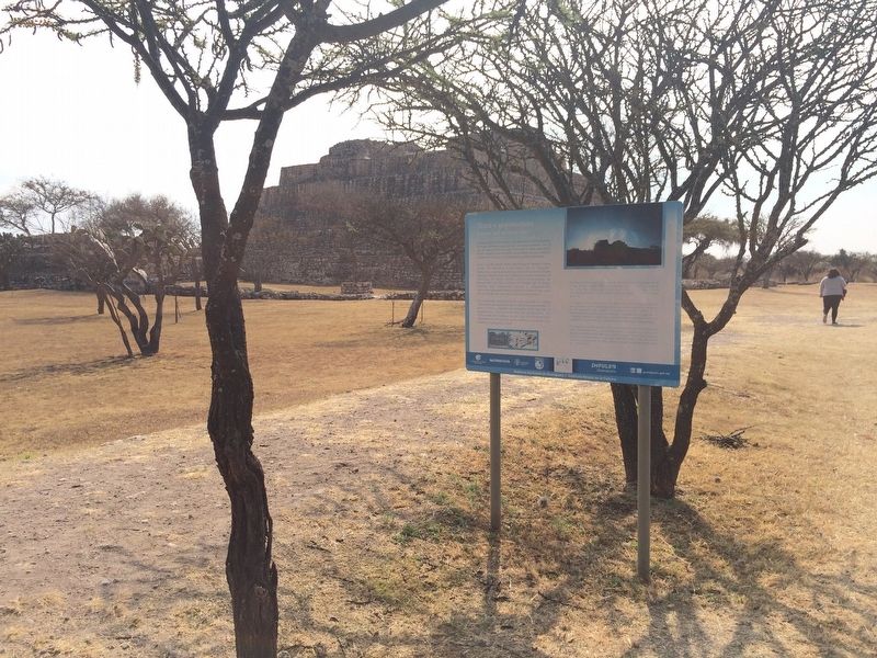
Location. 20° 51.521′ N, 100° 55.74′ W. Marker is near San Miguel de Allende, Guanajuato. Marker can be reached from Route 67. The marker is at the archaeological site of Cañada de la Virgen, to the left when traveling north on State Road 67, some 30 km west of San Miguel de Allende. Touch for map. Marker is in this post office area: San Miguel de Allende GTO 37701, Mexico. Touch for directions.
Other nearby markers. At least 8 other markers are within walking distance of this marker. Complex D. The wind house. (The house of the wind) (within shouting distance of this marker); Burial 13 The hierarch and ancestral veneration (within shouting distance of this marker); Complex B: The House of the Longest Night (about 90 meters away, measured in a direct line); Burial 18 The Decapitated Man (about 90 meters away); Observing the Stars (about 120 meters away); Complex A The House of the Thirteen Heavens (about 120 meters away); Cañada de la Virgen: A Ceremonial Civic Center in the Laja River Basin Marker (about 180 meters away); Ceremonial Road (about 210 meters away). Touch for a list and map of all markers in San Miguel de Allende.
Regarding Layout and Architecture. The previous marker text was slightly different.
It read:
Traza y arquitectura
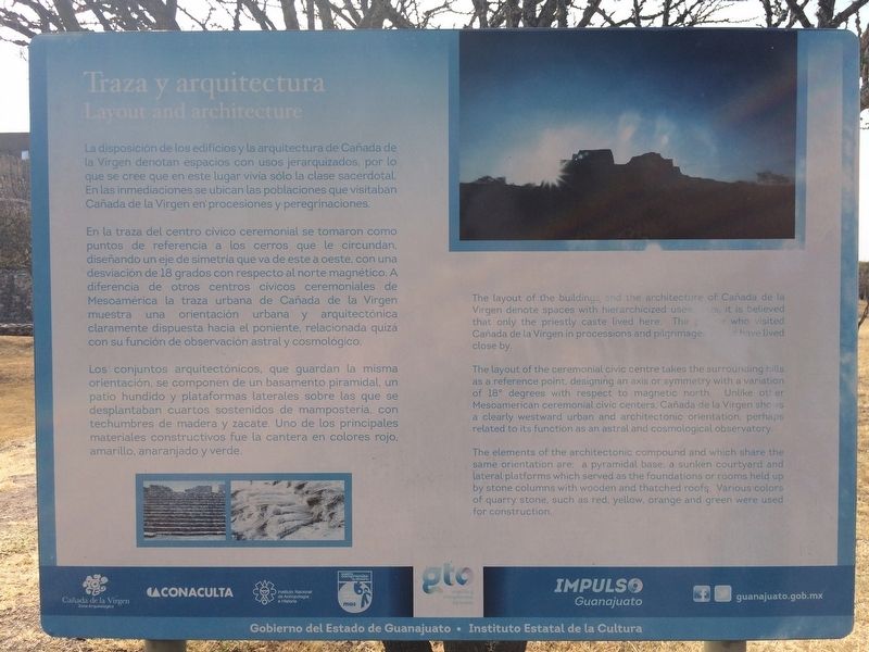
La disposición de los edificios y la arquitectura de Cañada de la Virgen denotan espacios con usos jerarquizados, por lo que se cree que en este lugar vivía sólo la clase sacerdotal. En las inmediaciones se ubican las poblaciones que visitaban Cañada de la Virgen en procesiones y peregrinaciones.
En la traza del centro cívico ceremonial se tomaron como puntos de referencia a los cerros que le circundan, diseñando un eje de simetría que va de este a oeste, con una desviación de 18 grados con respecto al norte magnético. A diferencia de otros centros cívicos ceremoniales de Mesoamérica la traza urbana de Cañada de la Virgen muestra una orientación urbana y arquitectónica claramente dispuesta hacia el poniente, relacionada quizá con su función de observación astral y cosmológico.
Los conjuntos arquitectónicos, que guardan la misma orientación, se componen de un basamento piramidal, un patio hundido y plataformas laterales sobre las que se desplantaban cuartos sostenidos de mampostería, con techumbres de madera y zacate. Uno de los principales materiales constructivos fue la cantera en colores rojo, amarillo, anaranjado y verde.
English:
Layout and architecture
The layout of the buildings and the architecture of Cañada de la Virgen denote spaces with hierarchicized uses: thus, it is believed that only the priestly caste lived here. The people who visited Cañada de la Virgen in processions and pilgrimages would have lived close by.
The layout of the ceremonial civic centre takes the surrounding hills as a reference point, designing an axis or symmetry with a variation of 18° degrees with respect to magnetic north. Unlike other Mesoamerican ceremonial civic centers, Cañada de la Virgen shows a clearly westward urban and architectonic orientation, perhaps related to its function as an astral and cosmological observatory.
The elements of the architectonic compound and which share the same orientation are: a pyramidal base, a sunken courtyard and lateral platforms which served as the foundations or rooms held up by stone columns with wooden and thatched roofs. Various colors of quarry stone, such as red, yellow, orange and green were used for construction.
Credits. This page was last revised on September 1, 2020. It was originally submitted on June 6, 2017, by J. Makali Bruton of Accra, Ghana. This page has been viewed 115 times since then and 9 times this year. Photos: 1. submitted on November 11, 2019, by J. Makali Bruton of Accra, Ghana. 2. submitted on June 6, 2017, by J. Makali Bruton of Accra, Ghana. 3. submitted on November 11, 2019, by J. Makali Bruton of Accra, Ghana. 4. submitted on June 6, 2017, by J. Makali Bruton of Accra, Ghana. 5. submitted on November 11, 2019, by J. Makali Bruton of Accra, Ghana.
