Teotihuacán de Arista in Teotihuacán, Mexico State, Mexico — The Central Highlands (North America)
The Importance of the Pyramid of the Sun
Photographed by J. Makali Bruton, June 28, 2017
1. The Importance of the Pyramid of the Sun Marker
Inscription.
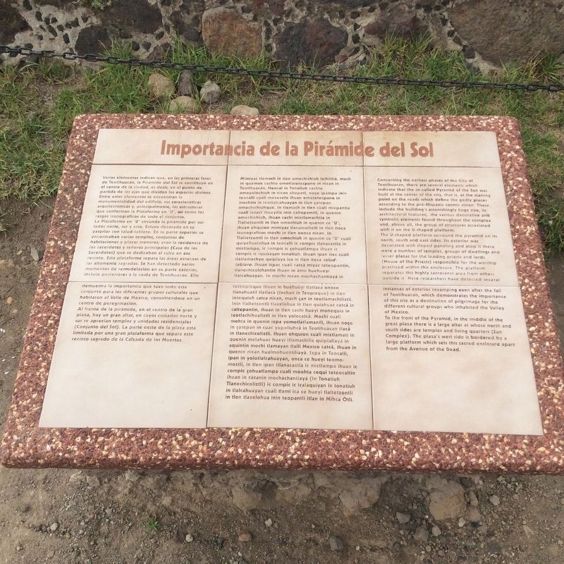
Importancia de la Pirámide del Sol
Varios elementos indican que, en las primeras fases de Teotihuacan, la Pirámide del Sol se constituyó en el centro de la ciudad, es decir, en el punto de partida de los ejes que dividen los espacios divinos. Entre estos elementos se encuentran la monumentalidad del edificio, sus características arquitectónicas y, principalmente, las estructuras que conforman la Plataforma en “U”, así como los rasgos iconográficos de todo el conjunto. La Plataforma en “U” circunda la pirámide por sus lados norte, sur y este. Estuvo decorada en su exterior con talud-tablero. En su parte superior se encontraban varios templos, conjuntos de habitaciones y plazas menores; eran la residencia de los sacerdotes y señores principales (Casa de los Sacerdotes) que se dedicaban al culto en ese recinto. Esta plataforma separa las areas externas de las altamente sagradas. Se han detectado varios momentos de remodelacion en su parte exterior, incluso posteriores a la caída de Teotihuacan. Ello demuestra la importancia que tuvo todo este
conjunto para los diferentes grupos culturales que
Click or scan to see this page online
habitaron el Valle de Mexico, convirtiéndose en un centro de peregrinación.
Al frente de la pirámide, en el centro de la gran plaza, hay un gran altar, en cuyos costados norte y sur se aprecian templos y unidades residenciales (Conjunto del Sol). La parte oeste de la plaza está limitada por una gran plataforma que separa este recinto sagrado de la Calzada de los Muertos.
Náhuatl:
La Importancia de la Pirámide del Sol
Mimiyac tlemach in tlen mochichiuh teihtitla, mach in queman cachto omotlatetecpano in nican in Teotihuacan, iteocal in Tonatiuh cachto omoyolochiuh in nican altepetl, noco ipampa inin teocalli cuali moxexelo ihuan emotetecpane in mochtin in teotlacahuayan in tien çatepan omochichiuhque. In tlemach in tlen cuali mixpantia cuali ixneci ihueyiliz inin caltepamitl, in quenin omochichiuh, ihuan cachi mixtlamachtia in Tlaltetzontli in tlen omochiuh in quenin ce “U”, ihuan ohquion mimiyac tlacuicuilitzli in tlen itoca iconográficos mochi in tlen oonca nican. In Tlaltetzontli in tlen omochiuh in quenin ce “U” cuali quiyehualohua in teocalli ic compic tlanacaztla in
mictlampa, ic compic ic cohuatlampa ihuan
Photographed by J. Makali Bruton, June 28, 2017
2. The Importance of the Pyramid of the Sun Marker
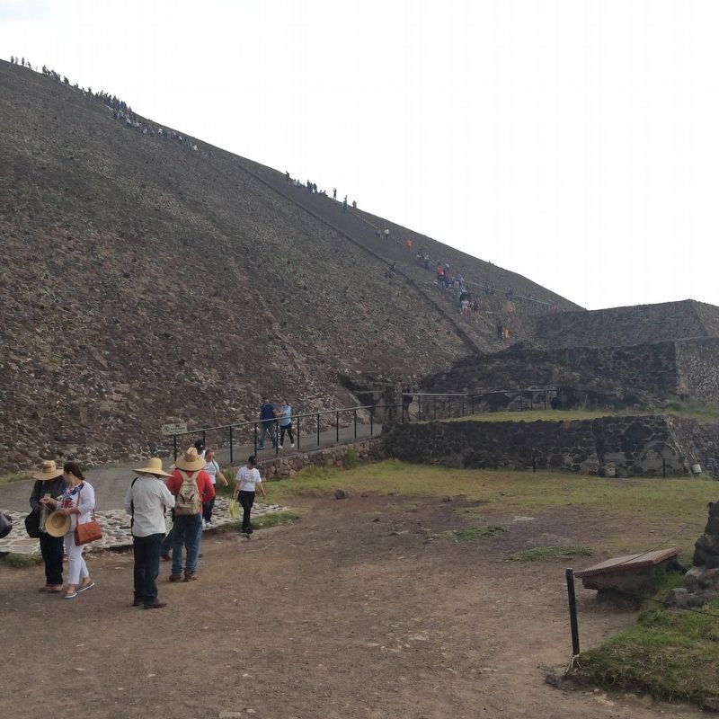
The marker is here to the right in this view. It is near the area where most tourists come down from climbing the pyramid on its northwest corner.
ic compic ic iquizayan Tonatiuh. Ihuan ipan itec cuali tlatlamachyo quipiaya ica in tlen itoca talud-tablero. Ihuan icpac cuali catca miyac teteopantin,
tlanechicolchantin ihuan in amo huehueyi tlalcahuayan. In mochi nican mochachantiaya in teteopixque ihuan in huehueyi tlatlaca onoco tlanahuatil tlatlaca (Inchan in Teopixque) in tlen intequiuh catca nican, mach çan in teotlamachiliztli. Inin tlaltetzontli tlaxelohua in tlen quiahuac catca in caltepantin, ihuan in tlen cachi hueyi monequia in teotlachihualiztli in tlen yolocatca. Mochi cuali mohta in quenin ixpa yomotlatlamanili, ihuan noço in catepan in cuac yopoliuhca in Teotihuacan tlaca in tlanechicoliztli. Ihuan ohquion cuali mixtlamati in
quenin melahuac hueyi itlamachiliz quipialiaya in aquintin mochi tlamayan tlalli Mexico catca, ihuan in quenin nican hualmohuentiliayà. Ixpa in Teocalli, ipan in yolotlalcahuayan, onca ce hueyi teomomoztli, in tlen ipan itlanacaztla ic mictlampa ihuan ic compic çohuatlampa cuali moohta cequi teteocaltin ihuan in cacanin mochachantiaya (In Tonatiuh Tlanechicoliztli) ic compic ic icalaquiyan in Tonatiuh in tlalcahuayan cuali tlami ica ce hueyi
Photographed by J. Makali Bruton, June 28, 2017
3. The Importance of the Pyramid of the Sun Marker
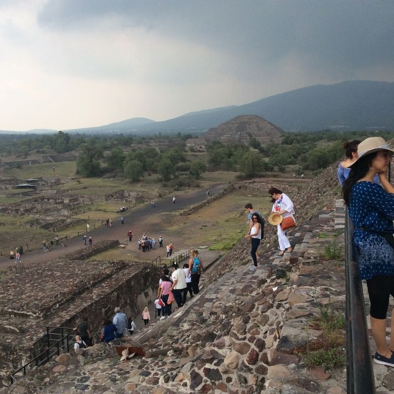
In this view from the top of the Pyramid of the Sun, the marker can be seen below. It is to the right of a low wall and to the left of the pyramid's exit ramp walkway. Note the Pyramid of the Moon in the background.
tlaltetzontli in tlen tlaxelohua inin teopantli itlan in Mihca Otli.
English:
The Importance of the Pyramid of the Sun
Concerning the earliest phases of the City of Teotihuacan, there are several elements which indicate that the so-called Pyramid of the Sun was built at the center of the city, that is, at the starting point on the roads which define the godly places according to the pre-Hispanic cosmic vision. These include the building's astonishingly huge size, its
architectural features, the various decorative and symbolic elements found throughout the complex
and, above all, the group of structures associated with it on the U-shaped platform.
The U-shaped platform surround the pyramid on its north, south and east sides. Its exterior was decorated with sloped paneling and atop it there were a number of temples, groups of dwellings and lesser plazas for the leading priests and lords (House of the Priests) responsible for the worship practiced within this enclosure. The platform separates this highly sacrosanct area from others outside it. Here researchers have detected several
instances of exterior revamping even after the fall
Photographed by J. Makali Bruton, June 28, 2017
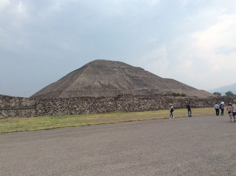
4. The Pyramid of the Sun, seen towards the east from the Calzada de los Muertos.
of Teotihuacan, which demonstrates the importance of this site as a destination of pilgrimage for the different cultural groups who inhabited the Valley of Mexico.
To the front of the Pyramid, in the middle of the great plaza there is a large altar at whose north and south sides are temples and living quarters (Sun Complex). The plaza's west side is bordered by a
large platform which sets this sacred enclosure apart from the Avenue of the Dead.
Location. 19° 41.599′ N, 98° 50.675′ W. Marker is in Teotihuacán de Arista, Estado de Mexico (Mexico State), in Teotihuacán. It is on Route 132 just east of Avenida Pirámides. This marker is just at the northwest corner of the Pyramid of the Sun at the Teotihuacan Archaeological Site. Touch for map. Marker is in this post office area: Teotihuacán de Arista MEX 55880, Mexico. Touch for directions.
Regionally, this marker is in Central Mexico and specifically in Mexico City Metropolitan Area. Globally, it is in North America, specifically in Mesoamerica, on the Ring of Fire, and in the Western Hemisphere. Historically, it finds itself in what was once New Spain, a Spanish colony, and the Aztec Empire.
Credits. This page was last revised on November 30, 2018. It was originally submitted on July 16, 2017, by J. Makali Bruton of Washington, District of Columbia. This page has been viewed 390 times since then and 37 times this year. Photos:1, 2, 3, 4. submitted on July 16, 2017, by J. Makali Bruton of Washington, District of Columbia.