Teotihuacán de Arista in Teotihuacán, Mexico State, Mexico — The Central Highlands (North America)
The Meaning of the Pyramid of the Sun
Photographed by J. Makali Bruton, June 28, 2017
1. The Meaning of the Pyramid of the Sun Marker
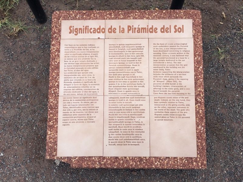
Las evidencias que apoyan esta interpretación son, entre otras, la existencia de un canal de 3 m. de ancho que circunda en su base a la Pirámide, dándole el significado de Altepetl o Cerro de Agua; la existencia de enterramientos infantiles en las esquinas del edificio, característicos de ofrendas dedicadas al dios del agua, y de una cueva debajo de la pirámide. Las cuevas tienen un significado dual dentro de la cosmovision prehispanica: son vida y muerte. En efecto, por un lado son lugares relacionados con Tláloc, identificados como matrices que dan vida y, por otro, son la entrada al mundo de los muertos. Los dioses que simbolizan estos aspectos de la
this page online
Náhuatl:
In oztome cuali quitoznequi çan ome itlamachiliz in
Photographed by J. Makali Bruton, June 28, 2017
2. The Meaning of the Pyramid of the Sun Marker
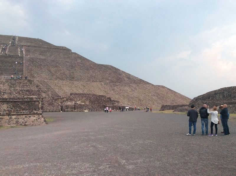
The marker is roughly in the middle of the photo in this view, in front of a group of three people. To the left is a simple marker noting that the conservation of the Pyramid of the Sun completed 100 years. To the right are two additional markers: "Pyramid of the Sun" and "Pyramids That Look Like Mountains".
English:
Evidence supporting this interpretation includes the existence of a ten-foot
Photographed by J. Makali Bruton, June 28, 2017
3. An additional marker on the 100th anniversary of the investigation of the Pyramid of the Sun.
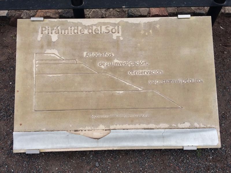
This additional marker is to the left (north) of the featured marker. It is slightly in error, as archaeological research was done earlier than 2010 at the Pyramid of the Sun, most prominently in 1906 by Leopoldo Batres. It is likely that this marker was placed as a way to coincide with the 2010 Mexican Independence 200th anniversary celebrations. It reads:
Pirámide del Sol
A 100 años de su investigación, conservación y apertura al publico.
Septiembre 1910-Septiembre 2010
English translation:
Pyramid of the Sun
To 100 years of its investigacion, conservation and opening to the public.
September 1910-September 2010
A 100 años de su investigación, conservación y apertura al publico.
Septiembre 1910-Septiembre 2010
To 100 years of its investigacion, conservation and opening to the public.
September 1910-September 2010
Topics. This historical marker is listed in these topic lists: Anthropology & Archaeology • Indigenous Peoples and Communities • Man-Made Features.
Location. 19° 41.546′ N, 98° 50.694′ W. Marker is in Teotihuacán de Arista, Estado de Mexico (Mexico State), in Teotihuacán. It can be reached from Calle Paloma just west of Calle Tuxpan. The marker is roughly towards the middle-right of the western face of the Pyramid of the Sun at the Teotihuacan Archaeological Site. Touch for map. Marker is in this post office area: Teotihuacán de Arista MEX 55880, Mexico. Touch for directions.

Regionally, this marker is in Central Mexico and specifically in Mexico City Metropolitan Area. Globally, it is in North America, specifically in Mesoamerica, on the Ring of Fire, and in the Western Hemisphere. Historically, it finds itself in what was once New Spain, a Spanish colony, and the Aztec Empire.
Other nearby markers. At least 8 other markers are within walking distance of this marker: Pyramid of the Sun (here, next to this marker); A Ceremonial Incense Burner (within shouting distance of this marker); a different marker also named The Pyramid of the Sun (within shouting distance of this marker); The Importance of the Pyramid of the Sun (about 90 meters away, measured in a direct line); Teotihuacan After Its Abandonment (about 120 meters away); Construction Systems of the Pyramid of the Sun (about 180 meters away); a different marker also named The Meaning of the Pyramid of the Sun (approx. 0.3 kilometers away); a different marker also named The Importance of the Pyramid of the Sun (approx. 0.3 kilometers away). Touch for a list and map of all markers in Teotihuacán de Arista.
Credits. This page was last revised on July 19, 2017. It was originally submitted on July 19, 2017, by J. Makali Bruton of Washington, District of Columbia. This page has been viewed 942 times since then and 62 times this year. Photos: 1, 2, 3. submitted on July 19, 2017, by J. Makali Bruton of Washington, District of Columbia.
