Fort Pierce in St. Lucie County, Florida — The American South (South Atlantic)
Old Fort Park
Photographed by Jay Kravetz, August 17, 2017
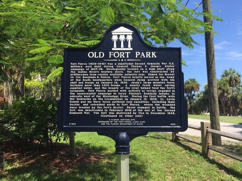
1. Old Fort Park Marker
Fort Pierce (1838-1842) was a significant Second Seminole War U.S. military post built during General Thomas S. Jesup’s winter campaign of 1837-38. Strategically located on a high bluff along the Indian River’s western shore, the fort was constructed by artillerymen from readily available palmetto logs. Named for Brevet Lt. Col. Benjamin K. Pierce, Fort Pierce briefly served as the Army of the South headquarters when General Jesup arrived with his staff and troops on January 14, 1838. Jesup’s large mounted force included more than 1,000 troops. A nearby fresh water spring supplied water, and the bounty of the river helped feed the fort’s occupants. Fort Pierce bustled with activity as troops engaged in the unsuccessful campaign to force Florida’s Seminole Indians to relocate west of the Mississippi River. During the first battle with the Seminoles on the Loxahatchee on January 15, 1838, Lt. Levin Powell and his Navy force suffered four casualties, including their doctor, and retreated north to Fort Pierce, where the wounded were treated by the fort’s doctor. Never engaged in battle, the fort was deactivated in February
this page online
Photographed by Jay Kravetz, August 17, 2017
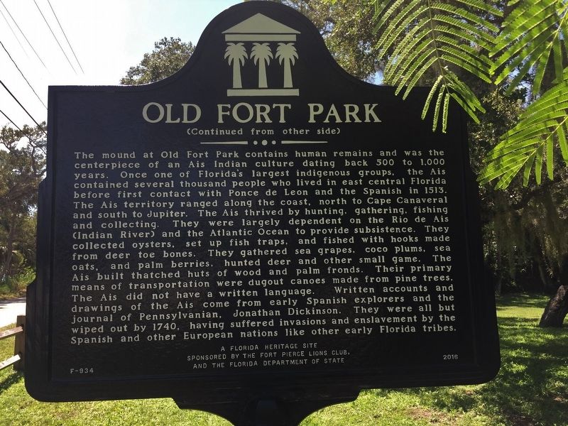
2. Old Fort Park Marker
Erected 2016 by Fort Pierce Lions Club and the Florida Department of State. (Marker Number F-934.)
Topics. This historical marker is listed in these topic lists: Cemeteries & Burial Sites • Forts and Castles • Indigenous Peoples and Communities • Wars, US Indian. A significant historical date for this entry is January 14, 1838.
Location. 27° 26.222′ N, 80° 19.189′ W. Marker is in Fort Pierce, Florida, in St. Lucie County. It is on South Indian River Drive (County Road 707) 0.3 miles south of Florida Avenue, on the right when traveling south. Touch for map. Marker is at or near this postal address: 901 South Indian River Drive, Fort Pierce FL 34950, United States of America. Touch for directions.

Regionally, this marker is on Florida’s Treasure Coast. It is also in the American South and on the Eastern Seaboard. Globally, it is in the North Atlantic Region, North America, a Gulf of Mexico state,
Photographed by Tim Fillmon, December 26, 2017
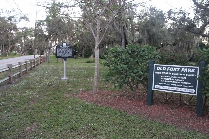
3. Old Fort Park Marker looking south
Other nearby markers. At least 8 other markers are within 2 miles of this marker, measured as the crow flies: Fort Pierce (within shouting distance of this marker); Traces of an Early Indian Village (within shouting distance of this marker); Military Fort Pierce at Old Fort Park, Fort Pierce (within shouting distance of this marker); A.E. “Beanie” Backus Studio (approx. one mile away); A.E. “Bean” Backus (approx. one mile away); St. Lucie County Veterans Memorial (approx. 1.2 miles away); The United States Submarine Service Memorial (approx. 1.2 miles away); a different marker also named St. Lucie County Veterans Memorial (approx. 1.2 miles away). Touch for a list and map of all markers in Fort Pierce.
Another marker is no longer nearby. St. Lucie County (was approx. 0.7 miles away but has been confirmed missing).
Photographed by Jay Kravetz, August 17, 2017
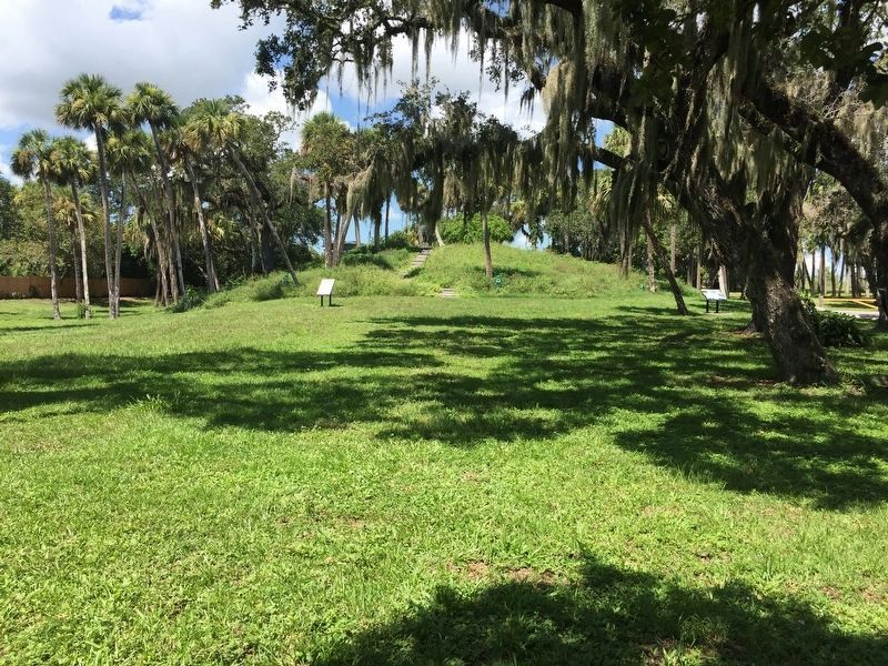
4. Old Fort Park
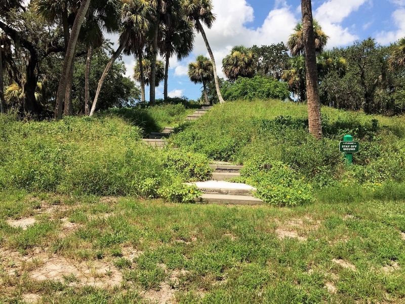
Photographed by Jay Kravetz, August 17, 2017
5. A view of Old Fort Park
Credits. This page was last revised on August 3, 2019. It was originally submitted on August 17, 2017, by Jay Kravetz of West Palm Beach, Florida. This page has been viewed 799 times since then and 58 times this year. Photos: 1, 2. submitted on August 17, 2017, by Jay Kravetz of West Palm Beach, Florida. 3. submitted on April 28, 2019, by Tim Fillmon of Webster, Florida. 4, 5. submitted on August 17, 2017, by Jay Kravetz of West Palm Beach, Florida. • Bernard Fisher was the editor who published this page.
