Downtown Providence in Providence County, Rhode Island — The American Northeast (New England)
The Woonasquatucket River
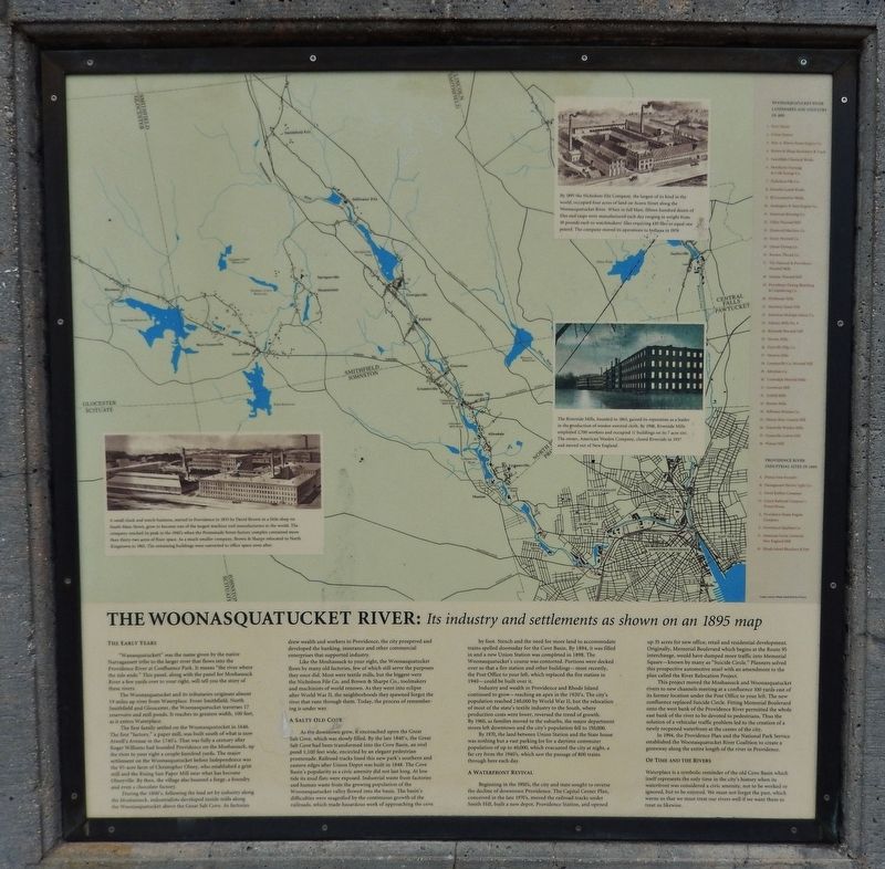
Its industry and settlements as shown on an 1895 map
Photographed by Cosmos Mariner, June 18, 2017
1. The Woonasquatucket River Marker
The Early Years
“Wanasquatucket” was the name given by the native Narragansett tribe to the larger river that flows into the Providence River and Confluence Park. It means “the river where the tide ends.” This panel, along with the panel for Moshassuck River a few yards over to your right, will tell you the story of these rivers.
The Woonasquatucket and its tributaries originate almost 19 miles upriver from Waterplace. From Smithfield, North Smithfield and Gloucester, the Woonasquatucket traverses 17 reservoirs and mill ponds. It reaches its greatest width, 100 feet, as it enters Waterplace.
The first family settled on the Woonasquatucket in 1646. The first “factory,” a paper mill, was built south of what is now Atwell’s Avenue in the 1740’s. That was fully a century after Roger Williams had founded Providence on the Moshassuck, up the river to your right a couple hundred yards. The major settlement on the Woonasquatucket before Independence was that 95-acre farm of Christopher Olney, who established a grist mill and the Rising Sun Paper Mill near what has become Olneyville. By then, the village also boasted
this page online
During the 1800’s, following the lead set by industry along the Moshassuck, industrialists developed textile mills along the Woonasquatucket above the Great Salt Cove. As factories drew wealth and workers to Providence, the city prospered and developed the banking, insurance and other commercial enterprises that supported industry.
Like the Moshassuck to your right, the Woonasquatucket flows by many old factories, few of which still serve the purposes they once did. Most were textile mills, but the biggest were the Nicholson File Co. and Brown & Sharpe Co., toolmakers and machinists of world renown. As they went into eclipse after World War II, the neighborhoods they spawned forgot the river that runs through them. Today, the process of remembering is under way.
A Salty Old Cove
As the downtown grew, it encroached upon the Great Salt Cove, which was slowly filled. By the late 1840’s, the Great Salt Cove had been transformed into the Cove Basin, an oval pond 1,100 feet wide, encircled by an elegant pedestrian promenade. Railroad tracks lined this new park’s southern and eastern
Photographed by Cosmos Mariner, June 18, 2017
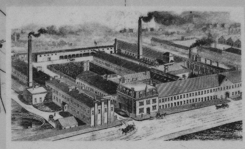
2. Marker Detail: Nicholson File Company 1895
By 1895 the Nicholson File Company, the largest of its kind in the world, occupied four acres of land on Acorn Street along the Woonasquatucket River. When in full blast, fifteen hundred dozen of files and rasps were manufactured each day ranging in weight from 10 pounds each to watchmakers’ files requiring 430 files to equal one pound. The company moved its operations to Indiana in 1959.
Industry and wealth in Providence and Rhode Island continued to grow – reaching an apex in the 1920’s. The city’s population reached 240,000 by World War II, but the relocation of most of the state’s textile industry to the South, where production costs were lower, reversed the trend of growth. By 1960, as families moved to the suburbs,
Photographed by Cosmos Mariner, June 18, 2017
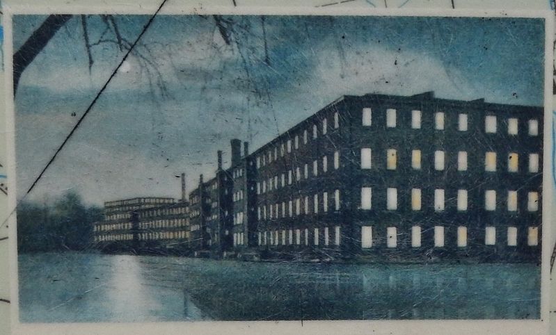
3. Marker Detail: Riverside Mills circa 1920
The Riverside Mills, founded in 1863, gained its reputation as a leader in the production of woolen worsted cloth. By 1908, Riverside Mills employed 2,700 workers and occupied 11 buildings on its 7 acre site. The owner, American Woolen Company, closed Riverside in 1927 and moved out of New England.
By 1970, the land between Union Station and the State house was nothing but a vast parking lot for a daytime commuter population of up to 40,000, which evacuated the city at night, a far cry from the 1940’s which say the passage of 800 trains through here each day.
A Waterfront Revival
Beginning in the 1950’s, the city and state sought to reverse the decline of downtown Providence. The Capital Center Plan, conceived in the late 1970’s, moved the railroad tracks under Smith Hill, built a new depot, Providence Station, and opened up 35 acres for new office, retail and residential development. Originally, Memorial Boulevard which begins at the Route 95 interchange, would have dumped more traffic into Memorial Square – known by many as “Suicide Circle.” Planners solved the prospective automotive snarl with an amendment to the plan called the River Relocation Project.
This project moved the Moshassuck and Woonasquatucket rivers to new channels meeting at a confluence 100 yards east of its former location under the Post Office to your left. The
Photographed by Cosmos Mariner, June 18, 2017
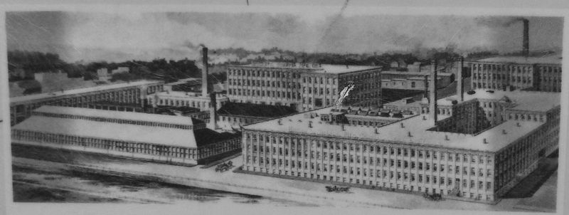
4. Marker Detail: Brown & Sharpe Promenade Street factory complex circa 1940's
A small clock and watch business, started in Providence in 1833 by David Brown in a little shop on South Main Street, grew to become one of the largest machine tool manufacturers in the world. The company reached its peak in the 1940’s when the Promenade Street factory complex contained more than thirty-two acres of floor space. As a much smaller company, Brown & Sharpe relocated to North Kingstown in 1963. The remaining buildings were converted to office space soon after.
In 1994, the Providence Plan and the National Park Service established the Woonasquatucket River Coalition to create a greenway along the entire length of the river in Providence.
Of Time and the Rivers
Waterplace is a symbolic reminder of the old Cove Basin which itself represents the only time in the city’s history when its waterfront was considered a civic amenity, not to be worked or ignored, but to be enjoyed. We must not forget the past, which warns us that we must treat our rivers well if we want them to treat us likewise.
Topics. This historical marker is listed in these topic lists: Colonial Era • Industry & Commerce • Roads & Vehicles • Settlements & Settlers • Waterways & Vessels. A significant historical year for this entry is 1646.
Location. 41° 49.619′ N, 71° 24.62′ W. Marker is in Providence,
Photographed by Cosmos Mariner, June 18, 2017
5. The Woonasquatucket River Marker
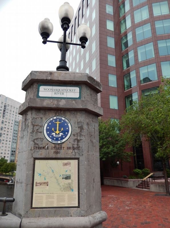
Marker is mounted on the Steeple Street Bridge tower, on the east side of the Woonasquatucket River.

Regionally, this marker is on Narragansett Bay. It is also in the American Northeast, in New England, and on the Eastern Seaboard. Globally, it is in the North Atlantic Region, North America, the Western Hemisphere, the Western World, and the Anglosphere. Historically, it finds itself in what was once one of the original Thirteen Colonies.
Other nearby markers. At least 8 other markers are within walking distance of this marker: The Moshassuck River (a few steps from this marker); Steeple Street (within shouting distance of this marker); a different marker also named Steeple Street (within shouting distance of this marker); Washington Street (within shouting distance of this marker); World War I Monument (within shouting distance of this marker); Steeple Street Complex (within shouting distance of this marker); The First Baptist Meetinghouse (within shouting distance of this marker); Providence Preservation Organizations (within shouting distance of this marker). Touch for a list and map of all markers in Providence.
Regarding The Woonasquatucket River. Downtown Providence was once known as the Great Salt Cove, prior to filling and conversion to uplands. It is estimated that 60% of Rhode Island's salt marshes have been filled with mud and sand dredged during navigation projects or waste material derived from upland sources.
Related markers. Click here for a list of markers that are related to this marker.
Also see . . .
1. Spades of work to save our salt marshes. Save the Bay website entry:
Winnapaug marsh and other Rhode Island salt marshes provide natural filtration against stormwater pollution, a buffer against storms, and habitat for at-risk species such as the saltmarsh sparrow. For these and other reasons, a healthy and resilient Narragansett Bay requires healthy and resilient salt marshes. (Submitted on December 11, 2022, by Larry Gertner of New York, New York.)
2. Waterplace Park: Providence, Rhode Island.
Lending a multi-faceted, urban panorama and feel of Venice to Rhode Island's capital city is Waterplace Park and Riverwalk, a remarkable collection of cobblestone walkways, plazas, pedestrian bridges, gondolas and other features intertwined with the Moshassuck, Woonasquatucket, and Providence rivers. The park and riverwalk have been central to the revitalization of one of the largest and fastest growing cities in New England. (Submitted on August 26, 2017, by Cosmos Mariner of Cape Canaveral, Florida.)
3. Brown & Sharpe Company.
Brown & Sharpe was founded in 1833 on South Main Street in Providence, Rhode Island by David Brown and his son Joseph R. Brown. The elder Brown retired in 1841, and the younger Brown formed a partnership with Lucian Sharpe in 1853, giving the company its name. (Submitted on August 26, 2017, by Cosmos Mariner of Cape Canaveral, Florida.)
Credits. This page was last revised on May 8, 2023. It was originally submitted on August 25, 2017, by Cosmos Mariner of Cape Canaveral, Florida. This page has been viewed 834 times since then and 82 times this year. Last updated on August 30, 2017, by Cosmos Mariner of Cape Canaveral, Florida. Photos: 1. submitted on August 25, 2017, by Cosmos Mariner of Cape Canaveral, Florida. 2, 3, 4, 5. submitted on August 26, 2017, by Cosmos Mariner of Cape Canaveral, Florida. • Bill Pfingsten was the editor who published this page.
