Near Pioneer in West Carroll Parish, Louisiana — The American South (West South Central)
Poverty Point Artifacts
| — | Poverty Point World Heritage Site | — |
Photographed by Mark Hilton, October 25, 2017
1. Poverty Point Artifacts Marker
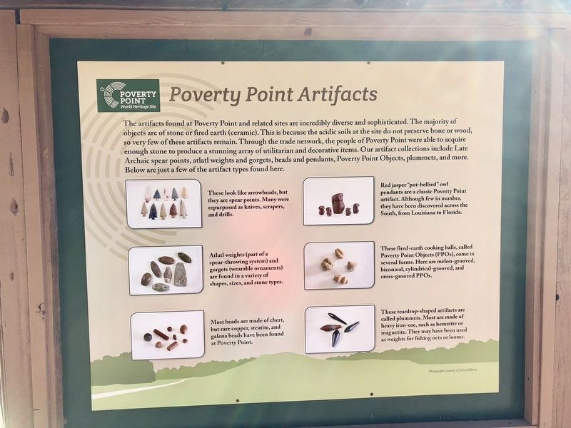
The artifacts found at Poverty Point and related sites are incredibly diverse and sophisticated. The majority of objects are of stone or fired earth (ceramic). This is because the acidic soils at the site do not preserve bone or wood, so very few of these artifacts remain. Through the trade network, the people of Poverty Point were able to acquire enough stone to produce a stunning array of utilitarian and decorative items. Our artifact collections include Late Archaic spear points, atlatl weights and gorgets, beads and pendants, Poverty Point Objects, plummets, and more. Below are just a few of the artifact types found here.
[Photo captions]
Left, top-to-bottom:
These look like arrowheads, but they are spear points. Many were repurposed as knives, scrapers, and drills.
Atlatl weights (part of a spear-throwing system) and gorgets (wearable ornaments) are found in a variety of shapes, sizes, and stone types.
Most beads are made of chert, but rare copper, steatite, and galena beads have been found at Poverty Point.
Right, top-to-bottom:
Red jasper "pot-bellied" owl pendants are a classic Poverty Point artifact. Although few in number, they have been discovered across the South, from Louisiana to Florida.
These fired-earth cooking balls, called Poverty Point Objects (PPOs), come in several forms. Here are melon-grooved, biconical, cylindrical-grooved, and cross-grooved PPOs.
These teardrop-shaped artifacts are called plummets. Most are made of heavy iron-ore, such as hematite or magnetite. They may have been used as weights for fishing nets or looms.
Erected by the
this page online
Topics. This historical marker is listed in these topic lists: Anthropology & Archaeology • Indigenous Peoples and Communities • Natural Features.
Location. 32° 38.152′ N, 91° 24.218′ W. Marker is near Pioneer, Louisiana, in West Carroll Parish. It can be reached from Louisiana Route 577 1.2 miles north of Route 134. Located near the Poverty Point Heritage Site Museum. Touch for map. Marker is in this post office area: Pioneer LA 71266, United States of America. Touch for directions.

Regionally, this marker is in North Louisiana. It is also in the American South, specifically in the Deep South, and in the Mississippi Delta. Globally, it is in North America, a Gulf of Mexico state, the Western Hemisphere, the Western World, and the Anglosphere. Historically, it finds itself in what was once the territory of the Mississippian Culture, the Louisiana Purchase, one of the Confederate States of America, and the Antebellum South.
Other nearby markers. At least 8 other markers are within walking distance of this marker: Peopling of the Americas
Photographed by Mark Hilton, October 25, 2017
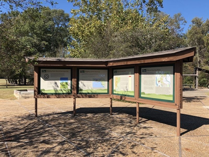
2. Poverty Point Artifacts Marker on other side.
Also see . . . Wikipedia article on Poverty Point. (Submitted on November 13, 2017, by Mark Hilton of Montgomery, Alabama.)
Photographed by Mark Hilton, October 25, 2017
3. Entrance to the Poverty Point World Heritage Site.
Credits. This page was last revised on September 23, 2020. It was originally submitted on November 13, 2017, by Mark Hilton of Montgomery, Alabama. This page has been viewed 1,187 times since then and 111 times this year. Photos: 1, 2, 3. submitted on November 13, 2017, by Mark Hilton of Montgomery, Alabama.
