The National Mall in Southwest Washington in Washington, District of Columbia — The American Northeast (Mid-Atlantic)
Lunar Calendars
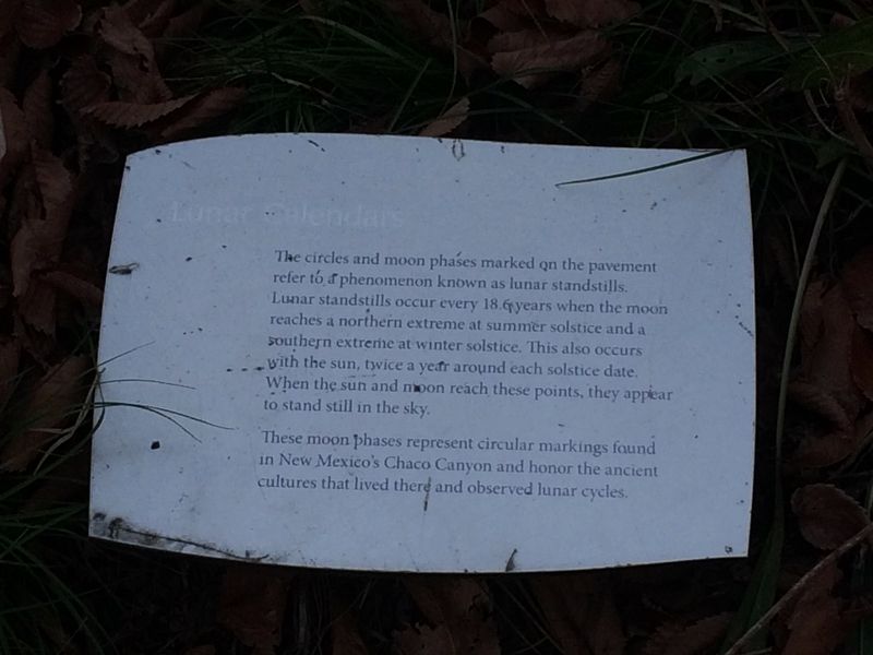
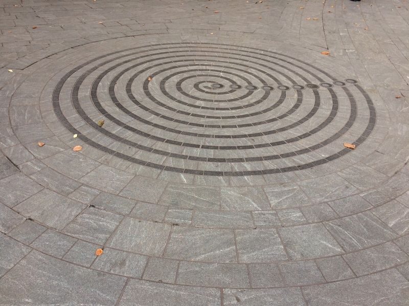
The circles and moon phases marked on the pavement refer to a phenomenon known as lunar standstills. Lunar standstills occur every 18.6 years when the moon reaches a northern extreme at summer solstice and a southern extreme at winter solstice. This also occurs with the sun, twice a year around each solstice date. When the sun and moon reach these points, they appear to stand still in the sky.
These moon phases represent circular markings found in New Mexico's Chaco Canyon and honor the ancient cultures that lived there and observed lunar cycles.
Erected by National Museum of the American Indian, Smithsonian Institution.
Topics. This historical marker is listed in these topic lists: Anthropology & Archaeology • Indigenous Peoples and Communities • Science & Medicine.
Location. Marker has been permanently removed. It was located near 38° 53.27′ N, 77° 1.008′ W. Marker was in Southwest Washington in Washington, District of Columbia. It was in The National Mall. It was on Independence Avenue Southwest west of 3rd Street Southwest, on the right when traveling
this page online
We have been informed that this marker is no longer there and will not be replaced. This page is an archival view of what was.
Regionally, this marker was in the Washington Metropolitan Area. It was also in the American Northeast, in the Upper South, in the Mid-Atlantic, in the Tidewater, and in the Chesapeake Bay Region. Globally, it was in North America, the Western Hemisphere, the Western World, and the Anglosphere.

Other nearby markers. At least 6 other markers are within walking distance of this location: Nora Naranjo-Morse (here, next to this marker); a different marker also named Nora Naranjo-Morse (a few steps from this marker); Eastern Meadow (within shouting distance of this marker); a different marker also named Cardinal Direction Marker: South (within shouting distance of this marker); Traditional Croplands (within shouting distance of this marker); The Growth of Social Security (within shouting distance of
Other markers no longer nearby. Nora Naranjo-Morse (was a few steps from this marker but has been replaced with another marker now near it); a different marker also named Nora Naranjo-Morse (was a few steps from this marker but has been replaced with another marker now near it); Meadow (was within shouting distance of this marker but has been replaced with another marker now near it); Wingapo (was within shouting distance of this marker but has been replaced with another marker now near it); Cardinal Direction Marker: South (was within shouting distance of this marker but has been replaced with another marker now near it); Broomsedge (was within shouting distance of this marker but has been permanently removed); a different marker also named Traditional Croplands (was within shouting distance of this marker but has been replaced with another marker now near it); Eastern Redcedar • Muráhk (mah-dok) (was within shouting distance of this marker but has been permanently removed); Sunflower • Wádxaweew (wah-ha-way-oh) (was within shouting
Credits. This page was last revised on January 30, 2023. It was originally submitted on November 14, 2017, by Devry Becker Jones of Washington, District of Columbia. This page has been viewed 278 times since then and 8 times this year. Photos: 1, 2, 3. submitted on November 14, 2017, by Devry Becker Jones of Washington, District of Columbia. • Bill Pfingsten was the editor who published this page.
