Ninety Six in Greenwood County, South Carolina — The American South (South Atlantic)
Ninety Six
1775
— A Colonial Center in a Time of Change —
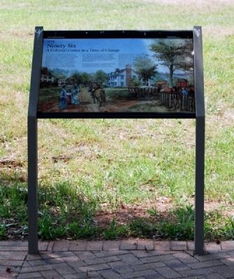
The convergence of roads at Ninety Six ensured its success as a hub of commerce, center for law and order, and haven for settlers in colonial times. In 1775 the village had a dozen dwellings, a jail, and, most importantly, a courthouse, making it a seat of power in the area. Residents included blacksmiths, coopers, carpenters, field hands, and slaves. While the 1775 population is not known, a record shows 79 males living here by 1776. American colonists, recent immigrants from Europe, and slaves were among the residents. Cherokee traded here. The land was cleared for crops and animals grazed freely. Water from nearby Spring Branch was plentiful. It was remote and often dangerous in the surrounding wilderness, but inhabitants of Ninety Six achieved a fragile peace in the backcountry. That was changed with the Revolutionary War.
In Charleston, Patriot supporters formed an independent government and on September 15, 1775, the royal governor of the South Carolina colony fled to a British warship in Charleston Harbor, leaving the colony in the hands of the Americans. Confused and concerned by these events, backcountry residents split between those remaining loyal to the King and those siding with the Patriots. In Ninety Six, William Henry Drayton, a representative from the new government, successfully converted the townspeople to the Patriot cause, fortified the jail, and sent militias out to contain the Loyalist threat. But the town was too small to accommodate the garrison and Williamson's Fort was built nearby.
Erected 2009 by National Park Service.
Topics. This historical marker is listed in these topic lists: Colonial Era • Industry & Commerce • Law Enforcement • Settlements & Settlers • War, US Revolutionary. A significant historical month for this entry is September 1306.
Location. 34° 8.712′ N, 82° 1.191′ W. Marker is in Ninety Six, South Carolina, in Greenwood County. Marker is on South Cambridge Street (State Highway 248). The marker is located near the northern entrance to the town. Touch for map. Marker is in this post office area: Ninety Six SC 29666, United States of America. Touch for directions.
Other nearby markers. At least 10 other markers are within walking distance of this marker. Woman and Child (within shouting distance of this marker); Why Did the British Burn Ninety Six? (within shouting distance of this marker); Gouedy Trail and Charleston Road (about 300 feet away, measured in a direct line); Covered Way (about 300 feet away); Law and Order in the Carolina Backcountry (about 400 feet away); The American Revolution Comes to the South (about 400 feet away); The Attack (about 400 feet away); The Forlorn Hope (about 400 feet away); Spring Branch (about 500 feet away); The Mine (about 500 feet away). Touch for a list and map of all markers in Ninety Six.
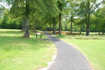
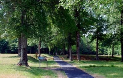
More about this marker. The current version of the marker is shown in Photo 1.
Also see . . .
1. Ninety Six National Historic Site (U.S. National Park Service). Here settlers struggled against the harsh backcountry to survive, Cherokee Indians hunted and fought to keep their land, two towns and a trading post were formed and abandoned to the elements, and two Revolutionary War battles that claimed over 100 lives took place here. (Submitted on July 19, 2010, by Brian Scott of Anderson, South Carolina.)
2. Ninety Six National Historic Site. Ninety Six National Historic Site, also known as Old Ninety Six and Star Fort, is a United States National Historic Site located about 60 miles (96 kilometers) south of Greenville, South Carolina. (Submitted on July 19, 2010, by Brian Scott of Anderson, South Carolina.)
3. Ninety Six National Historic Site. The historic district of Ninety Six National Historic Site contains numerous historical features associated with the economic and social development of the colonial South Carolina back country. (Submitted on July 19, 2010, by Brian Scott of Anderson, South Carolina.)
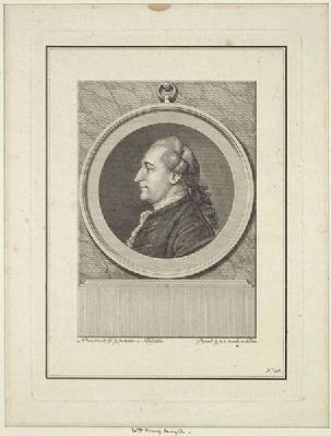
4. William Henry Drayton. William Henry Drayton (September 1742 – September 3, 1779) was an American planter and lawyer from Charleston, South Carolina. (Submitted on July 19, 2010, by Brian Scott of Anderson, South Carolina.)
Additional commentary.
1. First settler in Ninety Six was also first 'banker'
by Ann Heard Bowen
The place that became Ninety Six at first was merely a convenient campground along the Cherokee Path on the most direct route from the Indian towns to Charleston.
Before permanent settlers made their way to the Backcountry, Indian traders had developed a brisk commercial trade with the Cherokees. The first actual white residents near Ninety Six were hunters who arrived about 1730 and threw up “open log cabins,” or crude three-walled shelters, for hunting camps.
Another group of adventurers in the very earliest days were cattle drovers whose cow-pens became a vital economic institution. There was a cow-pen, presumably owned by Dr. John Murray of Charleston, near Ninety Six by 1756.
Ninety Six grew in importance because of the Indian trade and the increasing demand for fertile land.
The first land grant was recorded in 1736. Lander University history professor Marvin Cann described an influx of settlers a few years later:
“In January, 1746, John and Thomas Turk appeared in Charleston representing a number of British subjects in the ‘backparts of Pennsylvania and Virginia.’ They asked permission to settle near Ninety Six and promised that, if tax concessions were granted, several hundred families would move from the northern colonies. They chose the region near Ninety Six because they could ‘find no other Body of Land so healthy in its situation (or) so Good in its Kind.’
Although it is not clear how many settlers were attracted by the tax concessions and good land at Ninety Six, certainly the development of the Backcountry was profoundly influenced by the waves of Scotch-Irish immigrants who poured down the valleys from Pennsylvania.
Patrick Calhoun, the father of future vice president John C. Calhoun, first settled near Lancaster and then moved to the prairie country on Long Cane Creek.
John Turk returned from Virginia and secured a grant near Ninety Six. James Maxwell and Daniel Burnett became his neighbors.
In 1748, James Francis sold his property at Saludy Old Town and secured a tract about 10 miles above Ninety Six on the
Photographed By Brian Scott, September 5, 2008
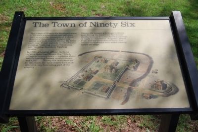
5. Original The Town of Ninety Six Marker
The village of Ninety Six developed about 1772 when a courthouse and jail were built to serve the westernmost judicial district of the province. Judges rode circuit and held court at Ninety Six twice each year. Trials typically involved horse-stealing, "uttering counterfeit money," and "keeping disorderly Tippling houses."
In 1780, a Loyalist officer, Anthony Allaire, described Ninety Six: "It is a village or country town -- contains about twelve dwelling houses, a court-house and a jail...Ninety Six is situated on an eminence, the land cleared for a mile around it, in a flourishing part of the country..."
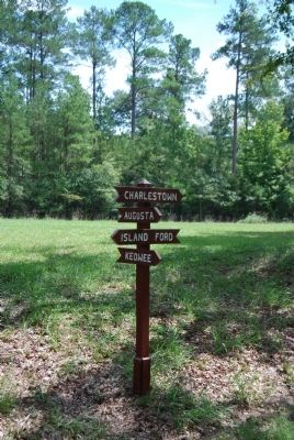
Ninety Six became a strategic military post during the American Revolution chiefly because it controlled the junction of roads to Charleston, Augusta, Island Ford, and the Cherokee country. The defensive stockades were added shortly before the siege.
Other prominent settlers around Ninety Six were Daniel Migler, a blacksmith; Andrew Williamson, who rose from humble beginnings as a cattle drover to become master of White Hall; John Lewis Gervais and John Savage. By mid-century, Ninety Six had passed the hunting stage and was developing into a fairly prosperous region of small farms and rudimentary industry.”
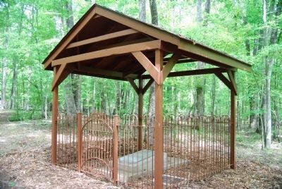
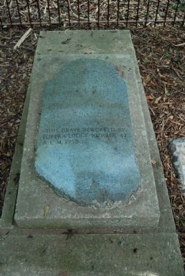
Robert Gouedy is generally regarded as the first permanent settler in Ninety Six and easily the most prominent.
An experienced trader with the Cherokees in the Indian Nation, Gouedy gave up the business in 1751 and purchased a 250-acre tract on the Cherokee Path at Ninety Six. He built a trading post which soon rivaled some Charleston merchants in its volume of business.
Gouedy diversified his holdings as his wealth increased and became a sort of frontier banker, loaning money and holding land mortgages. He also acquired 1,500 acres of land in several tracts near Ninety Six where he produced wheat, tobacco, corn, hemp, and indigo, as well as “an excellent Orchard of Peaches.”
Gouedy store had become the commercial center for a large area by the time of the proprietor’s death in 1775.
Backcountry settlers such as Francis
and Gouedy were exceptional men, a cut above the average of their day. After a visit to Ninety Six in 1753, Gov. James Glen reported that the people there “lived like savages.”
They were probably no better or worse than the vast majority of early settlers who were generally regarded as “ignorant, lazy, poor, and . . . hardly able to exist in a harsh and sometimes hostile land.”
An Anglican priest who ministered to early settlers near Camden found his parishioners “loose, dissolute, Idle People – Without either Religion or Goodness” and believed much the same was true of the whole body of settlers at the time.
The cabins at Ninety Six nearly always contained 10 or 12 children, wrote Gov. Glen, whose parents could not be bothered to “bestow the least Education on them, they take so much Care in raising a litter of Pigs, [and] their Children and equally naked and full as Nasty.”
Regardless of the governor’s disdain, it is clear that the settlers who pushed the Carolina frontier westward to Ninety Six were a hardy breed and brave in the face of constant danger. They clung tenaciously to wilderness outposts where they battled the elements, wrestled a living from the land, and sometimes fought hostile Indians.
Trade with the Indians influenced the development of South Carolina for generations. Colonial authorities had hoped South Carolina would become a source of silk, olive oil, sugar, wine, oranges, lemons, and other exotic products; but experimentation along these lines proved largely futile, and the colony’s chief exports turned out to be rice, indigo, and deerskins. The Indians were eager to trade deerskins in return for ‘cheap hunting rifles, calico, brass pots, and glass beads.’
Cured deerskins were the staple commodity and a valuable export; shipments averaged more than 100,000 skins annually between 1700 and 1745. The Indian trade centered in Charleston determined in large part whether peace or war would prevail between tribes and nations of the aborigines, as well as between the English and their foreign competitors. (Source: Greenwood County: A History by Ann Herd Bowen)
— Submitted September 9, 2008, by Brian Scott of Anderson, South Carolina.
2. Ninety Six Romantic Legends
Romantic legends of two beautiful maidens are part of Ninety Six folklore. In an old account of the Cherokee raid on the little settlement of Ninety Six February 1, 1760, it was written that advance warning was brought “by an Indian wench.” Many years later a story was written naming the girl Cateechee and telling of her daring horseback ride 96 miles from Keowee to the settlement because she loved an English trader who lived there and wanted to save him. The settlers fled into the stockade and were spared though some of their homes were burned. The story says Cateechee and her moved married and lived happily ever after.
The other legendary heroine was a pioneer’s daughter who fell in love with a British officer of Star Fort. She is credited with smuggling the news inside the besieged fort that Lord Rawdon and reinforcements were on the way, encouraging the British to hold out. An early historian wrote “a young woman of the neighborhood” helped pass along a message of Lord Rawdon’s approach and a later novel named her Kate Fowler. In Ninety Six today, Kate Fowler Road and Kate Fowler Branch commemorate her. (Source: Brochure published by Historic Ninety Six Visitors Center)
— Submitted September 10, 2008, by Brian Scott of Anderson, South Carolina.
3. William Henry Drayton (1742 - 1779)
William Henry Drayton, a Delegate from South Carolina; born at Drayton Hall, on Ashley River, S.C., in September 1742; pursued classical studies; attended Westminister School and Balliol College, Oxford, England; returned to South Carolina in 1764; studied law and was admitted to the bar; visited England again in 1770 and was appointed by King George III privy councilor for the Province of South Carolina; while on his way home was appointed assistant judge, but took such an active part in the pre-Revolutionary movement that he was deprived of both positions; president of the council of safety in 1775, and in 1776 was chief justice; Member of the Continental Congress in 1778 and served until his death in Philadelphia, Pa., on September 3, 1779; interment in Christ Church Cemetery. (Source: Biographical Directory of the United States Congress.)
— Submitted July 19, 2010, by Brian Scott of Anderson, South Carolina.
Credits. This page was last revised on December 13, 2019. It was originally submitted on September 9, 2008, by Brian Scott of Anderson, South Carolina. This page has been viewed 2,832 times since then and 25 times this year. Photos: 1, 2, 3, 4. submitted on July 19, 2010, by Brian Scott of Anderson, South Carolina. 5, 6. submitted on September 9, 2008, by Brian Scott of Anderson, South Carolina. 7. submitted on July 19, 2010, by Brian Scott of Anderson, South Carolina. 8, 9, 10, 11, 12, 13. submitted on September 9, 2008, by Brian Scott of Anderson, South Carolina. 14. submitted on July 19, 2010, by Brian Scott of Anderson, South Carolina. 15, 16, 17. submitted on September 9, 2008, by Brian Scott of Anderson, South Carolina. • Craig Swain was the editor who published this page.
