Waterford
A community built around water
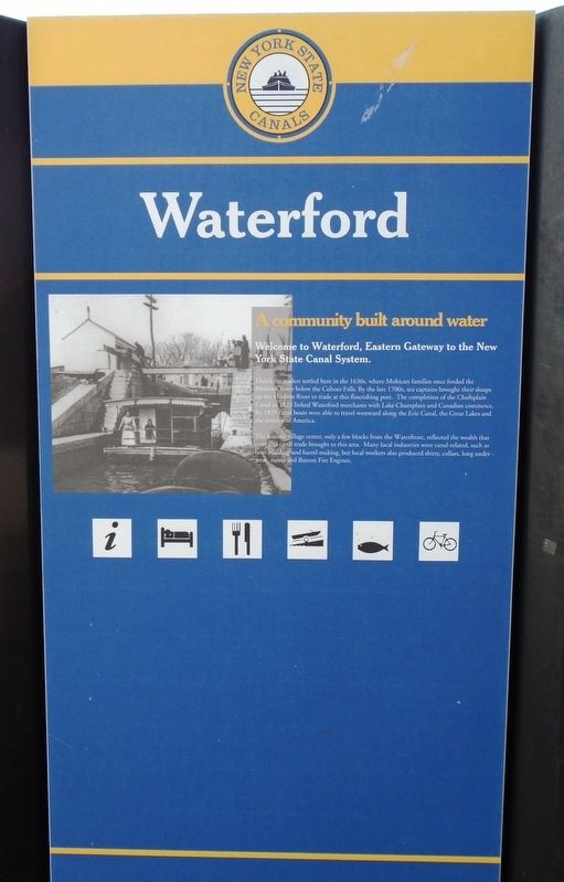
Welcome to Waterford, Eastern Gateway to the New York State Canal System.
Dutch fur traders settled here in the 1630s, where Mohican families once forded the Mohawk River below the Cohoes Falls. By the late 1700s, sea captains brought their sloops up the Hudson River to trade at this flourishing port. The completion of the Champlain Canal in 1823 linked Waterford merchants with Lake Champlain and Canadian commerce. By 1825 canal boats were able to travel westward along the Erie Canal, the Great Lakes and the interior of America.
The historic village center, only a few blocks from the Waterfront, reflected the wealth that river and canal trade brought to this area. Many local industries were canal-related, such as boat-building and barrel-making, but local workers also produced shirts, collars, long underwear, stoves and Button Fire Engines.
Erected by Erie Canalway National Heritage Corridor.
Topics. This historical marker is listed in these topic lists: Industry & Commerce • Man-Made Features • Parks & Recreational Areas • Waterways & Vessels. A significant historical year for this entry is 1823.
Location. 42° 47.251′ N, 73° 40.774′ W. Marker is in Waterford, New York, in Saratoga County. Marker is along the
Other nearby markers. At least 8 other markers are within walking distance of this marker. Button Park (a few steps from this marker); The Waterways that Shaped a Nation (within shouting distance of this marker); Parsonage of Dutch Church (about 600 feet away, measured in a direct line); Issac Eddy House (about 600 feet away); Breastworks (approx. 0.2 miles away); Water Ford (approx. 0.2 miles away); An Urban Refuge (approx. 0.2 miles away); Native American & 17th-century History of Peebles Island (approx. 0.2 miles away). Touch for a list and map of all markers in Waterford.
Also see . . .
1. Waterford Harbor Visitor Center. (Submitted on March 25, 2018, by William Fischer, Jr. of Scranton, Pennsylvania.)
2. Erie Canalway National Heritage Corridor. (Submitted on March 25, 2018, by William Fischer, Jr. of Scranton, Pennsylvania.)
Credits. This page was last revised on March 25, 2018. It was originally submitted on March 25, 2018, by William Fischer, Jr. of Scranton, Pennsylvania. This page has been viewed 191 times since then and 14 times this year. Photos: 1, 2, 3, 4. submitted on March 25, 2018, by William Fischer, Jr. of Scranton, Pennsylvania.


