Rockport in Essex County, Massachusetts — The American Northeast (New England)
Straitsmouth Island
Photographed by Cosmos Mariner, June 23, 2017
1. Straitsmouth Island Marker
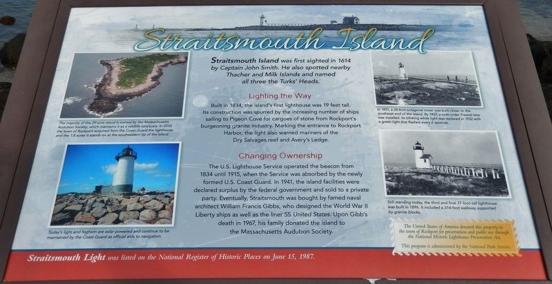
Straitsmouth Island was first sighted in 1614 by Captain John Smith. He also spotted nearby Thacher and Milk Islands and named all three the Turks' Heads.
Lighting the Way
Built in 1834, the island's first lighthouse was 19 feet tall. Its construction was spurred by the increasing number of ships sailing to Pigeon Cove for cargoes of stone from Rockport's burgeoning granite industry. Marking the entrance to Rockport Harbor, the light also warned mariners of the Dry Salvages reef and Avery's Ledge.
Changing Ownership
The U.S. Lighthouse Service operated the beacon from 1834 until 1915, when the Service was absorbed by the newly formed U.S. Coast Guard. In 1941, the island facilities were declared surplus by the federal government and sold to a private party. Eventually, Straitsmouth was bought by famed naval architect William Francis Gibbs, who designed the World War II Liberty ships as well as the liner SS United States. Upon Gibb's death in 1967, his family donated the island to the Massachusetts Audubon Society.
Straitsmouth Light was listed on the National Register of Historic Places on June 15,
this page online
The United States of America donated this property to the town of Rockport for preservation and public use through the National Historic Lighthouse Preservation Act. This program is administered by the National Park Service.
Topics and series. This historical marker is listed in these topic lists: Colonial Era • Communications • Parks & Recreational Areas • Waterways & Vessels. In addition, it is included in the Lighthouses series list. A significant historical year for this entry is 1614.
Location. 42° 39.651′ N, 70° 36.849′ W. Marker is in Rockport, Massachusetts, in Essex County. It is on Bearskin Neck east of Tuna Wharf Road, on the right when traveling east. Marker is located near the turnaround circle at the northeast end of Bearskin Neck, overlooking Rockport Harbor. Touch for map. Marker is at or near this postal address: 79 Bearskin Neck, Rockport MA 01966, United States of America. Touch for directions.

Regionally, this marker is on Cape Ann, on the North Shore, in Greater Boston, and in the Merrimack Valley. It is also in the American Northeast, in New England, and on the Eastern Seaboard. Globally,
Photographed by Cosmos Mariner, June 23, 2017
2. Marker detail: Straitsmouth Island
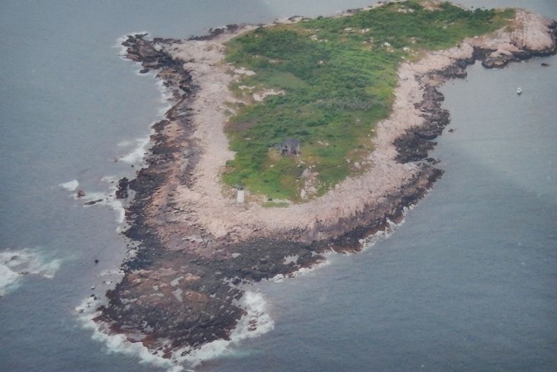
The majority of the 29-acre island is owned by the Massachusetts Audubon Society, which maintains it as a wildlife sanctuary. In 2010, the town of Rockport acquired from the Coast Guard the lighthouse and the 1.8 acres it stands on at the southeastern tip of the island.
Other nearby markers. At least 8 other markers are within walking distance of this marker: Old Stone Fort (a few steps from this marker); Cannon from the U.S.S. Constitution (about 800 feet away, measured in a direct line); Town Wharves (approx. 0.2 miles away); Bear Skin Neck (approx. 0.2 miles away); Rockport World War I & II Memorial (approx. ¼ mile away); Harvey Park (approx. ¼ mile away); First Congregational Church of Rockport Steeple Rehabilitation (approx. 0.3 miles away); The First Settlers of Sandy Bay (approx. 0.3 miles away). Touch for a list and map of all markers in Rockport.
Regarding Straitsmouth Island. The relatively small lighthouse is maintained by the U.S. Coast Guard but, the island itself is owned by the Massachusetts Audubon Society as a bird and wildlife sanctuary. The light is easily seen from the tip of Bearskin Neck in downtown Rockport.
The lighthouse signature is a Green light flashing every 6
Photographed by Cosmos Mariner, June 23, 2017
3. Marker detail: Today's Lighthouse
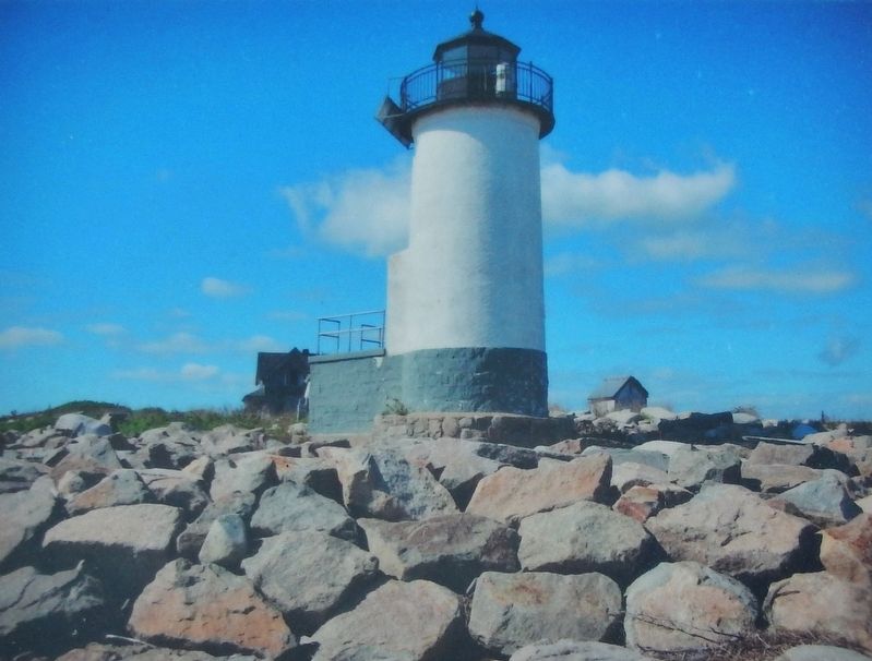
Today's light and foghorn are solar powered and continue to maintained by the Coast Guard as official aids to navigation.
The U.S. Coast Guard owns and operates the Straitsmouth Island Light Station and it is closed to the public.
Straitsmouth Island Light is visible from the breakwater at the end of Bearskin Neck in Rockport.
National Register of Historic Places (1987)
Also see . . .
1. History of Straitsmouth Island Light, Rockport, Massachusetts. New England Lighthouses website entry:
When the English explorer Capt. John Smith visited the area around Cape Ann in 1614, he found an abundance of timber and a "silver stream" of cod and other fish. Smith's coat of arms depicted three Turks' heads on a shield, in commemoration of three consecutive jousting victories during a siege in Transylvania. As he traveled along Cape Ann's eastern shore, Smith encountered three prominent islands that he named the "Turks' Heads." These islands are now known as Thacher, Milk, and Straitsmouth. (Submitted on March 27, 2018, by Cosmos Mariner of Cape Canaveral, Florida.)
2. Straitsmouth Island Lighthouse. Lighthouse friends website entry:
In the 1800s, the addition of Rockport’s growing granite trade to its already thriving fishing business
Photographed by Cosmos Mariner, June 23, 2017
4. Marker detail: 1851 Lighthouse
In 1851, a 24-foot octagonal tower was built closer to the southeast end of the island. By 1857, a sixth-order Fresnel lens was installed. Its blinking white light was replaced in 1932 with a green light that flashed every 6 seconds.
Photographed by Cosmos Mariner, June 23, 2017
5. Marker detail: 1896 Lighthouse
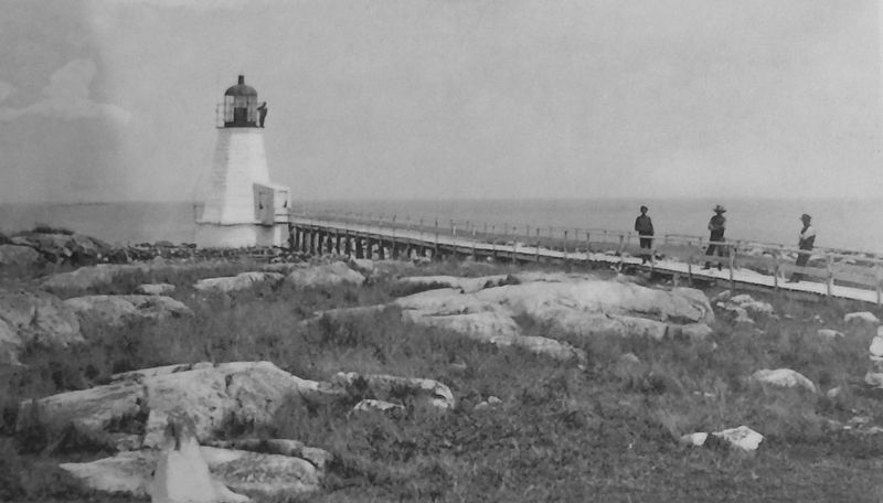
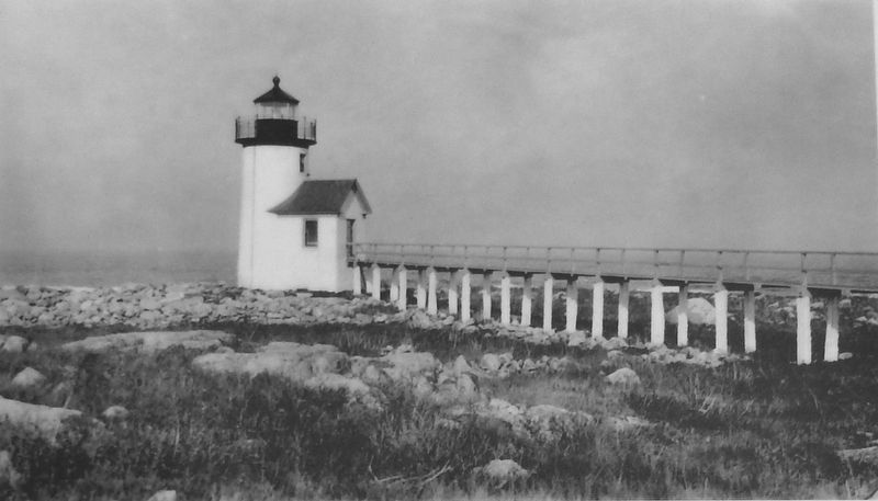
Still standing today, the third and final 37-foot-tall lighthouse was built in 1896. It included a 314-foot walkway supported by granite blocks.
Photographed by Cosmos Mariner, June 23, 2017
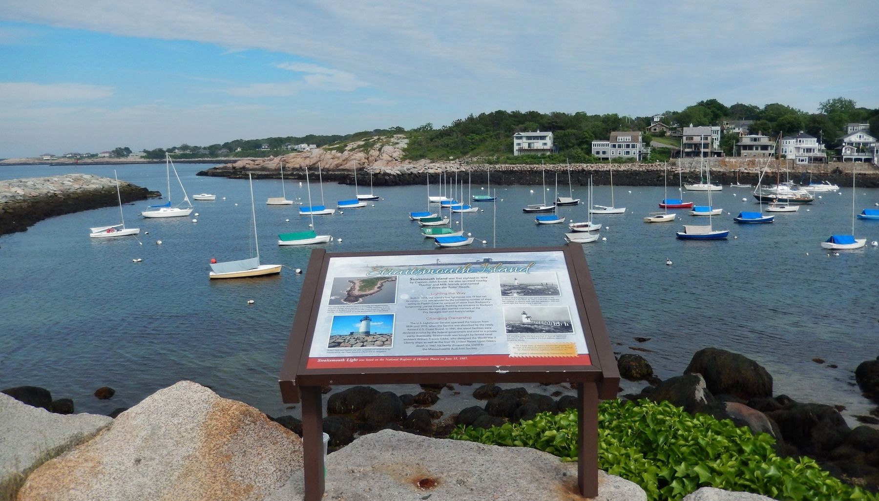
6. Straitsmouth Island Marker (wide view; looking east across Rockport Harbor)
Credits. This page was last revised on November 22, 2023. It was originally submitted on March 27, 2018, by Cosmos Mariner of Cape Canaveral, Florida. This page has been viewed 574 times since then and 36 times this year. Photos: 1, 2, 3, 4, 5, 6. submitted on March 27, 2018, by Cosmos Mariner of Cape Canaveral, Florida. • Andrew Ruppenstein was the editor who published this page.
