Potomac Yard in Alexandria, Virginia — The American South (Mid-Atlantic)
Virginia's First Highways
City of Alexandria Est. 1749
| — | Potomac Yard | — |
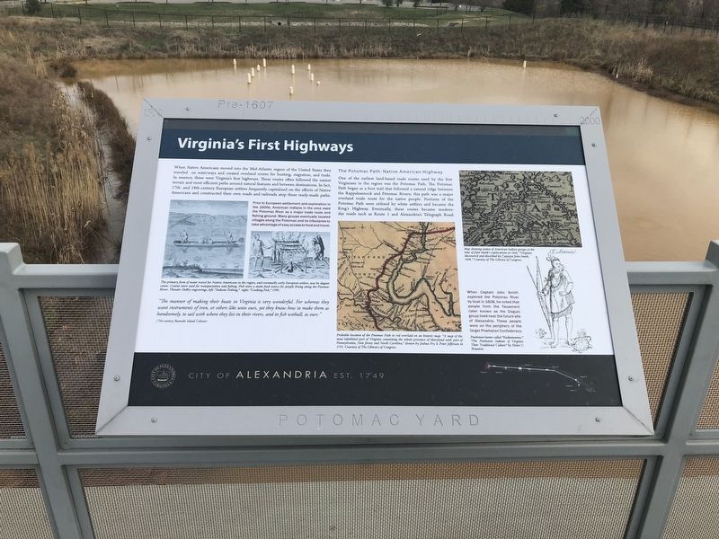
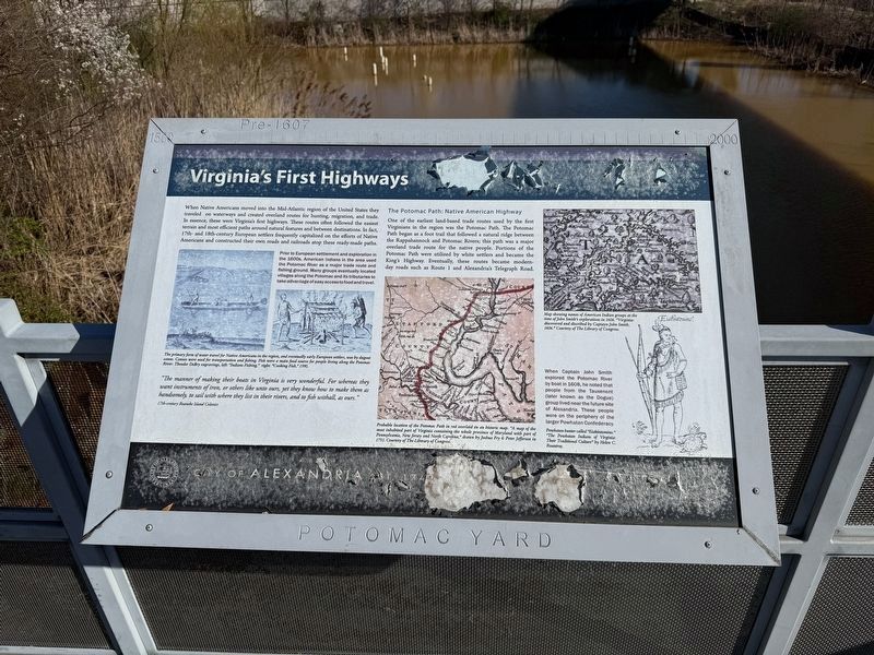
When Native Americans moved into the Mid-Atlantic region of the United States they traveled on the waterways created overland routes for hunting, migration, and trade. In essence, they were Virginia's first highways. These routes often followed the easiest terrain and most efficient paths around natural features and between destinations. In fact, 17th- and 18th-century European settlers frequently capitalized on the efforts of Native Americans and constructed their own roads and railroads atop these ready-made paths.
Prior to European settlement and exploration in the 1600s, American Indians in the area used the Potomac River as a major trade route and fishing ground. Many groups eventually located villages along the Potomac and tributaries to take advantage of easy access to food and travel.
"The manner of making their boats in Virginia is very wonderful. For whereas they want instruments of iron, or others like unto ours, yet they know how to make them as handsomely, to sail with where they list in their rivers, and to fish withal, as ours.
17th-century Roanoke Island Colonist
The Potomac Path: Native American Highway
One
this page online
When Captain John Smith explored the Potomac River by boat in 1608, he noted that people from the Tauxenent (later known as the Dogue) group lived near the future site of Alexandria. These people were on the periphery of the larger Powhatan Confederacy.
Erected by City of Alexandria.
Topics and series. This historical marker is listed in these topic lists: Indigenous Peoples and Communities • Roads & Vehicles • Settlements & Settlers • Waterways & Vessels. In addition, it is included in the Virginia, The City of Alexandria series list.
Location. 38° 50.003′ N, 77° 2.856′ W. Marker is in Alexandria,
Photographed by Devry Becker Jones (CC0), March 27, 2025
2. Virginia's First Highways Marker
The marker has significantly weathered.

Regionally, this marker is in the Washington Metropolitan Area and in Northern Virginia. It is also in the American South, specifically in the Upper South, in the Mid-Atlantic, and on the Eastern Seaboard. Globally, it is in the North Atlantic Region, North America, the Western Hemisphere, the Western World, and the Anglosphere. Historically, it finds itself in what was once the territory of the Mississippian Culture, one of the original Thirteen Colonies, one of the Confederate States of America, and the Antebellum South.
Other nearby markers. At least 8 other markers are within walking distance of this marker: The Alexanders & Agriculture (within shouting distance of this marker); Building Potomac Yard (approx. ¼ mile away); Ruby Tucker (approx. 0.3 miles away); All Aboard for Alexandria (approx.
Credits. This page was last revised on March 27, 2025. It was originally submitted on March 30, 2018, by Devry Becker Jones of Washington, District of Columbia. This page has been viewed 520 times since then and 40 times this year. Photos: 1. submitted on March 30, 2018, by Devry Becker Jones of Washington, District of Columbia. 2. submitted on March 27, 2025, by Devry Becker Jones of Washington, District of Columbia. 3. submitted on March 30, 2018, by Devry Becker Jones of Washington, District of Columbia. • Bernard Fisher was the editor who published this page.
