Rivers & Streams: Ancient Highways of the Wabanaki
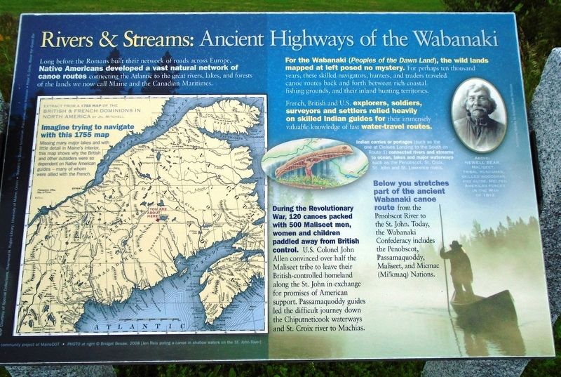
Long before the Romans built their network of roads across Europe, Native Americans developed a vast natural network of canoe routes connecting the Atlantic to the great rivers, lakes, and forests of the lands we now call Maine and the Canadian Maritimes.
For the Wabanaki (Peoples of the Dawn Land), the wild lands mapped at left posed no mystery. For perhaps ten thousand years, these skilled navigators, hunters, and traders traveled canoe routes back and forth between rich coastal fishing grounds, and their inland hunting territories.
French, British and U.S. explorers, soldiers, surveyors and settlers relied heavily on skilled Indian guides for their immensely valuable knowledge of fast water-travel routes.
[Left side] Extract from a 1755 map of the British & French Dominions in North America by Jn. Mitchell
Imagine trying to navigate with this 1755 map
Missing many major lakes and with little detail in Maine's interior, this map shows why the British and other outsiders were so dependent on Native American guides -- many of whom were allied with the French.
During the Revolutionary War, 120 canoes packed with 500 Maliseet men, women and children paddled away from British control. U.S. Colonel John Allen convinced over half the Maliseet tribe to leave their
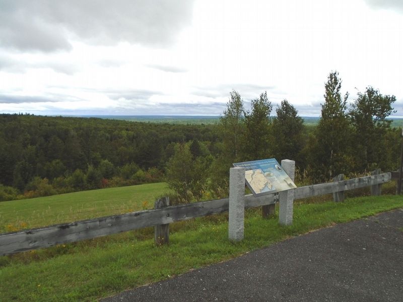
British-controlled homeland along the St. John [River] in exchange for promises of American support. Passamaquoddy guides led the difficult journey down the Chiputneticook waterways and St. Croix river to Machias.Below you stretches part of the ancient Wabanaki canoe route from the Penobscot River to the St. John. Today, the Wabanaki Confederacy includes the Penobscot, Passamaquoddy, Maliseet, and Micmac (Mi'kmaq) Nations.
Indian carries or portages (such as the one at Cleaves Landing to the South on Route 1) connecting rivers and streams to ocean, lakes and major waterways such as the Penobscot, St. Croix, St. John and St. Lawrence rivers.
[Upper right inset photo caption reads]
Newell Bear, Maliseet, tribal huntsman, skilled woodsman, and guide. Helped American forces in the War of 1812.
Erected by Million Dollar View Scenic Byway.
Topics. This historical marker is listed in these topic lists: Environment • Native Americans • Waterways & Vessels. A significant historical year for this entry is 1755.
Location. 45° 41.596′ N, 67° 51.739′ W. Marker is in Weston, Maine, in Washington County. Marker is on U.S. 1, on the left when traveling north. Marker is at the scenic Katahdin View roadside turnout. Touch for map. Marker is at or near this postal address: 341 US Hwy 1, Danforth ME 04424, United States of America. Touch for directions.
Other nearby markers. At least
Also see . . .
1. Native Languages of the Americas: Wabanaki. (Submitted on October 22, 2018, by William Fischer, Jr. of Scranton, Pennsylvania.)
2. Wabanaki Confederacy at Wikipedia. (Submitted on October 22, 2018, by William Fischer, Jr. of Scranton, Pennsylvania.)
3. Maine Rivers and Streams. (Submitted on October 22, 2018, by William Fischer, Jr. of Scranton, Pennsylvania.)
4. Million Dollar View Scenic Byway. (Submitted on October 22, 2018, by William Fischer, Jr. of Scranton, Pennsylvania.)
Credits. This page was last revised on October 22, 2018. It was originally submitted on October 22, 2018, by William Fischer, Jr. of Scranton, Pennsylvania. This page has been viewed 449 times since then and 50 times this year. Photos: 1, 2. submitted on October 22, 2018, by William Fischer, Jr. of Scranton, Pennsylvania.

