Centro Histórico in Ciudad de México, Mexico — The Valley of Mexico (The Central Highlands)
Ruins of an Aztec Pyramid
Photographed by J. Makali Bruton, October 11, 2018
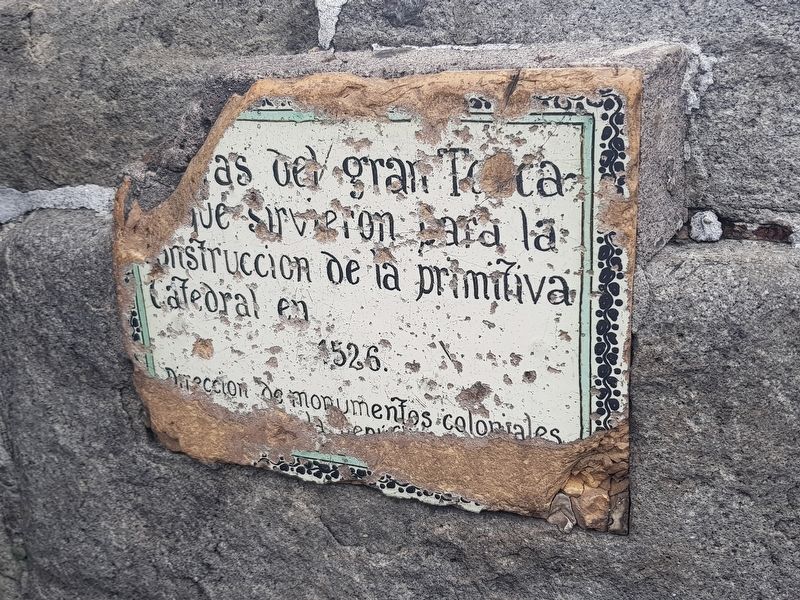
1. Ruins of an Aztec Pyramid Marker
This is probably one of the most badly damaged tile markers still left in Mexico City.

Ruinas del gran Teocalli que sirvieron para la construcción de la primitiva catedral en 1526.
Dirección de monumentos coloniales y de la República.
The ruins of an enormous Aztec pyramid served as the construction materials of the first, primitive cathedral here in 1526.
Office of Monuments of the Colony and the Republic.
Erected by Dirección de Monumentos Coloniales y de la República.
Topics. This historical marker is listed in these topic lists: Anthropology & Archaeology • Colonial Era • Indigenous Peoples and Communities • Religion & Religious Structures. A significant historical year for this entry is 1526.
Location. 19° 26.026′ N, 99° 8.019′ W. Marker is in Ciudad de México. It is in Centro Histórico. It is at the intersection of Plaza de la Constitución and Calle Monte de la Piedad, on the right when traveling west on Plaza de la Constitución. Touch for map. Marker is in this post office area: Ciudad de México 06000, Mexico. Touch for directions.

Regionally, this marker is in Central Mexico and specifically in Mexico City Metropolitan Area. Globally, it is in North
this page online
Other nearby markers. At least 8 other markers are within walking distance of this marker: The Main Chapels of the Cathedral of Mexico City (within shouting distance of this marker); Monument to Enrico Martínez (within shouting distance of this marker); Cuauhtémoc (within shouting distance of this marker); Samir Flores Soberanes (within shouting distance of this marker); Last Residence of Moctezuma (within shouting distance of this marker); Mexico Protests of 1968 (within shouting distance of this marker); Palace of Axayacatl (within shouting distance of this marker); Salón Peter Gay (about 90 meters away, measured in a direct line). Touch for a list and map of all markers in Ciudad de México.
Regarding Ruins of an Aztec Pyramid. The wording on the marker is not clear, but it relates a simple historical fact: the Aztec pyramids, temples and other buildings in the center of Mexico City were mostly torn down and their stones used to build
Photographed by J. Makali Bruton, October 11, 2018
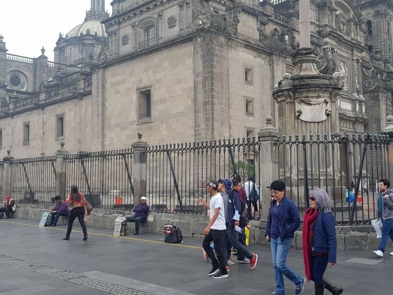
2. Ruins of an Aztec Pyramid Marker
This marker is very difficult to find as it is placed low along the stone portion of the fence around the Metropolitan Cathedral of Mexico City. Also, traditionally it is common for day laborers to sit next to the fence as they wait for work (as in the photo) so it is possible that it may be blocked from view.
Credits. This page was last revised on March 13, 2025. It was originally submitted on October 27, 2018, by J. Makali Bruton of Washington, District of Columbia. This page has been viewed 280 times since then and 13 times this year. Photos: 1, 2. submitted on October 27, 2018, by J. Makali Bruton of Washington, District of Columbia.
