Kure Beach in New Hanover County, North Carolina — The American South (South Atlantic)
Modern Greece
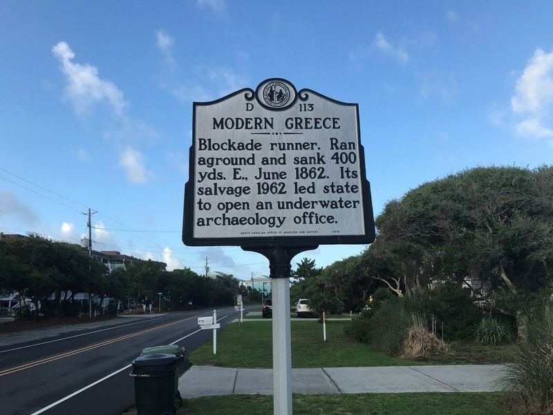
Photographed by S. C. McCullough, August 1, 2018
1. Modern Greece Marker
Erected 2012 by North Carolina Office of Archives and History. (Marker Number D-113.)
Topics and series. This historical marker is listed in these topic lists: Anthropology & Archaeology • War, US Civil • Waterways & Vessels. In addition, it is included in the North Carolina Division of Archives and History series list. A significant historical year for this entry is 1862.
Location. 33° 58.521′ N, 77° 54.858′ W. Marker is in Kure Beach, North Carolina, in New Hanover County. It is on Fort Fisher Boulevard (U.S. 421) 1.6 miles south of K. Avenue, on the right when traveling south. Touch for map. Marker is at or near this postal address: 1346 Fort Fisher Boulevard South, Kure Beach NC 28449, United States of America. Touch for directions.

Regionally, this marker is in the Coastal Plain and on the Cape Fear Coast. It is also in the American South, specifically in the Upper South, in the Tidewater, and on the Eastern Seaboard. Globally, it is in the North Atlantic Region, North
this page online
Other nearby markers. At least 8 other markers are within walking distance of this marker: 32 Pounder Naval Cannon (approx. 0.3 miles away); a different marker also named 32 Pounder Naval Cannon (approx. 0.3 miles away); Fort Fisher & the Civil War (approx. 0.3 miles away); I Knew That Desperate Work Was In Store (approx. 0.3 miles away); "[We] rushed forward like tempest, through the stockade and up the parapet" (approx. 0.3 miles away); "These are North Carolina's pets." (approx. 0.3 miles away); The Whole Garrison Has Gone To Gardening (approx. 0.3 miles away); It Was All Too Much For Even Demons (approx. 0.3 miles away). Touch for a list and map of all markers in Kure Beach.
Other markers no longer nearby. Lamb Expands the Fort, 1862-1865 (was approx. 0.3 miles away but has been confirmed missing); Growth of Fort Fisher, 1861-1862 (was approx. 0.3 miles away but has been confirmed missing).
Also see . . . Re-Excavating the Modern Greece (YouTube, 6 mins.). "In March 2012, the NC Department of Cultural Resources' Underwater Archaeology Branch (UAB) in conjunction with Fort Fisher State Historic Site and the Friends of Fort Fisher hosted students from East Carolina University's Maritime History Program and the University of North Carolina at Wilmington as they "rediscover" artifacts from the Blockade Runner Modern Greece." (Submitted on November 1, 2018.)
Credits. This page was last revised on June 30, 2021. It was originally submitted on November 1, 2018, by S. C. McCullough of Charlotte, North Carolina. This page has been viewed 506 times since then and 24 times this year. Photo 1. submitted on November 1, 2018, by S. C. McCullough of Charlotte, North Carolina. • Andrew Ruppenstein was the editor who published this page.
