Dade City in Pasco County, Florida — The American South (South Atlantic)
As Good as Gold
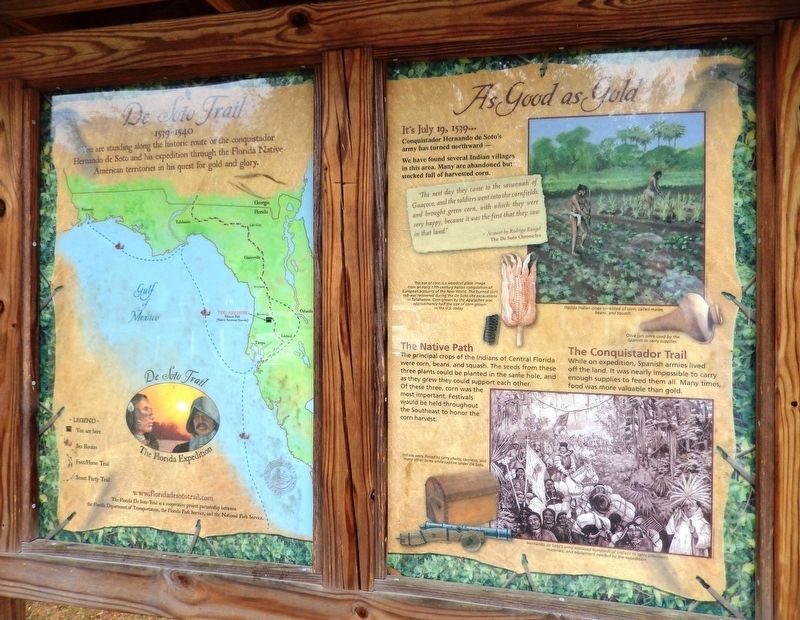
Florida De Soto Trail
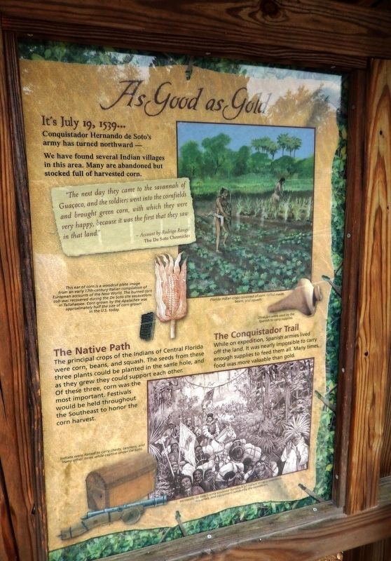
— July 19, 1539 —
Conquistador Hernando de Soto’s army has turned northward –
We have found several Indian villages in this area. Many are abandoned but stocked full of harvested corn.
”The next day they came to the savannah of Guacoco, and the soldiers went into the cornfields and brought green corn, with which they were very happy, because it was the first that they saw in that land.”
- Account by Rodrigo Rangel
The De Soto Chronicles
The Native Path
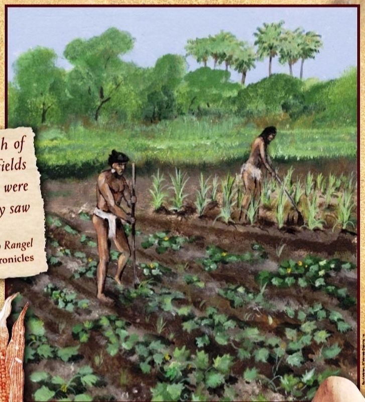
The principal crops of the Indians of Central Florida were corn, beans, and squash The seeds from these three plants could be planted in the same hole, and as they grew they would support each other. Of these three, corn was the most important. Festivals would be held throughout the Southeast to honor the corn harvest.
The Conquistador Trail
While on expedition, Spanish armies lived off the land. It was nearly impossible to carry enough supplies to feed them all. Many times, food was more valuable than gold.
Erected by Florida De Soto Trail, Florida Department of Transportation, the Florida Park Service, and the National Park Service. (Marker Number 10.)
Topics. This historical marker is listed in these topic lists: Agriculture • Colonial Era • Exploration • Native Americans. A significant historical date for this entry is July 19, 1539.
Location. 28° 21.359′ N, 82° 11.277′ W. Marker is in Dade City, Florida, in Pasco County. Marker is at the intersection of Bougainvillea Avenue and 7th Street (U.S. 98), on the left when traveling west on Bougainvillea Avenue. Marker is located beside the sidewalk at the northwest corner of Dade City's Hibiscus Park. Touch for map. Marker is in this post office area: Dade City FL 33525, United States of America. Touch for directions.
Other nearby markers. At least 8 other markers are within walking distance of this marker. Former St. Rita's Catholic Church (about 300 feet away, measured in a direct line); Dade City Woman’s Club (approx. 0.2 miles away); Pasco County Courthouse (approx. 0.6 miles away); Pasco County (approx. 0.6 miles away); Pasco County World War II Memorial (approx. 0.6 miles away); Dade City Atlantic Coast Line Depot (approx. 0.6 miles away); Atlantic Coast Line Depot (approx. 0.6 miles away); Price Park (approx. 0.7 miles away). Touch for a list and map of all markers in Dade City.
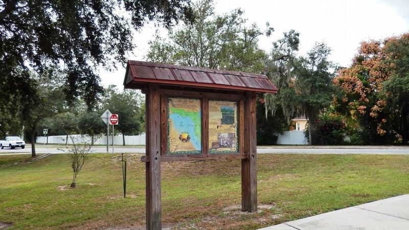
More about this marker. Marker is a large, composite plaque mounted vertically within a heavy-duty wooden kiosk
Related markers.
Click here for a list of markers that are related to this marker. Florida De Soto Trail
Also see . . . De Soto’s Expedition to North America. In 1536, de Soto obtained a royal commission to conquer and settle the region known as La Florida (now the southeastern United States), which had been the site of earlier explorations by Juan Ponce de León and others. De Soto set out from Spain in April 1538, set with 10 ships and 700 men. After a stop in Cuba, the expedition landed at Tampa Bay in May 1539. They moved inland and eventually set up camp for the winter at a small Indian village near present-day Tallahassee. (Submitted on November 4, 2018, by Cosmos Mariner of Cape Canaveral, Florida.)
Photographed By Florida Center for Instructional Technology, USF
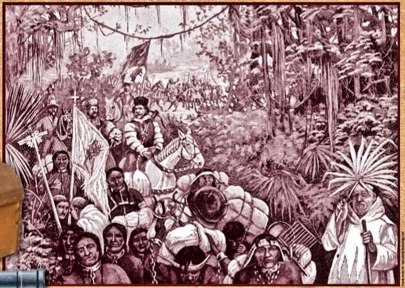
3. Marker detail: Slave labor
Hernando de Soto’s army enslaved hundreds of Indians to carry provisions, materials, and equipment needed by the expedition. Indians were forced to carry chests, cannons, and many other items while captive under De Soto.
Photographed By Cosmos Mariner, November 1, 2018
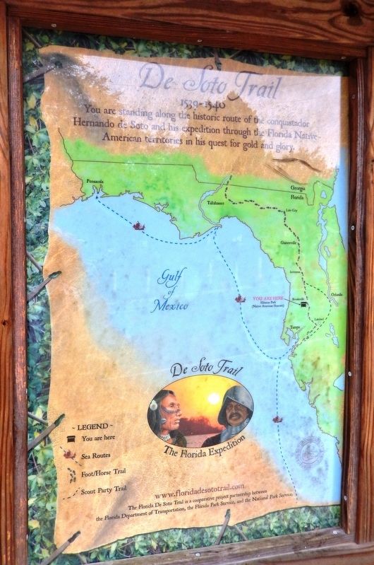
4. De Soto Trail Map (panel to the left of marker in kiosk)
1539-1540
Credits. This page was last revised on December 24, 2020. It was originally submitted on November 1, 2018, by Cosmos Mariner of Cape Canaveral, Florida. This page has been viewed 523 times since then and 45 times this year. Last updated on November 21, 2018, by Cosmos Mariner of Cape Canaveral, Florida. Photos: 1. submitted on November 1, 2018, by Cosmos Mariner of Cape Canaveral, Florida. 2, 3. submitted on November 2, 2018, by Cosmos Mariner of Cape Canaveral, Florida. 4. submitted on November 1, 2018, by Cosmos Mariner of Cape Canaveral, Florida. 5, 6. submitted on November 2, 2018, by Cosmos Mariner of Cape Canaveral, Florida. • Bernard Fisher was the editor who published this page.
