Near Dunnellon in Marion County, Florida — The American South (South Atlantic)
Badly Wounded
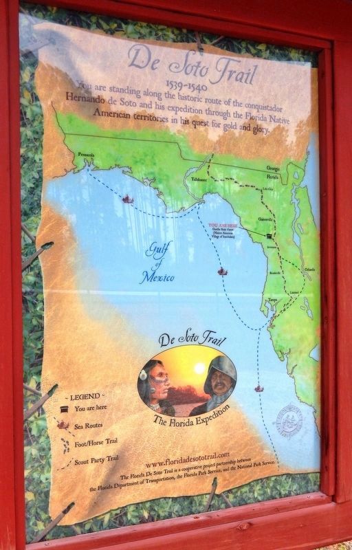
Florida De Soto Trail
— August 11, 1539 —
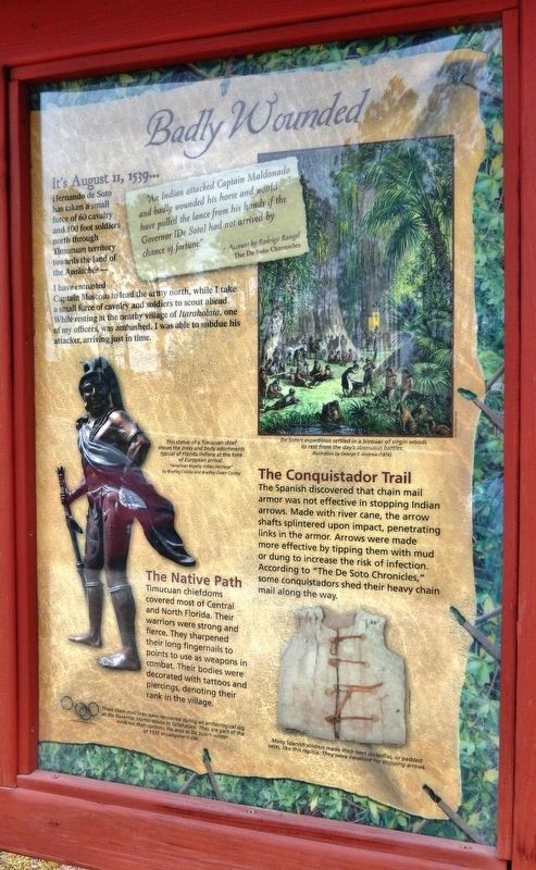
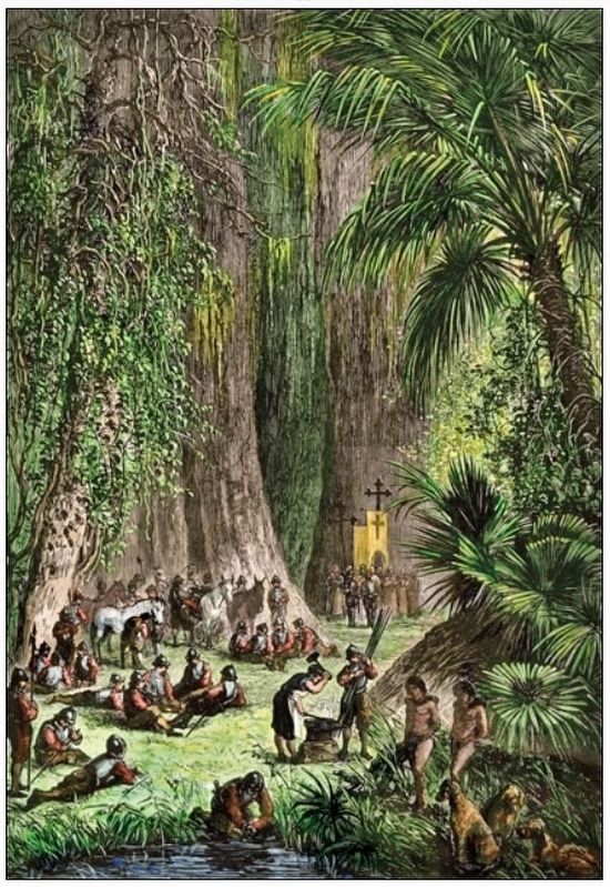
Hernando de Soto has taken a small force of 60 cavalry and 100 foot soldiers north through Timucuan territory towards the land of the Apalachee -
I have entrusted Captain Moscoso to lead the army north, while I take a small force of calvary and soldiers to scout ahead. While resting at the nearby village of Itaraholata, one of my officers was ambushed. I was able to subdue his attacker, arriving just in time.
”An Indian attacked Captain Maldonado and badly wounded his horse and would have pulled the lance from his hands if the Governor [De Soto] had not arrived by chance of fortune.”
- Account by Rodrigo Rangel
The De Soto Chronicles
The Conquistador Trail
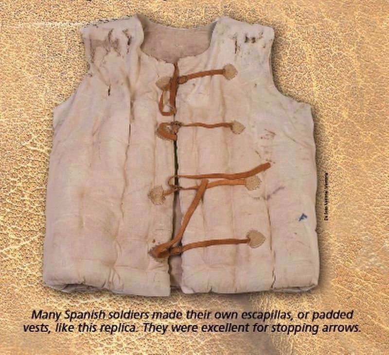
The Spanish discovered that chain mail armor was not effective in stopping Indian arrows. Made with river cane, the arrow shafts splintered upon impact, penetrating links in the armor. Arrows were made more effective by tipping them with mud or dung to increase the risk of infection. According to “The De Soto Chronicles,” some conquistadors shed their heavy chain mail along the way.
The Native Path
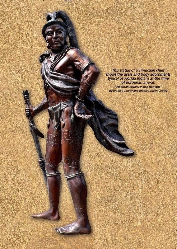
Timucuan chiefdoms covered most of Central and North Florida. Their warriors were strong and fierce. They sharpened their long fingernails to points to use as weapons in combat. Their bodies were decorated with tattoos and piercings, denoting their rank in the village.
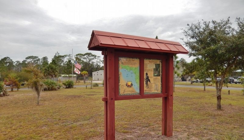
Erected by Florida De Soto Trail, Florida Department of Transportation, the Florida Park Service, and the National Park Service. (Marker Number 17.)
Topics. This historical marker is listed in these topic lists: Colonial Era • Exploration • Native Americans • Notable Events. A significant historical date for this entry is August 11, 1539.
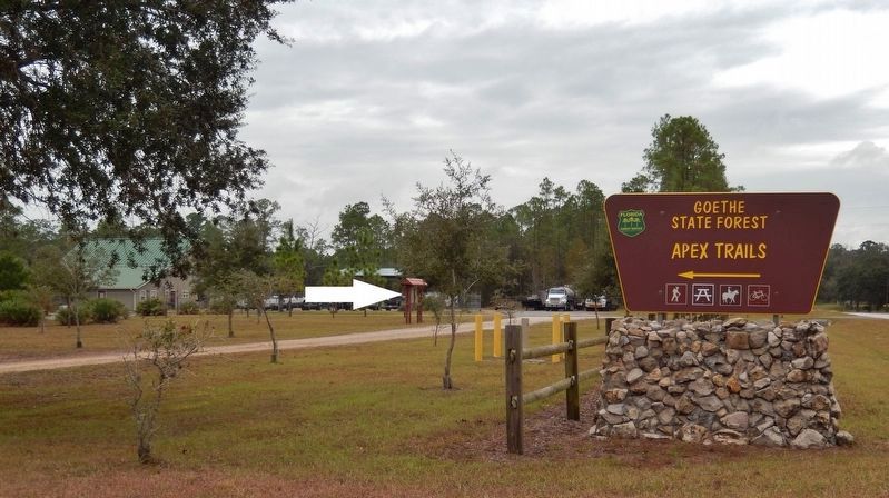
Location. 29° 11.913′ N, 82° 34.703′ W. Marker is near Dunnellon, Florida, in Marion County. Marker is on County Road 337, ¾ mile south of State Road 121, on the right when traveling south. Marker is located within the Goethe State Forest Headquarters Complex, along the trailhead access road on the east side of the highway. Touch for map. Marker is at or near this postal address: 9110 SE County Road 337, Dunnellon FL 34431, United States of America. Touch for directions.
Other nearby markers. At least 8 other markers are within 13 miles of this marker, measured as the crow flies. Patterson-McInnis Train (approx. 9.6 miles away); Pat-Mac Locomotive/Gulf Hammock as a Company Town (approx. 9.6 miles away); Rainbow Springs (approx. 10.8 miles away); Site of the Discovery of Phosphate in Florida (approx. 11.6 miles away); Inglis Lock (approx. 12.2 miles away); Inglis Bypass Spillway
(approx. 12.8 miles away); Inglis Island Overlook (approx. 13 miles away); Dunnellon Trail (approx. 13 miles away). Touch for a list and map of all markers in Dunnellon.
More about this marker. Marker is a large, composite plaque mounted vertically within a heavy-duty wooden kiosk.
Related markers. Click here for a list of markers that are related to this marker. Florida De Soto Trail
Also see . . . De Soto’s Expedition to North America. In 1536, de Soto obtained a royal commission to conquer and settle the region known as La Florida (now the southeastern United States), which had been the site of earlier explorations by Juan Ponce de León and others. De Soto set out from Spain in April 1538, set with 10 ships and 700 men. After a stop in Cuba, the expedition landed at Tampa Bay in May 1539. They moved inland and eventually set up camp for the winter at a small Indian village near present-day Tallahassee. (Submitted on November 5, 2018, by Cosmos Mariner of Cape Canaveral, Florida.)
Photographed By Cosmos Mariner, November 2, 2018
5. Florida De Soto Trail Map (panel to the left of marker in kiosk)
1539-1540
Credits. This page was last revised on December 31, 2020. It was originally submitted on November 5, 2018, by Cosmos Mariner of Cape Canaveral, Florida. This page has been viewed 473 times since then and 38 times this year. Last updated on November 21, 2018, by Cosmos Mariner of Cape Canaveral, Florida. Photos: 1, 2, 3. submitted on November 5, 2018, by Cosmos Mariner of Cape Canaveral, Florida. 4. submitted on December 27, 2018, by Cosmos Mariner of Cape Canaveral, Florida. 5, 6. submitted on November 5, 2018, by Cosmos Mariner of Cape Canaveral, Florida. 7. submitted on December 27, 2018, by Cosmos Mariner of Cape Canaveral, Florida. • Bernard Fisher was the editor who published this page.
