Woodland Drives in Tallahassee in Leon County, Florida — The American South (South Atlantic)
Land of the Apalachee
Florida De Soto Trail
| — | September 30, 1539 | — |
Photographed by Cosmos Mariner, November 14, 2018
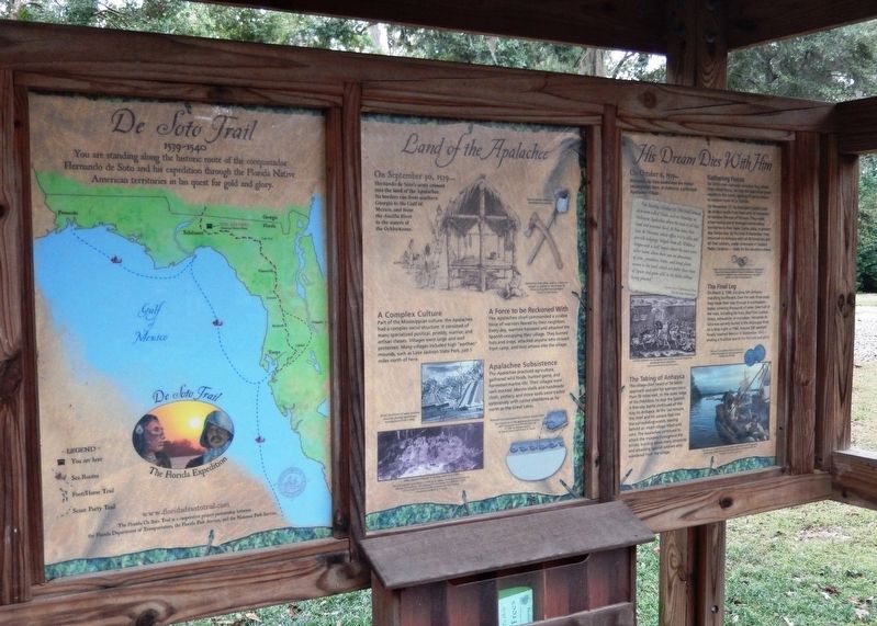
1. Land of the Apalachee Marker
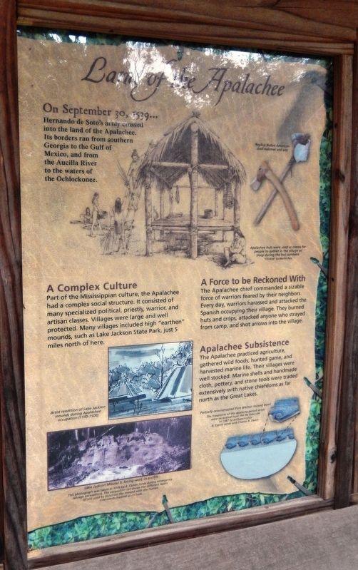
Hernando de Soto’s army crossed into the land of the Apalachee. Its borders ran from southern Georgia to the Gulf of Mexico, and from the Aucilla River to the waters of the Ochlockonee.
A Complex Culture
Part of the Mississippian culture, the Apalachee had a complex social structure. It consisted of many specialized political, priestly, warrior and artisan classes. Villages were large and well protected. Many villages included high “earthen” mounds, such as Lake Jackson State Park, just 5 miles north of here.
A Force to be Reckoned With
The Apalachee chief commanded a sizable force of warriors feared by their neighbors. Every day, warriors harassed and attacked the Spanish occupying their village. They burned huts and crops, attached anyone who strayed from camp, and shot arrows into the village.
Apalachee Subsistence
The Apalachee practiced agriculture, gathered wild foods, hunted game, and harvested marine life. Their villages were well stocked. Marine shells and handmade cloth, pottery, and stone tools were traded extensively with native chiefdoms as far north as the Great Lakes.
Erected by Florida De Soto Trail, Florida Department of Transportation, the Florida Park Service, and the National Park Service. (Marker Number 29b.)
Topics. This historical marker is listed in these topic lists: Colonial Era • Exploration • Indigenous Peoples and Communities • Notable Events. A significant historical date for this entry is September 30, 1539.
Location. 30° 26.159′ N, 84° 16.115′ W. Marker is in Tallahassee, Florida, in Leon County. It is in Woodland Drives. It is on Desoto Park Drive south of East Lafayette Street, on the left when traveling south. Kiosk and marker are located on the grounds of the DeSoto Site Historic State Park, on the east side of the road as you
this page online

Regionally, this marker is in North Florida. It is also in the American South and specifically in the Deep South. Globally, it is in the North Atlantic Region, North America, a Gulf of Mexico state, the Western Hemisphere, the Western World, and the Anglosphere. Historically, it finds itself in what was once New Spain, the territory of the Mississippian Culture, one of the Confederate States of America, and the Antebellum South.
Other nearby markers. At least 8 other markers are within walking distance of this marker: His Dream Dies With Him (here, next to this marker); De Soto Winter Encampment Site 1539~1540 (a few steps from this marker); Governor John W. Martin House (within shouting distance of this marker); Anhaica (approx. 0.3 miles away); Myers Park Historic District (approx. 0.4 miles away); Old Fort Park (approx. 0.4 miles away); Korean War Memorial (approx. 0.4 miles away); a different marker also named Old Fort Park (approx. half
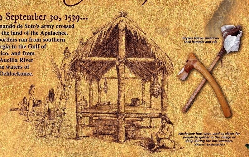
2. Marker detail: “Chickee” by Martin Pate
Apalachee huts were used as places for people to gather in the village or sleep during the hot summers.
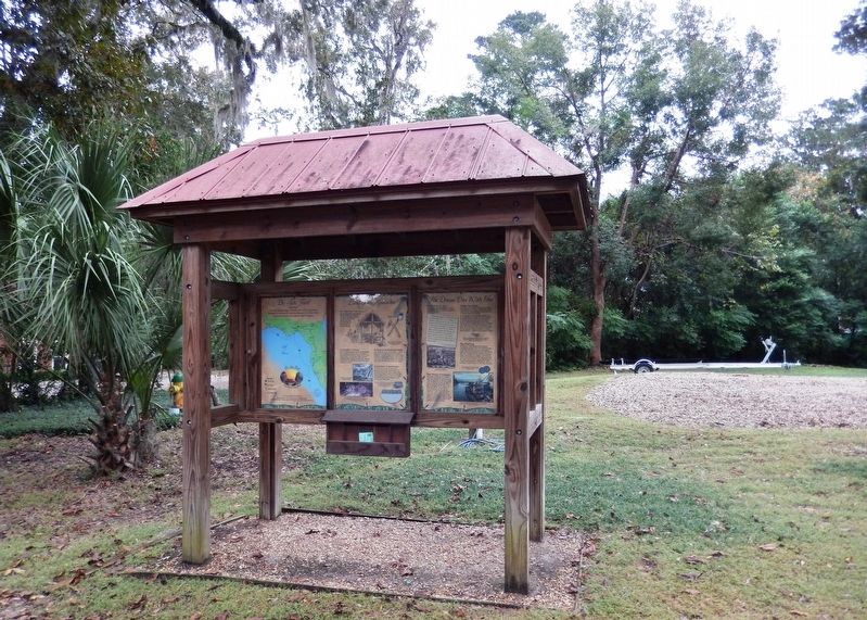
More about this marker. Marker is a large, composite plaque mounted vertically within a heavy-duty wooden kiosk. This marker is the center panel of a three-panel kiosk.
Regarding Land of the Apalachee. Hernando de Soto landed at Tampa Bay in 1539 and made his way north in search of gold and riches. A controversial figure in American history, Spanish Conquistador Hernando de Soto is regarded as a hero and brave explorer by some — and an overzealous madman by others. The De Soto Trail shows him as a product of Medieval Europe, a brutal society forged over 780 years of warfare. It also tells the story
of the Native American peoples of 16th-century Florida, a highly advanced collection of chiefdoms struggling against each other to gain dominance over their regions.
Related markers. Click here for a list of markers that are related to this marker. Florida De Soto Trail
Also see . . .
1. The Apalachees of Northwest Florida. From at least A.D. 1000, a group of farming Indians was living in northwest Florida. They were called the Apalachees.
Florida Division of Historical Resources, November 14, 2018
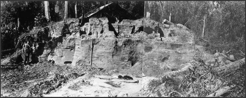
3. Marker detail: Lake Jackson Mound 3, facing west, in profile
This photograph was taken in 1976 by B. Calvin Jones during emergency salvage excavations. The excavation cut shows the different layers of soil used to construct the mound with the human interments located at its base.
2. De Soto’s Expedition to North America. In 1536, de Soto obtained a royal commission to conquer and settle the region known as La Florida (now the southeastern United States), which had been the site of earlier explorations by Juan Ponce de León and others. De Soto set out from Spain in April 1538, set with 10 ships and 700 men. After a stop in Cuba, the expedition landed at Tampa Bay in May 1539. They moved inland and eventually set up camp for the winter at a small Indian village near present-day Tallahassee. (Submitted on November 16, 2018, by Cosmos Mariner of Cape Canaveral, Florida.)
3. Apalachee People.
Photographed by Cosmos Mariner, November 14, 2018
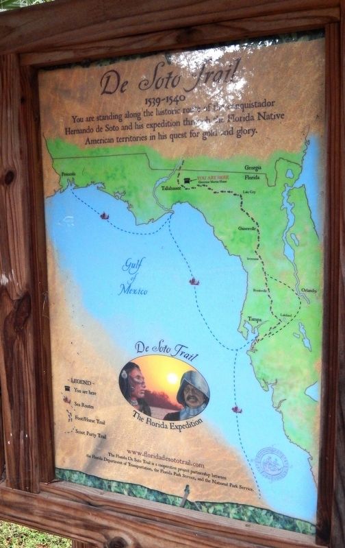
4. Florida De Soto Trail Map (panel to the left of marker in kiosk)
1539-1540
Photographed by Cosmos Mariner, November 14, 2018
5. Land of the Apalachee Marker Kiosk (marker panel is in center of kiosk; map is on left)
Photographed by Cosmos Mariner, November 14, 2018
6. Land of the Apalachee Marker Kiosk (wide view)
Credits. This page was last revised on February 12, 2023. It was originally submitted on November 16, 2018, by Cosmos Mariner of Cape Canaveral, Florida. This page has been viewed 1,261 times since then and 126 times this year. Last updated on November 21, 2018, by Cosmos Mariner of Cape Canaveral, Florida. Photos: 1, 2, 3, 4, 5, 6. submitted on November 16, 2018, by Cosmos Mariner of Cape Canaveral, Florida. • Bernard Fisher was the editor who published this page.
