Woodland Drives in Tallahassee in Leon County, Florida — The American South (South Atlantic)
His Dream Dies With Him
Florida De Soto Trail
— October 6, 1539 —
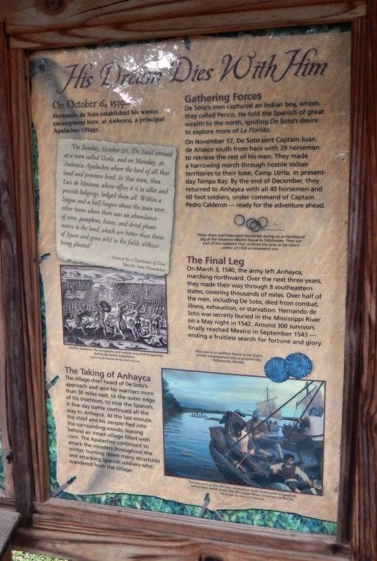
Hernando de Soto established his winter encampment here, at Anhayca, a principal Apalachee Village
”On Sunday, October 25, [De Soto] arrived at a town called Uzela, and on Monday, at Anhayca Apalachee where the lord of all that land and province lived. In that town, then Luis de Moscoso, whose office it is to allot and provide lodgings, lodged them all. Within a league and a half league about the town were other towns where there was an abundance of corn, pumpkins, beans, and dried plums native to the land, which are better than those of Spain and grow wild in the fields without being planted,”
- Account by a Gentleman of Elvas
The De Soto Chronicles
The Taking of Anhayca
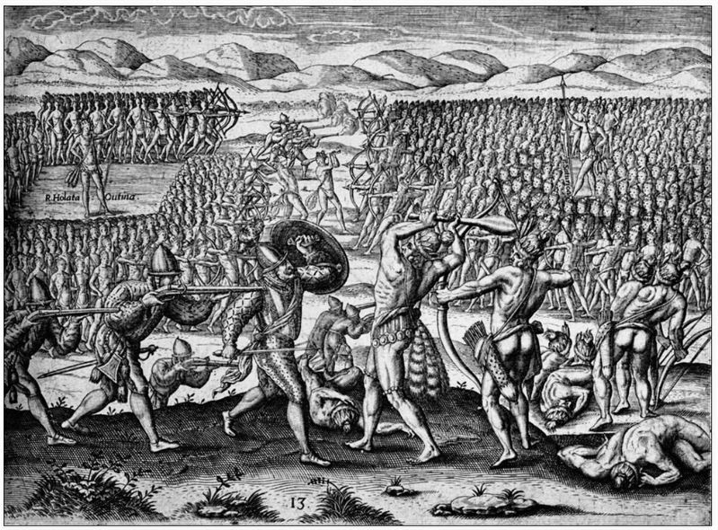
The village chief heard of De Soto’s approach and sent his warriors more than 30 miles east, to the outer edge of his chiefdom, to stop the Spanish. A five-day battle continued all the way to Anhayca. At the last minute, the chief and his people fled into the surrounding woods, leaving behind an intact village filled with corn. The Apalachee continued to attack the invaders throughout the winter, burning down many structures and attacking Spanish soldiers who wandered from the village.
Gathering Forces
De Soto’s men captured an Indian boy, whom they called Perico. He told the Spanish of great wealth to the north, igniting De Soto’s desire to explore more of La Florida.
On November 17, De Soto sent Captain Juan de Añasco south from here with 29 horsemen to retrieve the rest of his men. They made a harrowing march through hostile Indian territories to their base, Camp Uzita, in present-day Tampa Bay. By the end of December, they returned to Anhayca with all 40 horsemen and 60 foot soldiers, under command of Captain Pedro Calderon – ready for adventure ahead.
The Final Leg
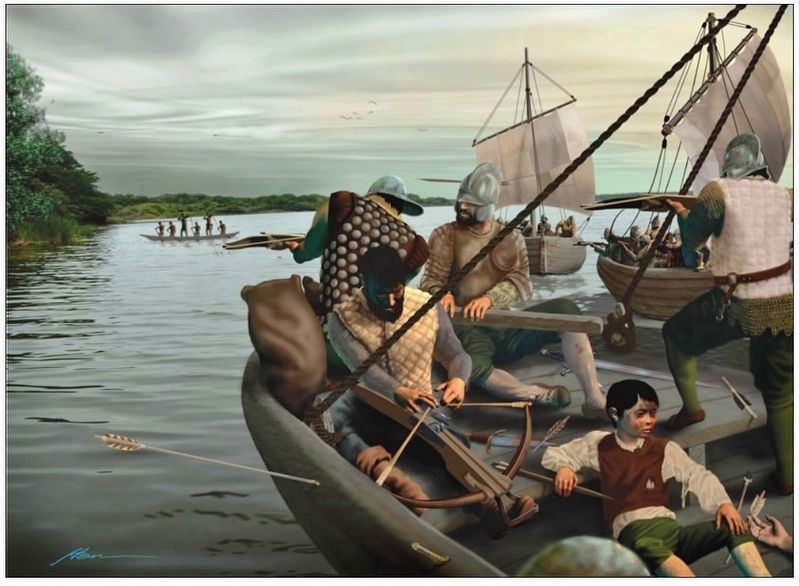
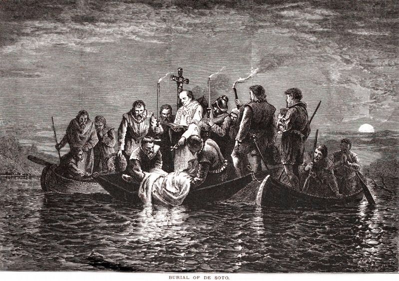
On March 3, 1540, the army left Anhayca, marching northward. Over the next three years, they made their way through 8 southeastern states, covering thousands of miles. Over half of the men, including De Soto, died from combat, illness, exhaustion, or starvation. Hernando de Soto was secretly buried in the Mississippi River on a May night in 1542. Around 300 survivors finally reached Mexico in September 1543 – ending a fruitless search for fortune and glory.
Erected by Florida De Soto Trail, Florida Department of Transportation, the Florida Park Service, and the National Park Service. (Marker Number 29a.)
Topics. This historical marker is listed in these topic lists: Colonial Era
• Exploration • Native Americans • Notable Events. A significant historical date for this entry is October 6, 1539.
Location. 30° 26.157′ N, 84° 16.115′ W. Marker is in Tallahassee, Florida, in Leon County. It is in Woodland Drives. Marker is on Desoto Park Drive south of East Lafayette Street, on the left when traveling south. Kiosk and marker are located on the grounds of the DeSoto Site Historic State Park, on the east side of the road as you approach the parking lot. Touch for map. Marker is at or near this postal address: 1001 Desoto Park Drive, Tallahassee FL 32301, United States of America. Touch for directions.
Other nearby markers. At least 8 other markers are within walking distance of this marker. Land of the Apalachee (here, next to this marker); De Soto Winter Encampment Site 1539~1540 (a few steps from this marker); Governor John W. Martin House (within shouting distance of this marker); Myers Park Historic District (approx. 0.4 miles away); Old Fort Park (approx. 0.4 miles away); Korean War Memorial (approx. 0.4 miles away); a different marker also named Old Fort Park (approx. 0.4 miles away); Modern Tallahassee (approx. half a mile away). Touch for a list and map of all markers in Tallahassee.
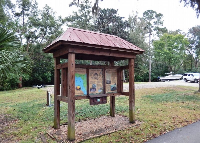
More about this marker. Marker is a large, composite
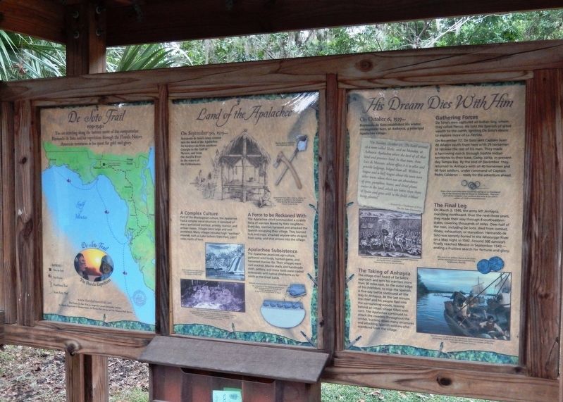
plaque mounted vertically within a heavy-duty wooden kiosk. This marker is the right-most panel of a three-panel kiosk.
Regarding His Dream Dies With Him. Hernando de Soto landed at Tampa Bay in 1539 and made his way north in search of gold and riches. A controversial figure in American history, Spanish Conquistador Hernando de Soto is regarded as a hero and brave explorer by some — and an overzealous madman by others. The De Soto Trail shows him as a product of Medieval Europe, a brutal society forged over 780 years of warfare. It also tells the story of the Native American peoples of 16th-century Florida, a highly advanced collection of chiefdoms struggling against each other to gain dominance over their regions.
Related markers. Click here for a list of markers that are related to this marker. Florida De Soto Trail
Also see . . .
1. De Soto Winter Encampment Site Historic State Park. After fighting their way up the state and across the Suwannee River, the army entered the territory of the Apalachee. These people, like the other tribes to the south, resisted the invasion with attacks by the fierce warriors, and by burning their own fields. The Apalachee abandoned their towns in anticipation of the Spaniards' arrival. From October 1539 through March 1540, the Spanish
Photographed By Cosmos Mariner, November 14, 2018
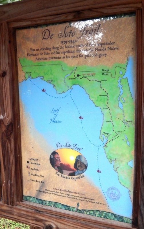
4. Florida De Soto Trail Map (left-most of three panels in the kiosk)
1539-1540
2. De Soto’s Expedition to North America. In 1536, de Soto obtained a royal commission to conquer and settle the region known as La Florida (now the southeastern United States), which had been the site of earlier explorations by Juan Ponce de León and others. De Soto set out from Spain in April 1538, set with 10 ships and 700 men. After a stop in Cuba, the expedition landed at Tampa Bay in May 1539. They moved inland and eventually set up camp for the winter at a small Indian village near present-day Tallahassee. (Submitted on November 16, 2018, by Cosmos Mariner of Cape Canaveral, Florida.)
Credits. This page was last revised on February 12, 2023. It was originally submitted on November 16, 2018, by Cosmos Mariner of Cape Canaveral, Florida. This page has been viewed 370 times since then and 23 times this year. Last updated on November 21, 2018, by Cosmos Mariner of Cape Canaveral, Florida. Photos: 1, 2, 3, 4, 5, 6. submitted on November 16, 2018, by Cosmos Mariner of Cape Canaveral, Florida. 7. submitted on January 9, 2019, by Allen C. Browne of Silver Spring, Maryland. • Bernard Fisher was the editor who published this page.
