
Near Fort White in Columbia County, Florida — The American South (South Atlantic)
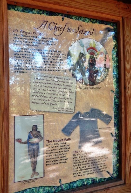
A Chief is Seized
Florida De Soto Trail
| — | August 17, 1539 | — |
Photographed by Cosmos Mariner, November 3, 2018
1. A Chief is Seized Marker
When Hernando de Soto’s scouts sight the abandoned Indian village of Caliquen, Cavalry Captain Baltasar de Gallegos is ordered to move ahead –
My men and I were sent to check for food and supplies. When we neared the village, we spotted a large number of Indians attempting to flee into the woods. We were able to capture 17. One was the daughter of Chief Aguacalequen. This afternoon, a group of Indians arrived with the chief. His efforts to negotiate with us for the release of his daughter failed. We seized him, holding them both as hostages.
”He ordered Luis de Moscoso to set out immediately from Cale and said that he was awaiting him there in Caliquen. It appeared to Luis de Moscoso and to many others that they must turn back from Apalachee and the buried iron and other things at Cale. They reached Caliquen after great hardship for the land over which the Governor had passed was destroyed and bare of maize.”
- Account by a Gentleman from Elvas
The De Soto Chronicles
The Native Path
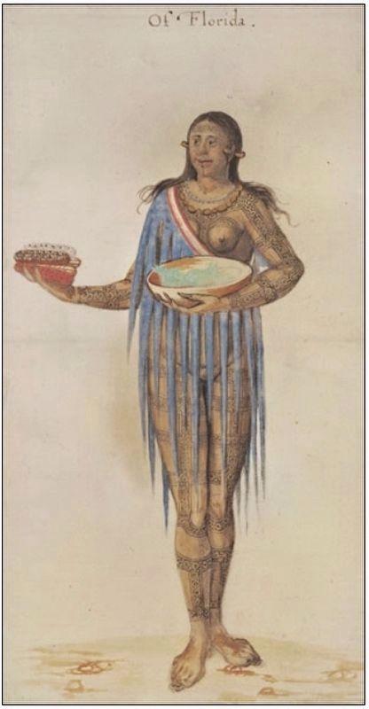
At that time, kinship was the most important connection in the Native American culture. Most of the tribes De Soso encountered traced their ancestry through their female lineage.
The Conquistador Trail
The army led by Luis Moscoso was starving when it left Ocale, as food was in short supply. Some lightened their load by discarding their chain-mail armor. Their hardship increased because De Soto’s scouting party had picked the crops clean a few weeks earlier. By the time the army reached De Soto, most of the men were on the verge of starvation.
Erected by Florida De Soto Trail, Florida Department of Transportation, the Florida Park Service, and the National Park Service. (Marker Number 22.)
Topics. This historical marker is listed in these topic lists: Colonial Era •
this page online
Location. 29° 59.061′ N, 82° 45.735′ W. Marker is near Fort White, Florida, in Columbia County. It can be reached from SW Elim Church Road (County Road 238) 0.2 miles east of SW Ichetucknee Avenue, on the right when traveling east. Marker is located near the Ichetucknee Springs parking lot, about 2/10 mile inside the park, accessible from the North Entrance to Florida's Ichetucknee Springs State Park. Touch for map. Marker is in this post office area: Fort White FL 32038, United States of America. Touch for directions.

Regionally, this marker is in North Florida. It is also in the American South. Globally, it is in the North Atlantic Region, North America, a Gulf of Mexico state, the Western Hemisphere, the Western World, and the Anglosphere. Historically, it finds itself in what was once New Spain, the territory of the Mississippian Culture, one of the Confederate States of America, and the Antebellum South.
Other nearby markers. At least 8 other markers are within 12 miles of this marker, measured
Courtesy of Florida Museum of Natural History, Randell Research Center
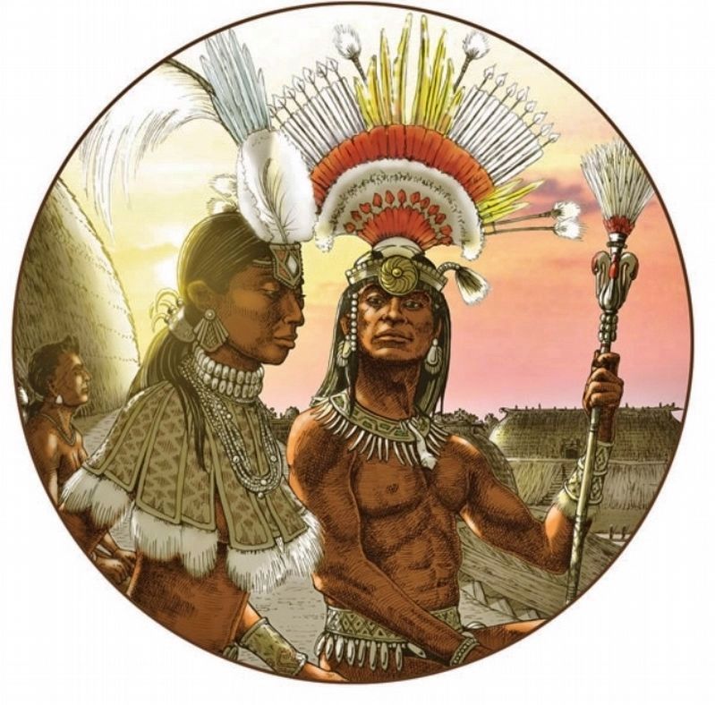
2. Marker detail: “On Top of the World” by Merald Clark
A Native American chief and his wife dressed in colorful furs and feathers sit in an elevated position.
More about this marker. Marker is a large, composite plaque mounted vertically within a heavy-duty wooden kiosk.
Related markers. Click here for a list of markers that are related to this marker. Florida De Soto Trail
Also see . . . De Soto’s Expedition to North America. In 1536, de Soto obtained a royal commission to conquer and settle the region known as La Florida (now the southeastern United States), which had been the site of earlier explorations by Juan Ponce de León and others. De Soto set out from Spain in April 1538, set with 10 ships and 700 men. After a stop in Cuba, the expedition landed at Tampa Bay in May
Courtesy of the Trustees of the British Museum
3. Marker detail: ”Florida Native Woman” by John White (1585)
Photographed by Cosmos Mariner, November 3, 2018
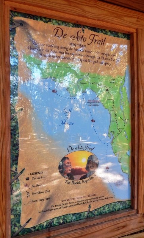
4. Florida De Soto Trail Map (panel to the left of marker in kiosk)
1539-1540
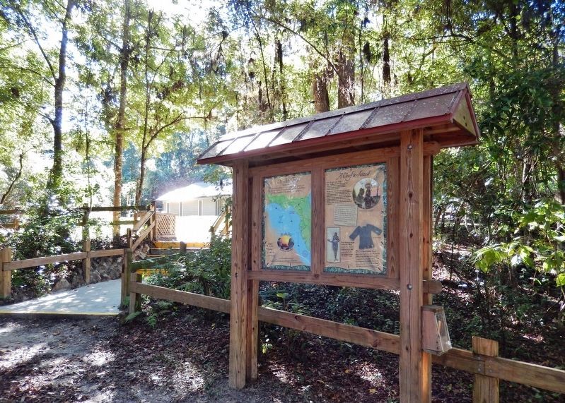
Photographed by Cosmos Mariner, November 3, 2018
5. A Chief is Seized Marker Kiosk (wide view)
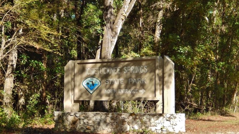
Photographed by Cosmos Mariner, November 3, 2018
6. Ichetucknee Springs State Park North Entrance Sign (turn here to access marker)
Credits. This page was last revised on January 3, 2021. It was originally submitted on November 6, 2018, by Cosmos Mariner of Cape Canaveral, Florida. This page has been viewed 1,065 times since then and 78 times this year. Last updated on December 2, 2018, by Byron Hooks of Sandy Springs, Georgia. Photos: 1, 2, 3, 4, 5. submitted on November 7, 2018, by Cosmos Mariner of Cape Canaveral, Florida. 6. submitted on December 27, 2018, by Cosmos Mariner of Cape Canaveral, Florida. • Bernard Fisher was the editor who published this page.
