Blakeley in Baldwin County, Alabama — The American South (East South Central)
The Apalachee Village
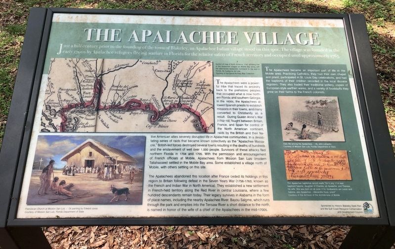
The Apalachees were a powerful tribe that traced its ancestry back to the prehistoric peoples that occupied what is now northern Florida and southern Georgia. In the 1600s, the Apalachees allowed Spanish priests to establish missions in their towns, and many converted to Christianity as a result. During Queen Anne's War (1702-13), fought between Britain, France, and Spain for control of the North American continent, raids by the British and their Native American allies severely disrupted life in Apalachee communities. In a devastating series of raids that became known collectively as the "Apalachee Massacre," British-led forces destroyed several towns resulting in the deaths of hundreds and the enslavement of well over 1,000 people. Survivors of these attacks fled northern Florida in 1704 and 1705. With the permission and encouragement of French officials at Mobile, Apalachees from Mission San Luis (modern Tallahassee) settled in the Mobile Bay area. Some established a village north of Mobile, with others settling on this site.
The Apalachees abandoned this location after France ceded its holdings in this region to Britain following defeat in the Seven Years War (1756-1763; known as the French and Indian War in North America). They established a new settlement in French-held territory along the Red River in central Louisiana, where a few hundred descendants remain today. Their legacy survives in Alabama in the form of place names, including the nearby Apalachee River. Bayou Salome, which runs through the park and empties into the Tensaw River a short distance to the north, is named in honor of the wife of a chief of the Apalachees in the mid-1700s.
The Apalachees became an important part of life in the Mobile area. Practicing Catholics, they had their own chapel and priest, participated in St. Louis Day celebrations, and had the baptisms of their children recorded in the local diocese registers. They also traded their traditional pottery, copies of European-style earthen wares, and a variety of foodstuffs they grew on their farms to the French colonists.
Photo captions:
Top left map: Section of map of North America, 1742, showing one of the Apalachee villages on Mobile Bay along with the abandoned Apalachee homeland to the east in Florida. By Guillaume de Lisle.
Bottom left: Franciscan Church at Mission San Luis - Oil painting by Edward Jonas
Right middle: Daily life among the Apalachees - By John LoCastro
Bottom right: This Apalachee baptismal record reads "On 5 July 1710 was baptized Salome, daughter of Charisto, an Apalache, and Therese, his wife. She was born on 28 June 1710. Godparents are Lasso and Salome, also Apalaches. --Alexandre Huve, priest"
Erected 2017 by Historic Blakeley State Park & Gulf Coast Resource Conservation & Development Council.
Topics. This historical marker is listed in these topic lists: Native Americans • Settlements & Settlers • War, French and Indian • Wars, US Indian. A significant historical date for this entry is June 28, 1710.
Location. 30° 44.851′ N, 87° 55.411′ W. Marker is in Blakeley, Alabama, in Baldwin County. Marker is on Franklin Street, 0.4 miles north of Washington Avenue, on the right when traveling west. Located in Historic Blakeley State Park. Touch for map. Marker is at or near this postal address: Franklin Street, Spanish Fort AL 36527, United States of America. Touch for directions.
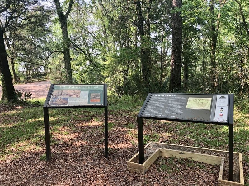
Other nearby markers. At least 8 other markers are within walking distance of this marker. The Bottle Creek Site (here, next to this marker); The Town of Blakeley (approx. ¼ mile away); Site of Baldwin County's First Courthouse (approx. ¼ mile away); Legendary Oaks (approx. ¼ mile away); Redoubt Six (approx. 0.6 miles away); Battle of Blakeley
(approx. 0.6 miles away); Alabama (approx. 0.6 miles away); Fort Blakeley (Blakely*) (approx. ¾ mile away). Touch for a list and map of all markers in Blakeley.
Also see . . . The Encyclopedia of Alabama article - Apalachees in Alabama. (Submitted on April 7, 2019, by Mark Hilton of Montgomery, Alabama.)
Credits. This page was last revised on April 9, 2019. It was originally submitted on April 7, 2019, by Mark Hilton of Montgomery, Alabama. This page has been viewed 1,172 times since then and 95 times this year. Photos: 1, 2, 3. submitted on April 7, 2019, by Mark Hilton of Montgomery, Alabama.


