Arches National Park in Grand County, Utah — The American Mountains (Southwest)
Wolfe Ranch
Photographed by Cosmos Mariner, June 14, 2013
1. Wolfe Ranch Marker
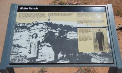
There are two inset pictures on the marker: (1) John Wesley Wolfe, and (2) Esther and Ferol Stanley (John Wolfe's grandchildren) with their pet burro.
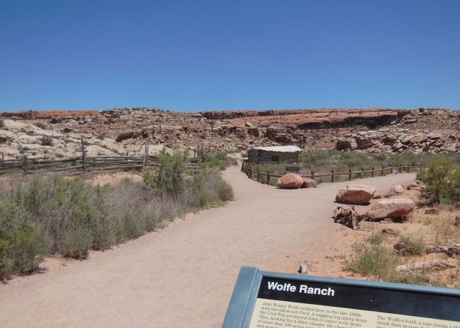
John Wesley Wolfe settled here in the late 1800s with his oldest son Fred. A nagging leg injury from the Civil War prompted John to move west from Ohio, looking for a drier climate. He chose this tract of more than 100 acres along Salt Wash for its water and grassland – enough for a few cattle.
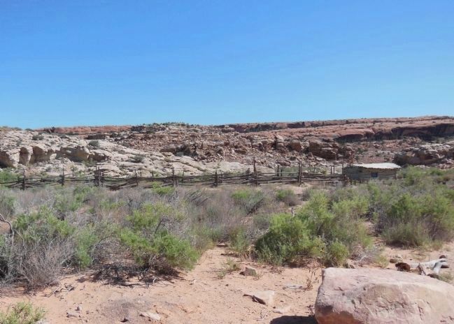
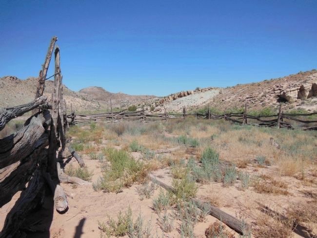
The Wolfes built a one-room cabin, a corral, and a small dam across Salt Wash. For more than a decade they lived alone on the remote ranch.
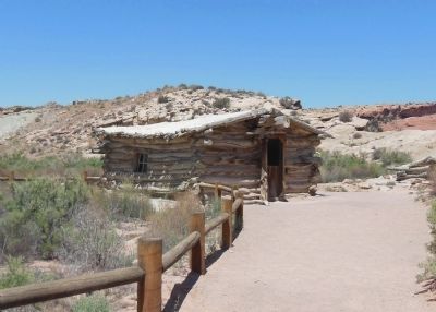
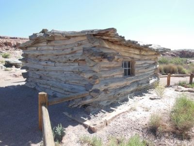
In 1906, John’s daughter Flora Stanley, her husband, and their children moved to the ranch. Shocked at the primitive conditions, Flora convinced her father to build a new cabin with a wood floor – the cabin you see today.
The reunited family weathered a few more years in Utah and in 1910 returned to Ohio. John Wolfe died on October 22, 1913, in Etna, Ohio, at the age of eighty four.
inset picture and text: John Wesley Wolfe
John Wesley Wolfe (right) and his family cared for this place for more than a decade. You can help preserve it by looking and thinking about the character of the original caretakers. Please do not touch the walls, do not enter the buildings, and do not leave marks or graffiti on the walls. Because of its importance in local history, this site has been listed on the National Register of Historic Places.
inset picture: Esther and Ferol Stanley
Esther and Ferol Stanley, with their pet burro, in front of the cabin on Grandpa Wolfe’s ranch, 1907.
Erected by National
this page online
Topics. This historical marker is listed in these topic lists: Indigenous Peoples and Communities • Settlements & Settlers. A significant historical date for this entry is October 22, 1913.
Location. This marker has been replaced by another marker nearby. It was located near 38° 44.159′ N, 109° 31.197′ W. Marker was in Arches National Park, Utah, in Grand County. It could be reached from Delicate Arch Trail. The marker is located near the beginning of the Delicate Arch Trail. Touch for map. Marker was in this post office area: Moab UT 84532, United States of America. Touch for directions.

Regionally, this marker was in Canyon Country. It was also in the American Mountain West, on the Colorado Plateau, and at the Four Corners. Globally, it was in North America, the Western Hemisphere, the Western World, and the Anglosphere. Historically, it found itself in what was once New Spain and also Mexico’s Alta California.

Other nearby markers. At least 8 other markers are within 4 miles of this location, measured as the crow flies: Home Sweet Desert (a few steps from this marker); Stories on Stone
Photographed by Cosmos Mariner, June 14, 2013
2. Remnants of the Past
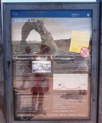
A short walk up the trail brings you to the Wolfe Cabin. John Wesley Wolf and his son Fred settled on the banks of Salt Wash around 1898. Drawn by the climate, which was drier and “healthier” than their previous home in Ohio, John and Fred spent more than a decade leading lives of solitude and hard work.
Beyond the cabin you can see rock art created by the Ute people depicting a hunting scene with riders on horseback from around the 1700s.
While the human story goes back thousands of years, the geologic story reaches much further. The remnant of rock born about 150 million years ago currently known as Delicate Arch, serves as most travelers’ destination. Surrounded by sky and pierced by nature, Delicate Arch stands as an iconic image of Arches National park.
Beyond the cabin you can see rock art created by the Ute people depicting a hunting scene with riders on horseback from around the 1700s.
While the human story goes back thousands of years, the geologic story reaches much further. The remnant of rock born about 150 million years ago currently known as Delicate Arch, serves as most travelers’ destination. Surrounded by sky and pierced by nature, Delicate Arch stands as an iconic image of Arches National park.
Photographed by Cosmos Mariner, June 14, 2013
3. Wolfe Ranch beyond Marker (wide view)
Photographed by Cosmos Mariner, June 14, 2013
4. Wolfe Cabin c1906 (front view)
Photographed by Cosmos Mariner, June 14, 2013
5. Wolfe Cabin c1906 (back view)
Photographed by Cosmos Mariner, June 14, 2013
6. Wolfe Ranch Corral (wide view)
Corral is on the left; cabin is on the right.
Photographed by Cosmos Mariner, June 14, 2013
7. Wolfe Ranch Corral (inside view)
Photographed by Cosmos Mariner, June 14, 2013
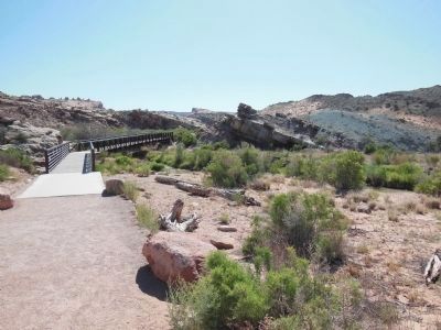
8. Wolfe Ranch Salt Wash Foot Bridge
The Delicate Arch trail crosses John Wolfe's Salt Wash on this foot bridge just beyond the cabin.
Photographed by Cosmos Mariner, June 14, 2013
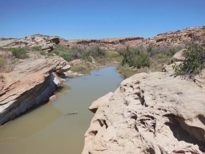
9. Salt Wash
Photographed by Cosmos Mariner, June 14, 2013
10. Delicate Arch Trail Map
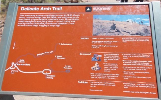
This moderately strenuous trail begins near the Wolfe Ranch cabin, crosses a bridge over Salt Wash, and continues up the long stretch of open slickrock to Delicate Arch. The trail also winds through an area full of chert – a hard, shiny rock used by Native Americans for tools and weapons – and around a short ledge, hugging a steep cliff.
Photographed by Craig Baker, April 8, 2019
11. Delicate Arch
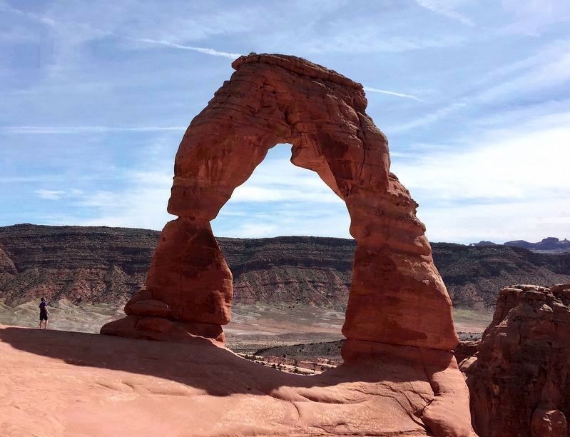
At the end of a strenuous hike from Wolfe Ranch. An iconic image of Arches National Park.
Photographed by James Hulse, March 31, 2025
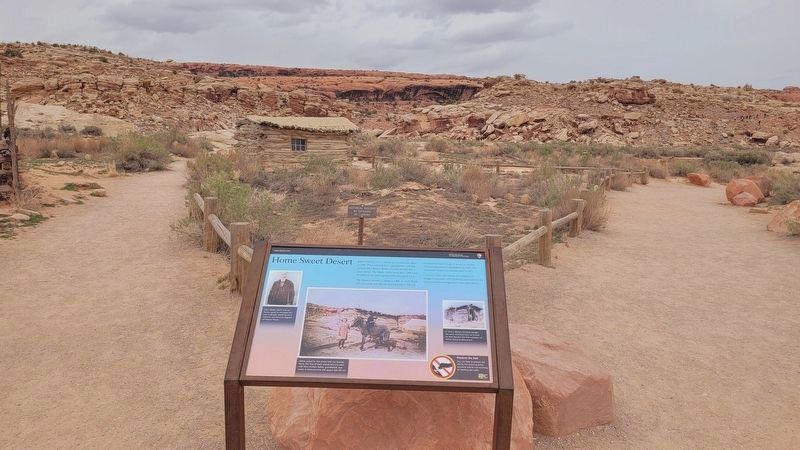
12. New replacement marker
Credits. This page was last revised on April 30, 2025. It was originally submitted on March 31, 2014, by Cosmos Mariner of Cape Canaveral, Florida. This page has been viewed 1,081 times since then and 32 times this year. Last updated on April 11, 2019, by Craig Baker of Sylmar, California. Photos: 1. submitted on March 31, 2014, by Cosmos Mariner of Cape Canaveral, Florida. 2, 3, 4, 5, 6, 7, 8, 9, 10. submitted on April 1, 2014, by Cosmos Mariner of Cape Canaveral, Florida. 11. submitted on April 11, 2019, by Craig Baker of Sylmar, California. 12. submitted on April 30, 2025, by James Hulse of Medina, Texas. • Andrew Ruppenstein was the editor who published this page.
