St. Mary's City in St. Mary's County, Maryland — The American Northeast (Mid-Atlantic)
Project Lead Coffins
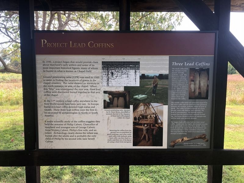
In 1990, a project began that would provide clues about Maryland's early settlers and some of its most important historical figures, many of whom lie buried in what is known as Chapel Field.
Ground penetrating radar (GPR) was used in 1989 to assist in finding the locations of graves in the chapel cemetery. The radar showed an anomaly in the north transept, or arm, of the chapel. When this "blip" was investigated the next year, three lead coffins were discovered buried together in that area of the chapel.
In the 17th century, a lead coffin anywhere in the New World would have been very rare. In Europe, burial in a lead coffin denoted high status and wealth. These three lead coffins were the first to be excavated by archaeologists in North or South America.
A major scientific study of the coffins suggests they held the remains of Philip Calvert, Chancellor of Maryland and youngest son of George Calvert; Anne Wolsley Calvert, Philip's first wife; and an infant. Archaeology clearly shows the infant was buried after the adults and is probably the only child of Philip by his second wife, Jane Sewell Calvert.
Three Lead Coffins
The small coffin held the remains of a six-month old baby, probably a girl. She had severe medical problems including obvious skull lesions and characteristics of dietary problems such as rickets. In addition to the child's remains, several shroud pins, a small metal eyelet, and traces of finely woven limit were found in the coffin.
The middle coffin held well-preserved wood from the inner coffin and the extremely well-preserved remains of a woman, probably about 60 years at death. The coffin included evidence of a linen shroud, intact silk ribbons, and rosemary, the herb of remembrance. Her skeletal remains showed that she had survived a severely broken leg. Her bones showed evidence of osteoporosis and her teeth were severely decayed.
The largest lead coffin also held an inner coffin. Inside were the highly deteriorated remains of an adult male, in his mid-50s at death. As his body decayed, the upper third of the skeleton was transformed into a white crystalline compound. This may have been the result of an unsuccessful attempt at embalming.
Erected by Historic St. Mary's City.
Topics. This historical marker is listed in these topic lists: Cemeteries & Burial Sites • Colonial Era • Women. A significant historical year for this entry is 1990.
Location. 38° 10.993′ N, 76° 25.716′ W. Marker is in St. Mary's City, Maryland, in St. Mary's County. Marker can be reached from Point Lookout Road (Maryland Route 5) 0.4 miles west of Rosecroft Road, on the left when traveling west. Touch for map. Marker is at or near this postal address: 16721 Point Lookout Road, Saint Marys City MD 20686, United States of America. Touch for directions.
Other nearby markers. At least 8 other markers are within walking distance of this marker. "…buried…in a most solemn manner" (here, next to this marker); Putting Together the Pieces (here, next to this marker); Andrew White, Apostle to Maryland (here, next to this marker); Shock Troops of the Counter-Reformation (here, next to this marker); The "Priests' House" (here, next to this marker); The Chapel Architecture (here, next to this marker); An End of Freedom but Persistence of Faith (here, next to this marker); Sacred Ground and Holy Buildings (here, next to this marker). Touch for a list and map of all markers in St. Mary's City.
Credits. This page was last revised on September 1, 2021. It was originally submitted on September 2, 2019, by Devry Becker Jones of Washington, District of Columbia. This page has been viewed 296 times since then and 26 times this year. Photo 1. submitted on September 2, 2019, by Devry Becker Jones of Washington, District of Columbia.
