St. Mary's City in St. Mary's County, Maryland — The American Northeast (Mid-Atlantic)
Historic St. Mary's City
Welcome
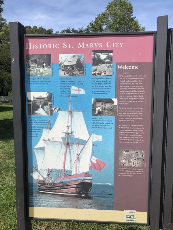
Welcome to Historic St. Mary's City, the site of Maryland's first capital. English settlers established the colony in 1634, not long after the founding of Jamestown and Plymouth. It flourished until the capital was removed to Annapolis in 1695. Today, Historic St. Mary's City is a National Historic Landmark and is recognized as one of America's best-preserved archaeological sites.
While the original city no longer stands, historians and archaeologists have succeeded in locating and re-creating many of the 17th-century roads and paths, houses, and public buildings.
We invite you to explore Historic St. Mary's City for yourself and discover a fascinating history rich in struggle and hardship, opportunity and triumph. Many of America's great ideals, including religious toleration and separation of church and state, were first tested in this place.
An extensive archaeology program has allowed Historic St Mary's City to discover much of the early capital's long-buried past.
[Captions, clockwise from top left:]
Godiah Spray Tobacco Plantation
Be sure to visit the Spray Plantation to learn about life in the 1600s.
Smith's
this page online
Historic St. Mary's City continues to reconstruct many of the buildings that were here in the 17th century based on historical, archaeological, and scientific research.
Woodland Indian Hamlet
This re-created hamlet represents the year 1634 when the first colonists arrived at a small Yaocomaco Indian settlement located in the St. Mary's River valley.
Cordea's Hope
This storehouse was completed in 1999 and is built on the site where the original 17th-century structure once stood.
Maryland Dove
Come aboard this replica of a trading vessel built much like the ones that brought goods to the colonies more than 300 years ago.
State House of 1676
This faithful reconstruction of the first brick State House was built in 1934 to commemorate the 300th anniversary of the founding of the colony of Maryland and its capital, St. Mary's City.
Erected by Historic St. Mary's City.
Topics and series. This historical marker is listed in these topic lists: Agriculture • Colonial Era • Indigenous Peoples and Communities • Settlements & Settlers. In addition, it is included in the National Historic Landmarks
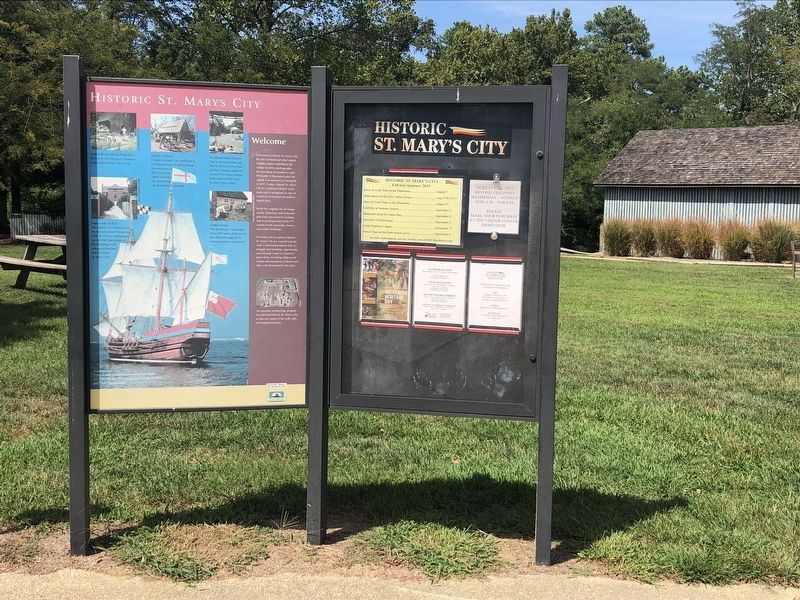
Location. 38° 10.849′ N, 76° 25.802′ W. Marker is in St. Mary's City, Maryland, in St. Mary's County. It is on Hogaboom Lane 0.2 miles west of Rosecroft Road, on the right when traveling west. Touch for map. Marker is at or near this postal address: 18751 Hogaboom Lane, Saint Marys City MD 20686, United States of America. Touch for directions.

Regionally, this marker is in Southern Maryland. It is also in the American South, specifically in the Upper South, in the Mid-Atlantic, in the Tidewater, in the Chesapeake Bay Region, and on the Eastern Seaboard. Globally, it is in the North Atlantic Region, North America, the Western Hemisphere, the Western World, and the Anglosphere. Historically, it finds itself in what was once one of the original Thirteen Colonies and also the Antebellum South.
Other nearby markers. At least 8 other markers are within walking distance of this marker: A different marker also named Historic St. Mary's City (within shouting distance of this marker); Where is the City? (within shouting distance of this marker); a different marker also named An Opportunity Awaits… (about 400 feet away); Encountering the Other (about 400 feet away); "a lande, even as God made it" (about 600 feet away); The Calvert Family and the Founding of Maryland (about 600 feet away); Welcome to the Chapel Field (about 700 feet away); An Experiment with Liberty of Conscience (approx. 0.2 miles away). Touch for a list and map of all markers in St. Mary's City.
Other markers no longer nearby. An Opportunity Awaits… (was about 400 feet away, measured in a direct line but has been replaced with another marker now near it); a different marker also named "a lande, even as God made it" (was about 600 feet away but has been replaced with another marker now near it).
Credits. This page was last revised on April 16, 2026. It was originally submitted on September 3, 2019, by Devry Becker Jones of Washington, District of Columbia. This page has been viewed 487 times since then and 48 times this year. Photos: 1, 2. submitted on September 3, 2019, by Devry Becker Jones of Washington, District of Columbia.
