St. Mary's City in St. Mary's County, Maryland — The American Northeast (Mid-Atlantic)
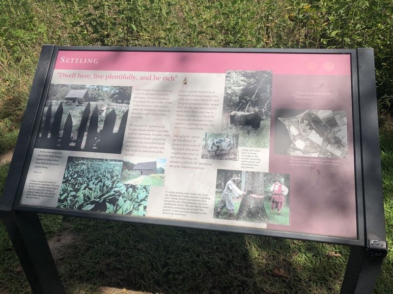
"Dwell here, live plentifully, and be rich"
Settling

Photographed By Devry Becker Jones (CC0), August 30, 2019
1. "Dwell here, live plentifully, and be rich" Marker
The demands for animal furs in Europe initially seemed to promise such an opportunity. However, other colonies had already cornered the market on the most prized northern sources of furs, and there was little profit for newcomers in the fur trade.
Tobacco quickly replaced fur as Maryland's dominant source of income, but it took a toll on the land. The great Chesapeake forest canopy, once virtually unbroken except for small Indian fields, gave way to tobacco plantations in which the soil gradually exhausted its own nutrients, requiring constant rotation of the planted fields.
During the 18th century, the introduction of plows to plant crops of wheat and other grains caused further stress on the land. Plowing contributed to soil run-off, depositing silt in the region's waterways.
[Captions:]
"...the tobacco trade destroyes abundance of timber, both for making of hogsheads & building of tobacco houses, besides clearing of ground yearly for planting."
Hugh James, 1698
Tobacco was grown widely in Maryland for more than 350 years. By the 21st century, responding to concerns about the health of tobacco users, the state government began paying farmers to stop growing it.
To avoid clearing entire fields, the colonists adopted the Indian method of girdling trees. A strip of bark was removed from around the tree, preventing the sap from reaching the leaves. The tree lost its leaves and died, permitting sun to reach the ground. Crops were then planted in the hills around the dead trees.
Cattle and swine were let loose to forage in the woods, trampling native plants and disrupting hunting patterns.
[Aside:]
"...the place abounds not alone with profit, but also with pleasure."
Father Andrew White, 1634
The great forest canopy of the Chesapeake Bay eventually succumbed to agriculture and town settlement.
Erected by Historic St. Mary's City.
Topics. This historical marker is listed in these topic lists: Agriculture • Colonial Era • Environment • Settlements & Settlers. A significant historical year for this entry is 1698.
Location. 38° 10.967′ N, 76° 25.942′ W. Marker is in St. Mary's City, Maryland, in St. Mary's County. Marker can be reached from Point Lookout Road (Maryland Route

Photographed By Devry Becker Jones (CC0), August 30, 2019
2. "Dwell here, live plentifully, and be rich" Marker
Other nearby markers. At least 8 other markers are within walking distance of this marker. From Slavery to Freedom (about 300 feet away, measured in a direct line); Framing the Past (about 300 feet away); "…once the Metropolis" (about 500 feet away); Horse High, Pig Tight, and Bull Strong (about 500 feet away); "a lande, even as God made it" (about 500 feet away); Early Signs of Industry (about 500 feet away); Witness to History (about 600 feet away); Fear of War, People of Peace (about 600 feet away). Touch for a list and map of all markers in St. Mary's City.
Credits. This page was last revised on September 3, 2019. It was originally submitted on September 3, 2019, by Devry Becker Jones of Washington, District of Columbia. This page has been viewed 124 times since then and 5 times this year. Photos: 1, 2. submitted on September 3, 2019, by Devry Becker Jones of Washington, District of Columbia.