Near Georgesville in Franklin County, Ohio — The American Midwest (Great Lakes)
The Voss Site
Photographed by Joel Seewald, October 14, 2019
1. The Voss Site Marker
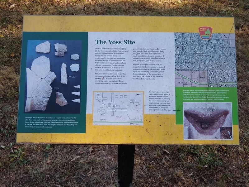
On this terrace bench overlooking Big Darby Creek, people of the Fort Ancient Culture constructed a large circular village with a central plaza and constructed a low earthen mound on the plaza's edge to commemorate the burial location of important members of their community. The location of the site is unique as it is one of the northern-most Fort Ancient sites.
The Voss Site was occupied more than once during the period ca. A.D. 1100-1440 by Fort Ancient populations practicing maize agriculture. These populations during the later half of the period were intercropping maize, beans, and squash. They supplemented their diet with deer and wild turkey and made use of the extensive resources of the creek including freshwater mussels, fish, waterfowl, and turtle species.
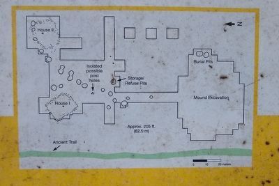
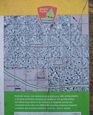
Remote sensing techniques such as magnetometry have recently been used to map the village settlement and build upon the knowledge of the site gained from excavation of the mound and a portion of the village in the 1960s by the Ohio Historical Society.
Erected by Columbus and Franklin County Metro Parks.
Topics. This historical marker is listed
this page online
Location. 39° 52.817′ N, 83° 13.22′ W. Marker is near Georgesville, Ohio, in Franklin County. It can be reached from Harrisburg Georgesville Road (County Highway 281). Marker is on the Ancient Trail in Battelle Darby Creek Metro Park. The trail is reached from a small parking lot at the north end of Harrisburg Georgesville Road, about 5.2 miles north of Haenzel Road (County Highway 135). The marker is about 0.3 miles from the parking lot. Touch for map. Marker is in this post office area: Galloway OH 43119, United States of America. Touch for directions.

Regionally, this marker is in the Scioto Valley and in the Columbus Metropolitan Area. It is also in the American Midwest and in the Corn Belt. Globally, it is in North America, the Western Hemisphere, the Western World, and the Anglosphere. Historically, it finds itself in what was once the Haudenosaunee (Iroquois) Confederacy, the territory of the Mississippian Culture, and the Northwest Territory.
Other nearby markers. At
2. The Voss Site Marker - left image
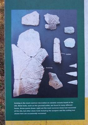
Incising is the most common decoration on ceramic vessels found at the site. Bone tools, such as this grooved antler, are found in many different forms. Arrow points (lower right) are the most common stone tool recovered at the site, but other stone tools including the scrapers and the cutting tool shown here are occasionally recovered.
Also see . . .
1. Fort Ancient. Wikipedia article (Submitted on October 21, 2019, by Joel Seewald of Madison Heights, Michigan.)
2. Archaeological Investigation of the Voss Site. Article on the Ohio Archaeological Council website about the 1960s investigations. (Submitted on October 21, 2019, by Joel Seewald of Madison Heights, Michigan.)
3. The Voss Site Marker - middle image
4. The Voss Site Marker - upper right image
Magnetic survey, one remote sensing technique, aids archaeologists in locating prehistoric features not visible on the ground surface and allows large areas to be surveyed. A magnetic survey was conducted at the site from 2002-2006 revealing numerous magnetic anomalies and potential prehistoric features.
5. The Voss Site Marker - lower right image
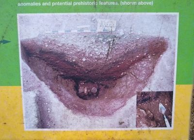
The feature shown to the right was revealed through testing of a magnetic anomaly. The pit feature, excavated by removing the eastern half, was originally dug for storage then later filled with refuse. The grass lining the bottom of the pit (inset) was preserved as a result of burning.
Photographed by Joel Seewald, October 14, 2019
6. The Voss Site Marker
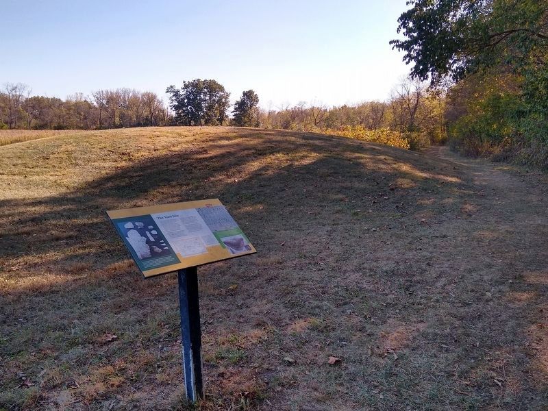
View looking toward the south. The Ancient Trail is on the right.
Credits. This page was last revised on June 30, 2022. It was originally submitted on October 21, 2019, by Joel Seewald of Madison Heights, Michigan. This page has been viewed 1,517 times since then and 180 times this year. Photos: 1, 2, 3, 4, 5, 6. submitted on October 21, 2019, by Joel Seewald of Madison Heights, Michigan.
