Centerville in Fairfax County, Virginia — The American South (Mid-Atlantic)
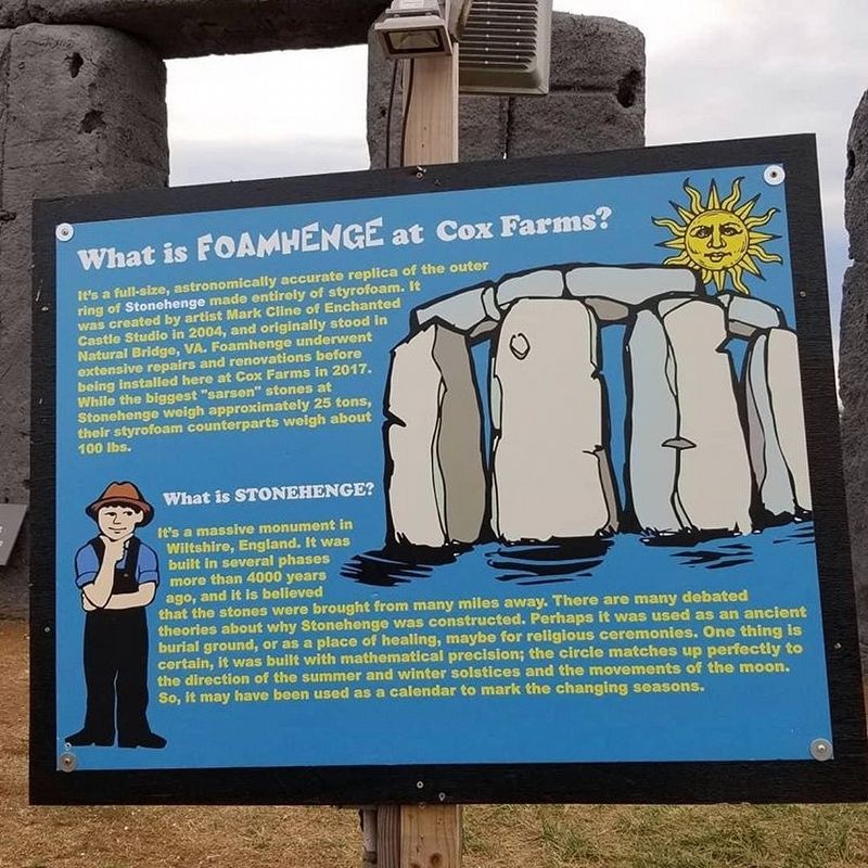
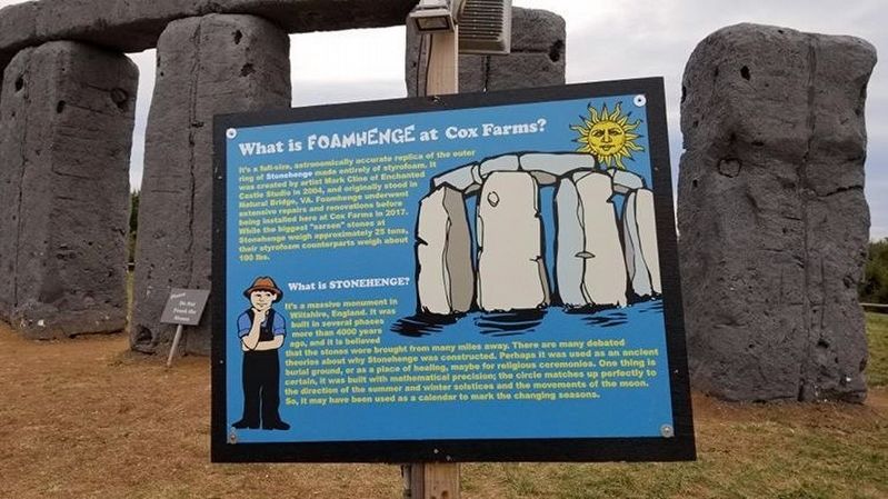
What is Foamhenge at Cox Farms?
It's a full-size, astronomically accurate replica of the outer ring of Stonehenge made entirely of styrofoam. It was created by artist Mark Cline of Enchanted Castle Studio in 2004, and originally stood in Natural Bridge, VA. Foamhenge underwent extensive repairs and renovations before being installed here at Cox Farms in 2017. While the biggest "sarsen" stones at Stonehenge weigh approximately 25 tons, their styrofoam counterparts weigh about 100 lbs.
What is Stonehenge?
It's a massive monument in Wiltshire, England. It was built in several phases more than 4000 years ago, and it is believed that the stones were brought from many miles away. There are many debated theories about why Stonehenge was constructed. Perhaps it was used as an ancient burial ground, or as a place of healing, maybe for religious ceremonies. One thing is certain, it was built with mathematical precision; the circle matches up perfectly to the direction of the summer and winter solstices and the movements of the moon. So, it may have been used as a calendar to mark the changing seasons.
Erected by Cox Farms.
Topics. This historical marker is listed in these topic lists: Arts, Letters, Music • Cemeteries & Burial Sites • Parks & Recreational Areas • Science & Medicine. A significant historical year for this entry is 2004.
Location. 38° 52.847′ N, 77° 29.572′ W. Marker is in Centerville, Virginia, in Fairfax County. Marker can be reached from Braddock Road (Virginia Route 620) half a mile west of Pleasant Valley Road (Virginia Route 609), on the left when traveling west. Touch for map. Marker is at or near this postal address: 15621 Braddock Road, Centreville VA 20120, United States of America. Touch for directions.
Other nearby markers. At least 8 other markers are within 4 miles of this marker, measured as the crow flies. Manassas Gap Railroad (approx. 1.7 miles away); The Dean Family (approx. 2.1 miles away); The Settle Family (approx. 2.1 miles away); The Settle-Dean Cabin (approx. 2.1 miles away); The Village of Conklin (approx. 2.1 miles away); Newton Boundary Stone (approx. 2.3 miles away); Campaign of Second Manassas (approx. 2.4 miles away); Colonel John Singleton Mosby (approx. 3.2 miles away).
Also see . . . Foamhenge at Cox Farms. (Submitted on October 25, 2019.)
Credits. This page was last revised on May 23, 2022. It was originally submitted on October 25, 2019. This page has been viewed 396 times since then and 29 times this year. Photos: 1, 2. submitted on October 25, 2019.

