Brockville in Leeds and Grenville United Counties, Ontario — Central Canada (North America)
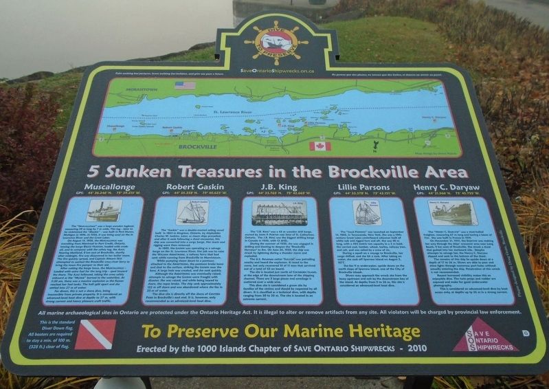
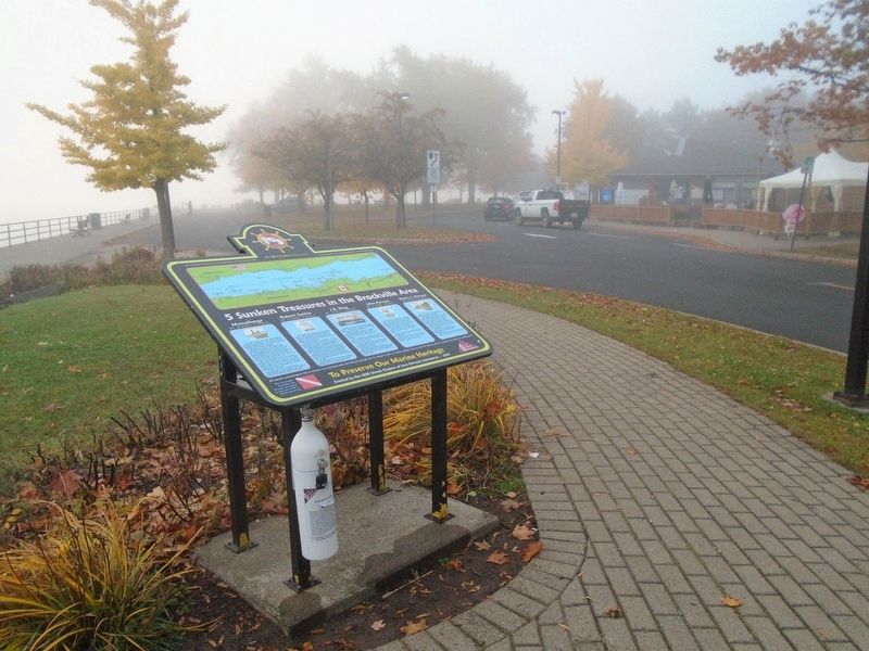
5 Sunken Treasures in the Brockville Area
To Preserve Our Marine Heritage
Inscription.
GPS: 44° 36.246’ N. 75° 39.215' W.
The “Muscallonge” was a large wooden tugboat, measuring 39 m long by 7 m wide. This tug – later to be nicknamed the “Muskie” – was built in Port Huron, Michigan in 1896. In 1936, it was being used on the St. Lawrence River and the Great Lakes.
On August 15, 1936, the MUSCALLONGE was travelling from Montreal to Port Credit, Ontario, towing the barge BRUCE HUDSON, loaded with crude oil, and in company with the safety tug, the AJAX. Nearing Maitland, 8 km east of Brockville, shortly after midnight, fire was discovered in her boiler room. The fire quickly spread, and Captain Ahearn first attempted to contact the Brockville cross-river ferry to bring the town fire pumper to their aid.
After cutting the barge loose, the MUSCALLONGE – [l]oaded with extra fuel for the long trip – sped toward the shore. The AJAX followed, taking the crew safely onboard as the “Muskie” burned to the waterline. At 5:30 am, there was a massive explosion as the flames reached her fuel tanks. The hull split apart and she settled into 27 m of water.
For divers, this is not a shore dive, being inaccessible from private property. It is considered an advanced-level boat dive at depths to 27 m, with strong current and heavy pleasure craft traffic.
GPS: 44° 35.358’ N. 75° 40.625’ W.
The “Gaskin” was a double-masted sailing vessel built in 1863 in Kingston, Ontario, by shipbuilder Charles W. Jenkins. Later, as steam ships prevailed, and after it sank following a shoal encounter, this ship was converted into a cargo barge. Her masts and rigging were then removed.
In 1889, the GASKIN was operating as a salvage barge on the St. Lawrence River. Her job was to raise the WILLIAM ARMSTRONG, a railway ferry that had sunk while running from Brockville to Morristown.
While pumping steam down to a pontoon attached to the ARMSTRONG, the pontoon broke loose and shot to the surface, striking the GASKIN near the bow. A large hole was created, and she sank quickly.
Although the ARMSTRONG was eventually raised, attempts to salvage the GASKIN were fraught with disaster. She was raised, and while being towed to shore, the ropes broke. The ship sank approximately 122 m off shore and was abandoned where she lies in 20 m of water.
The dive site is directly off the shore of CENTEEN PARK in Brockville’s east end. It is, however, only recommended as an advanced-level boat dive.
GPS: 44° 33.765’ N. 75° 42.665’ W.
The “J.B. King” was a 43 m wooden drill barge, owned by JOHN P. PORTER and SONS of St. Catherines,
Ontario. The J.B. King was the biggest drilling barge in Canada in 1930, with 12 drills.
During the summer of 1930, she was engaged in drilling and blasting to deepen the “Brockville Narrows” to 8m. On June 26, 1930, the ship was struck by lightning during a thunder storm and exploded.
The U.S. Revenue cutter “SUCCOR” was patrolling nearby and heard the explosion. It raced to the scene, but only recovered 10 of 11 men that survived out of a total of 43 on board.
The site is located just north of COCKBURN ISLAND, at the edge of the downstream lane of the shipping channel. There are 3 large pieces and wreckage is scattered over a wide area.
This dive is considered a grave site by families of the victims and should be respected by all divers. It is classified as a technical dive, with depths ranging from 30 to 50 m. The site is located in an extreme current.
GPS: 44° 33.378’ N. 75° 43.151’ W.
The “LILLIE PARSONS” was launched on September 14, 1868, in Tonawanda, New York. She was a 19th-century Great Lakes centerboard schooner built of white oak and rigged fore and aft. She was 40 m long, with a 454 metric ton capacity in a 3 m hold. She carried coal, lumber, wheat, barley, railway iron, and salt, and was sailed by a crew of six.
During a squall on a voyage to Brockville, her cargo shifted, and she hit a rock. After taking on water, she sank off Sparrow Island on August 5, 1877.
She lies 9 m underwater, upside down on the north slope of Sparrow Island, one of the City of Brockville islands.
Divers may approach the wreck site from the buoy upstream and exit by the downstream bay of the island. At depths from 9 to 26 m, this site is considered an advanced-level boat dive.
GPS: 44° 31.566’ N. 75° 45.755’ W.
The “HENRY C. DARYAW” was a steel-hulled freighter, measuring 67 m long and having a beam of 11m. She was built in France in 1919.
On November 21, 1941, the DARYAW was making her way through the ships’ crossover area near Long Beach, 9 km west of Brockville. She struck a shoal that gashed into her starboard side. Despite attempts to salvage her, the Henry C. Daryaw slipped and sank to the bottom of the shoal.
The remains of this ship lie upside down at a depth of 17 to 26 m. Divers are able to peer and shine lights through numerous port holes without actually entering the ship. Penetration of this wreck is not recommended.
Recent increased visibility makes this an enjoyable dive. The twin props and rudder are exposed and make for good underwater photography.
This is considered an advanced-level dive by boat access only, at depths up t[o] 26 m in a strong current.
All marine archaeological sites in Ontario are protected under the Ontario Heritage Act. It is illegal to alter or remove artifacts from any site. All violators will be charged by provincial law enforcement.
Erected 2010 by 1000 Islands Chapter, Save Ontario Shipwrecks.
Topics. This historical marker is listed in these topic lists: Disasters • Industry & Commerce • Man-Made Features • Waterways & Vessels. A significant historical date for this entry is June 26, 1930.
Location. 44° 35.286′ N, 75° 40.858′ W. Marker is in Brockville, Ontario, in Leeds and Grenville United Counties. Marker is on Block House Island Road, 0.2 kilometers south of Water Street, on the left when traveling south. Touch for map. Marker is at or near this postal address: 30 Block House Island Rd, Brockville ON K6V 4S9, Canada. Touch for directions.
Other nearby markers. At least 8 other markers are within walking distance of this marker. Blockhouse Island (here, next to this marker); The Bluenose Visit, 1933 / La visite du Bluenose, 1933 (a few steps from this marker); SS Kingston (a few steps from this marker); Con Darling (within shouting distance of this marker); The Wreck of the ROBERT GASKIN (within shouting distance of this marker); a different marker also named Blockhouse Island (within shouting distance of this marker); a different marker also named Blockhouse Island (within shouting distance of this marker); Brockville & Ottawa Railway - Passenger Depot (about 90 meters away, measured in a direct line). Touch for a list and map of all markers in Brockville.
Also see . . .
1. Save Ontario Shipwrecks. (Submitted on October 28, 2019, by William Fischer, Jr. of Scranton, Pennsylvania.)
2. The story of the St. Lawrence River: ‘Lifeblood of the country’ (The Globe and Mail, 2015). (Submitted on October 28, 2019, by William Fischer, Jr. of Scranton, Pennsylvania.)
Credits. This page was last revised on April 29, 2023. It was originally submitted on October 28, 2019, by William Fischer, Jr. of Scranton, Pennsylvania. This page has been viewed 643 times since then and 93 times this year. Photos: 1, 2. submitted on October 28, 2019, by William Fischer, Jr. of Scranton, Pennsylvania.

