Mount Morris in Livingston County, New York — The American Northeast (Mid-Atlantic)
The Largest Dry Bed Dam East of the Mississippi River
Inscription.
(left panel)
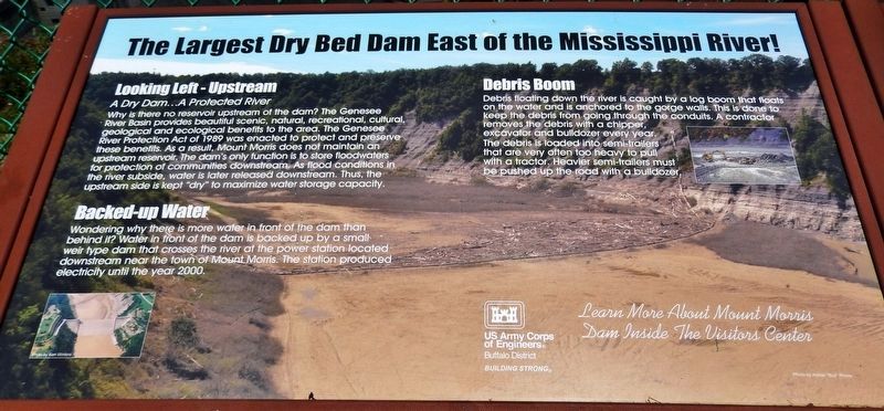
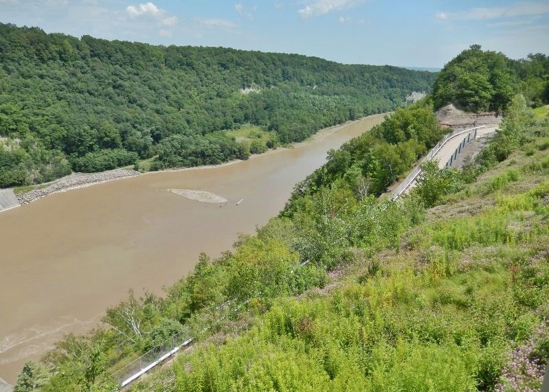
Looking Left – Upstream
A Dry Dam… A Protected River
Why is there no reservoir upstream of the dam? The Genesee River Basin provides beautiful scenic, natural, recreational, cultural, geological and ecological benefits to the area. The Genesee River Protection Act of 1989 was enacted to protect and preserve these benefits. As a result, Mount Morris does not maintain an upstream reservoir. The dam's only function is to store floodwaters for protection of communities downstream. As flood conditions in the river subside, water is later released downstream. Thus, the upstream side is kept "dry" to maximize water storage capacity.
Backed-up Water
Wondering why there is more water in front of the dam than behind it? Water in front of the dam is backed up by a small weir type dam that crosses the river at the power-station located downstream near the town of Mount Morris. The station produced electricity until the year 2000.
Debris Boom
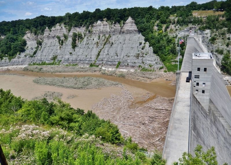
Debris floating down the river is caught by a log boom that floats on the water and is anchored to the gorge walls. This is done to keep the debris from going through the conduits. A contractor removes the debris with a chipper, excavator and bulldozer every year. The debris is loaded into semi-trailers that are very often too heavy to pull with a tractor. Heavier semi-trailers must be pushed up the road with a bulldozer.
(right panel)
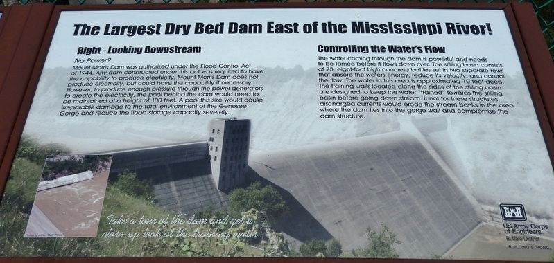
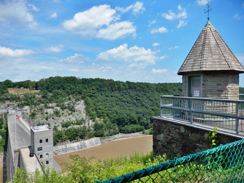
Right - Looking Downstream
No Power?
Mount Morris Dam was authorized under the Flood Control Act of 1944. Any dam constructed under this act was required to have the capability to produce electricity. Mount Morris Dam does not produce electricity, but could have the capability if necessary. However, to produce enough pressure through the power generators to create the electricity, the pool behind the dam would need to be maintained at a height of 100 feet. A pool this size would cause irreparable damage to the total environment of the Genesee Gorge and reduce the flood storage capacity severely.
Controlling the Waters Flow
The water coming through the dam is powerful and needs to be tamed before it flows down river. The stilling basin consists of 73, eight-foot high concrete battles set in two separate rows that absorb the waters energy, reduce its velocity, and control the flow. The water in this area is approximately 10 feet deep. The training walls located along the sides of the stilling basin are designed to keep the water "trained" towards the stilling basin before going down stream. If not for these structures, discharged currents would erode the stream banks in the area where the dam ties into the gorge
wall and compromise the dam structure.
Erected by U.S. Army Corps of Engineers.
Topics. This historical marker is listed in these topic lists: Environment • Man-Made Features • Waterways & Vessels.
Location. 42° 43.901′ N, 77° 54.345′ W. Marker is in Mount Morris, New York, in Livingston County. Marker can be reached from Visitor Center Road, 1.8 miles north of Mount Morris Nunda Road (State Route 408). Marker is located along the walkway, overlooking the dam, in front of the Mount Morris Dam & Recreation Area Visitor Center. Touch for map. Marker is at or near this postal address: 6103 Visitor Center Road, Mount Morris NY 14510, United States of America. Touch for directions.
Other nearby markers. At least 8 other markers are within 2 miles of this marker, measured as the crow flies. Dam Facts (within shouting distance of this marker); Why Was This Dam Built? (within shouting distance of this marker); Mount Morris Dam Commemorative Kiosk (within shouting distance of this marker); Mt. Morris Dam (approx. ¼ mile away); "Da-Yo-It-Ga-O" (approx. 0.7 miles away); Murray Hill (approx. 1.1 miles away); John Wesley Powell (approx. 1.4 miles away); Francis Bellamy Memorial Park (approx. 1½ miles away). Touch for a list and map of all markers in Mount Morris.
Related markers. Click here for a list of markers that are related to this marker. Mount Morris
Dam
Also see . . . Mount Morris Dam (Wikipedia). The water inflow due to Hurricane Agnes (1972) exceeded the storage capacity of the reservoir and it was necessary to release water through the gates of the dam, causing minor downstream flooding. These releases were made to prevent overtopping of the spillway. Had the spillway overtopped, accumulated debris in the reservoir would have passed downstream, causing log jams and additional damage. Inflows of this magnitude are only expected to happen an average of every 300 years. (Submitted on December 8, 2019, by Cosmos Mariner of Cape Canaveral, Florida.)
Photographed By Cosmos Mariner, July 19, 2017
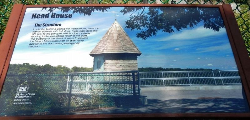
6. Head House Interpretive Panel (located near marker)
Inside this building called the Head House, there is a narrow stairwell with 166 stairs. These stairs descend 125 feet to the parapet, which is the roadway leading to the operations tower of the dam. The purpose of the Head House is to provide the Mount Morris Dam staff an alternative access to the dam during emergency situations.
Credits. This page was last revised on December 12, 2019. It was originally submitted on December 7, 2019, by Cosmos Mariner of Cape Canaveral, Florida. This page has been viewed 584 times since then and 61 times this year. Photos: 1, 2, 3, 4, 5, 6, 7. submitted on December 8, 2019, by Cosmos Mariner of Cape Canaveral, Florida.
