Edwardsville in Madison County, Illinois — The American Midwest (Great Lakes)
Edwardsville, Illinois
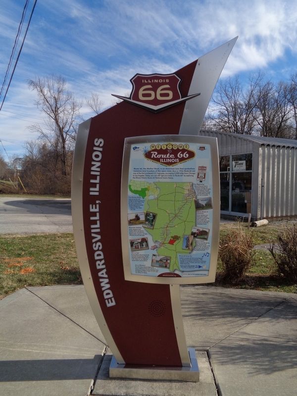
Welcome to Route 66 Illinois
Route 66, the Mother Road, is an American icon that symbolizes romance and freedom of the open road. Born in 1926, Route 66 was one of the first numbered U.S. highways, journeying 2,500 miles from Chicago to Los Angeles. Today, you can still "get your kicks on Route 66" by exploring the Illinois Historic Route 66 National Scenic Byway.
The Mother Road
Route 66 was the road of flight for people escaping the Dust Bowl in the 1930s. It was the route of adventure for families seeking the wonders of the Southwest and California in the 1950s and '60s.
Roadside Oddities
Quirky attractions lured travelers off the road with the promise of fun and adventure. Explore giants, museums, and other attractions that still exist today.
Fill 'er Up?
Service stations along Route 66 did more than just pump gas. Friendly attendants assisted travelers with a smile. Today, you can rediscover several historic service stations.
On to Missouri
The Old Chain of Rocks Bridge is the scenic endpoint of Route 66 in Illinois. It served as a crossing over the Mississippi River for traffic from 1936 to 1955. It is now open for walking and biking.
The Beginning
Historic Route 66 starts in downtown Chicago, the business and cultural capital of the Midwest. It travels through bustling Chicago suburbs before reaching the rural countryside.
Main Street of America
Grain elevators and fields greet modern travelers, much as they did in earlier eras. Journey through prairie farmland and friendly Midwestern towns.
Good Eatin'
Diners and cafes sprang up along the road catering to people on the move. You can still enjoy home style cooking from a time before fast food.
Route 66 Lives On
Unable to compete with fast-moving freeways, U.S. Route 66 was decommissioned in 1985. Nostalgia for hometowns and America's landscape, fueled by movies, TV shows, and music, keeps the Mother Road alive.
(reverse, top:)
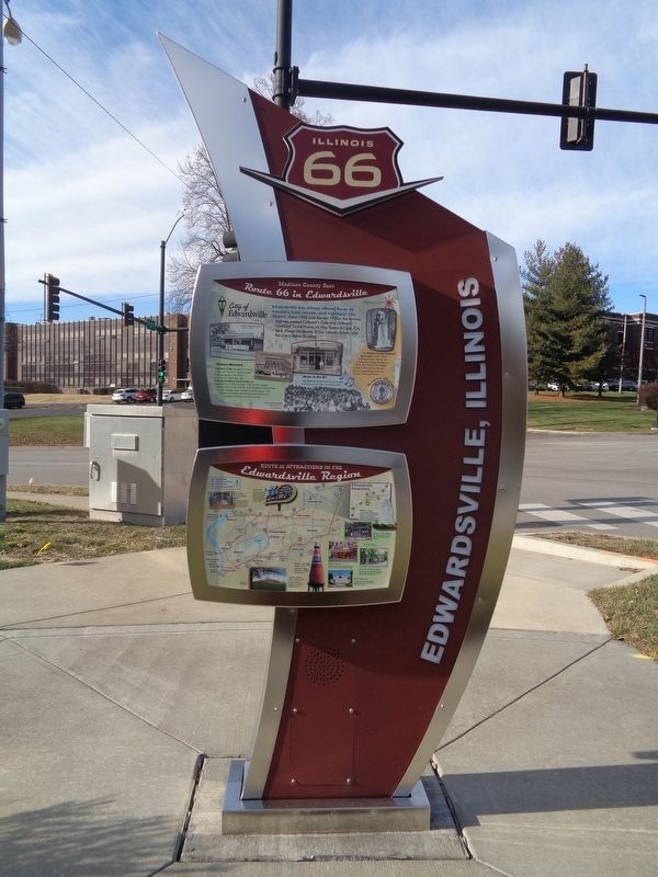
Madison County in Edwardsville - Route 66 in Edwardsville
City of Edwardsville
Edwardsville has always offered Route 66 travelers food, service, and a glimpse into history. From 1926 until the mid-1950s, the famous highway passed Cathcart's Cafe and Cathcart/Goddard Tourist Home, Hi-Way Tavern & Cafe, City Park, Kriege Hardware, El Del Uptown Tavern, and the iconic Bohm Building.
The Madison County Centennial Monument, in front of the Carnegie Public Library, was sculpted by Charles Mulligan in 1912. This 16-foot tall marble sculpture features four female figures representing: Learning, Justice, Plenty, and Virtue.
Visitors Welcome
Cathcart's Cafe was open 24 hours a day with "famous coast to coast" food, groceries, and tourist information. Next door, the Cathcart/Goddard Tourist Home was operated from 1922 through 1954 by the George Cathcart family and later the Fred Goddard family. Three tourist cottages were located on the property. They weren't insulated and tourists used a bathroom located on the home's back porch.
Music in the Air
City Park has hosted free band concerts and festivals for over a hundred years.
(reverse, bottom:)
Route 66 Attractions in the Edwardsville Region
1. Halley's Cash Market - From 1927 through 1972, Halley's offered groceries and snacks to travelers.
2. Madison County Centennial Monument - Erected in 1912, this restored marble sculpture commemorates the founding of Madison County in 1812.
3. Wildey Theatre - Built as an opera house in 1909, the restored theater serves as a performing arts destination.
4. West End Service Station - Built in 1922, this station featured Mobil gas, car washes, and cold sodas. Today, the building serves as a dental office.
5. Coles Monument - Anti-slavery Illinois governor Edward Coles is honored with
a monument in Valley View Cemetery.
6. Luna Cafe - Grab a bite to eat at the historic Luna Cafe. Built in 1924 it is rumored to have been a gangster hangout, with gambling in the basement and a brothel upstairs.
7. Old Chain of Rocks Bridge - At the scenic endpoint of Route 66 in Illinois, walk over this 1929 bridge with a unique 22-degree bend in the middle.
8. Brooks Catsup Water Tower - Visit the World's Largest Catsup Bottle, 170 feet tall, built in 1949 for the bottlers of Brooks Catsup.
9. Cahokia Mounds State Historic Site - Discover the largest Pre-Columbian settlement north of Mexico at this UNESCO World Heritage Site.
Erected 2013 by Illinois Route 66 Scenic Byway.
Topics and series. This historical marker is listed in these topic lists: Anthropology & Archaeology • Arts, Letters, Music • Bridges & Viaducts • Entertainment • Industry & Commerce • Native Americans • Roads & Vehicles • Waterways & Vessels. In addition, it is included in the U.S. Route 66, and the UNESCO World Heritage Sites series lists. A significant historical year for this entry is 1926.
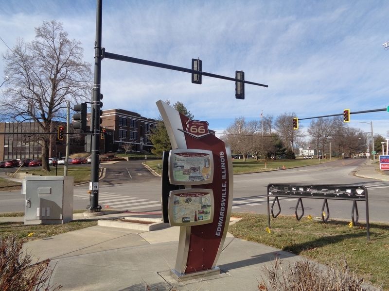
Location. 38° 48.474′ N, 89° 57.835′ W. Marker is in Edwardsville, Illinois, in Madison County. Marker is at the intersection of West Street (Illinois Route 157) and West Schwarz Street, on the right when traveling east on West Street. Marker is next to Lizotte Sheet Metal and across from Circle K and Lincoln Middle School. Touch for map. Marker is at or near this postal address: 632 W Schwarz Street, Edwardsville IL 62025, United States of America. Touch for directions.
Other nearby markers. At least 8 other markers are within walking distance of this marker. West End Service Station (approx. 0.2 miles away); First Cemetery in the City of Edwardsville (approx. 0.3 miles away); Ninian Edwards (approx. 0.4 miles away); a different marker also named Edwardsville (approx. 0.4 miles away); The Madison County Poor Farm (approx. 0.4 miles away); Governor Charles Deneen (approx. half a mile away); Governor Thomas Ford (approx. half a mile away); Governor John Reynolds (approx. half a mile away). Touch for a list and map of all markers in Edwardsville.
More about this marker. This is one of 14 "experience hubs" that are all over Illinois along the old Route 66. This was unveiled on April 20, 2013, and it features a map of the different alignments of Route 66. All experience hub markers have the same front text, but have different reverse signs on the back. They also have a button where people can listen to Bobby Troup's "Get Your Kicks on Route 66". Some have a passport rubbing area, as this one does.
Credits. This page was last revised on January 17, 2020. It was originally submitted on January 16, 2020, by Jason Voigt of Glen Carbon, Illinois. This page has been viewed 504 times since then and 55 times this year. Photos: 1, 2, 3. submitted on January 16, 2020, by Jason Voigt of Glen Carbon, Illinois. • Devry Becker Jones was the editor who published this page.


