Collinsville in St. Clair County, Illinois — The American Midwest (Great Lakes)
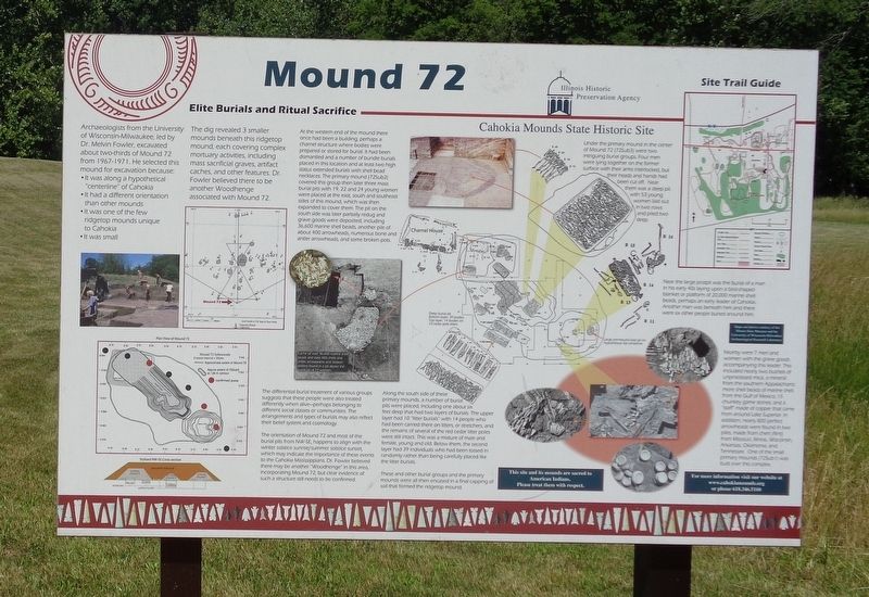
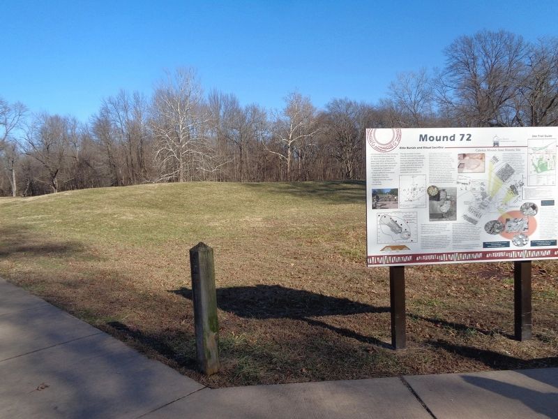
Mound 72
Elite Burials and Ritual Sacrifice
• It was along a hypothetical "centerline" of Cahokia
• It had a different orientation than other mounds
• It as one of the few ridgetop mounds unique to Cahokia
• It was small
The dig revealed 3 smaller mounds beneath this ridgetop mound, each covering complex mortuary activities, including mass sacrificial graves, artifact caches, and other features. Dr. Fowler believed there to be another Woodhenge associated with Mound 72.
At the western end of the mound there once had been a building, perhaps a charnel structure where bodies were prepared or stored for burial. It had been dismantled and a number of bundle burials placed in this location and at least two high status extended burials with shell bead necklaces. The primary mound (72Sub2) covered this group then later three mass burial pits with 19, 22 and 24 young women were placed at the east, south and southeast sides of this mound, which was then expanded to cover them. The pit on the south side was later partially redug and grave goods were deposited, including 36,600 marine shell beads, another pile of about 400 arrowheads, numerous bone and antler arrowheads, and some broken pots.
The differential burial treatment of various groups suggests that these people were also treated differently when alive-perhaps belonging to different social classes or communities. The arrangements and types of burials may also reflect their belief system and cosmology.
The orientation of Mound 72 and most of the burial pits from NW-SE, happens to align with the winter solstice sunrise/summer solstice sunset, which may indicate the importance of these events to the Cahokia Mississippians. Dr. Fowler believed there may be another "Woodhenge" in this area, incorporating Mound 72, but clear evidence of such a structure still needs to be confirmed.
Along the south side of these primary mounds, a number of burial pits were placed, including one about six feet deep that had two layers of burials. The upper layer had 10 "litter burials" with 14 people who had been carried there on litters, or stretchers, and the remains of several of the red cedar litter poles were still intact. This was a mixture of male and female, young and old. Below them, the second layer had 39 individuals who had been tossed in randomly rather than being carefully placed like the litter burials.
These and other burial groups and the primary mounds were all then encased in a final capping of soil that formed the ridgetop mound.
Under the primary mound in the center of Mound 72 (72Sub3) were two intriguing burial groups. Four men were lying together on the former surface with their arms interlocked, but their heads and hands had been cut off. Near them was a deep pit with 53 young women laid out in two rows and piled two deep.
Near the large postpit was the burial of a man in his early 40s laying upon a bird-shaped blanket or platform of 20,000 marine shell beads, perhaps an early leader of Cahokia. Another man was beneath him and there were six other people buried around him.
Nearly were 7 men and women with the grave goods accompanying this leader. This included nearly two bushels of unprocessed mica, a mineral from the southern Appalachians; more shell beads of marine shell from the Gulf of Mexico; 15 chunkey game stones; and a "staff" made of copper that came from around Lake Superior. In addition, nearly 800 perfect arrowheads were found in two piles, made from chert (flint) from Missouri, Illinois, Wisconsin, Arkansas, Oklahoma, and Tennessee. One of the small primary mounds (72Sub1) was built over this complex.
Erected by Illinois Historic Preservation Agency and Cahokia Mounds State Historic Site.
Topics and series. This historical marker is listed in these topic lists: Anthropology & Archaeology • Cemeteries & Burial Sites • Native Americans. In addition, it is included in the UNESCO World Heritage Sites series list.
Location. 38° 39.057′ N, 90° 3.84′ W. Marker is in Collinsville, Illinois, in St. Clair County. Marker can be reached from Ramey Street, 0.6 miles south of Collinsville Road, on the right when traveling south. Marker is located off a sidewalk path south of the grounds of Cahokia Mounds State Historic Site. Touch for map. Marker is at or near this postal address: 30 Ramey Street, Collinsville IL 62234, United States of America. Touch for directions.
Other nearby markers. At least 8 other markers are within walking distance of this marker. The Twin Mounds (approx. 0.2 miles away); The South Stockade (approx. 0.2 miles away); West Stockade (approx. ¼ mile away); Cahokia (approx. 0.4 miles away); Cahokia Mounds (approx. 0.4 miles away); Grand Plaza (approx. 0.4 miles away); You Are Walking Where a Cahokia Neighborhood Once Stood (approx. 0.4 miles away); Interpretive Center Tract (approx. 0.4 miles away). Touch for a list and map of all markers in Collinsville.
Also see . . .
1. Mound 72 on Wikipedia. (Submitted on January 18, 2020, by Jason Voigt of Glen Carbon, Illinois.)
2. Cahokia Mounds. Official website for the UNESCO World Heritage Site. Includes plenty of information and what to expect when visiting the mounds, including Mound 72. (Submitted on January 18, 2020, by Jason Voigt of Glen Carbon, Illinois.)
Credits. This page was last revised on July 18, 2022. It was originally submitted on January 18, 2020, by Jason Voigt of Glen Carbon, Illinois. This page has been viewed 515 times since then and 53 times this year. Photos: 1, 2. submitted on January 18, 2020, by Jason Voigt of Glen Carbon, Illinois. • Devry Becker Jones was the editor who published this page.

