Tapachula, Chiapas, Mexico — The Southeast (North America)
Tapachula and Chiapas
Photographed by J. Makali Bruton, December 19, 2019
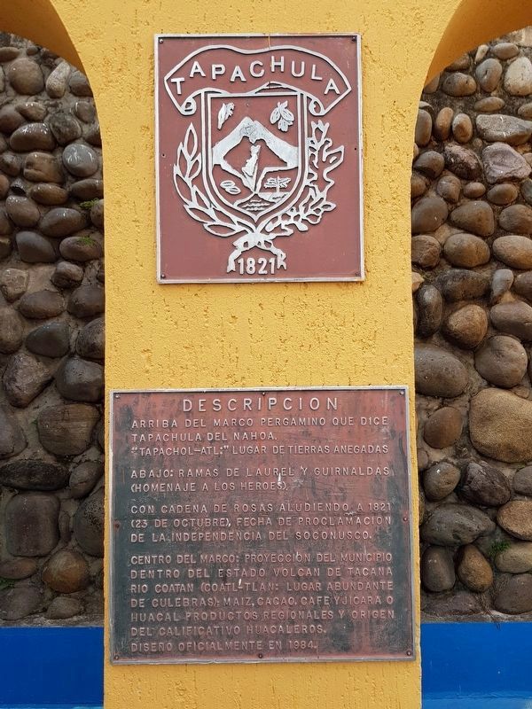
1. The Tapachula Seal and Marker

1821
Descripcion
Arriba del marco pergamino que dice Tapachula del Nahoa.
“Tapachol-atl:” lugar de tierras anegadas
Abajo: Ramas de laurel y guirnaldas (Homenaje a los Heroes).
Con cadenas de rosas aludiendo a 1821 (23 de octubre), fecha de Proclamacion de la Independencia del Soconusco.
Centro del marco: Proyeccion del municipio dentro del estado volcán de Tacana Rio Coatan (Coatl-tlan: Lugar abundante de culebras); maíz, cacao, café y jícara o huacal productos regionales y origen del calificativo huacaleros.
Diseño oficialmente en 1984.
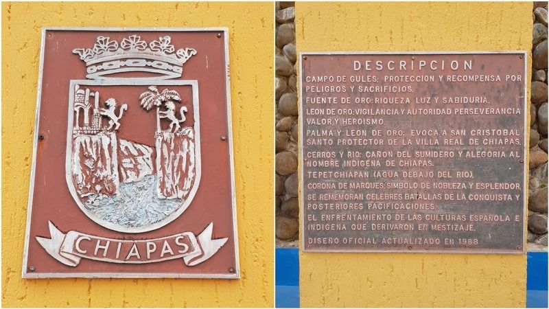
Chiapas
Descripcion
Campo de gules: Proteccion y recompensa por peligros y sacrificios.
Fuente de oro: Riqueza luz y sabiduría.
Leon de oro: Vigilancia y autoridad perseverancia valor y heroísmo.
Palma y león de oro: Evoca a San Cristobal Santo Protector de la Villa Real de Chiapas.
Cerros y rio: Cañon del Sumidero y alegoría al nombre indígena de Chiapas.
Tepetchiapan (Agua debajo del rio).
Corona de marques: Simbolo de nobleza y esplendor. Se rememoran celebres batallas de la Conquista y posteriores pacificaciones.
El enfrentamiento de las culturas española e
this page online
Diseño oficial actualizado en 1988
Tapachula
1821
The municipal seal includes a parchment frame that says ‘Tapachula del Nahoa’ towards the top. “Tapachol-atl” means “the place of flooded lands.” Towards the bottom are laurel branches and garlands as a tribute to heroes. A chain of roses alludes to October 23, 1821, the date of the Soconusco Proclamation of Independence. In the center of the frame is a projection of the municipality within the shape of the state, with Tacana Volcano in the background. The Coatan River (Coatl-tlan: A place with an abundance of snakes) is shown together with images of corn, cocoa, coffee and gourds (huacales), all of which are regional products and give origin to the local nickname of “huacaleros.”
It was officially designed in 1984.
Chiapas
The state seal includes a red background, which symbolizes protection and rewards for dangers and sacrifices. A golden fountain represents light, wealth and wisdom. A golden lion stands for vigilance and authority, perseverance, courage and heroism. Nearby a palm and another
Photographed by J. Makali Bruton
2. The Chiapas Seal and Marker
The official design was updated in 1988.
Topics. This historical marker is listed in these topic lists: Colonial Era • Indigenous Peoples and Communities • Settlements & Settlers • Wars, Non-US. A significant historical date for this entry is October 23, 1821.
Location. 14° 54.657′ N, 92° 15.905′ W. Marker is in Tapachula, Chiapas. It is on Calle Quinta Poniente just east of 10a Avenida Norte, on the left when traveling east. Touch for map. Marker is in this post office area: Tapachula CHIS 30830, Mexico. Touch for directions.

Regionally, this marker is in Southern Mexico, in the Maya Heartland, on the Pacific Coast, and in the Sierra Madre. Globally, it is in North America, specifically
Photographed by J. Makali Bruton, December 20, 2019
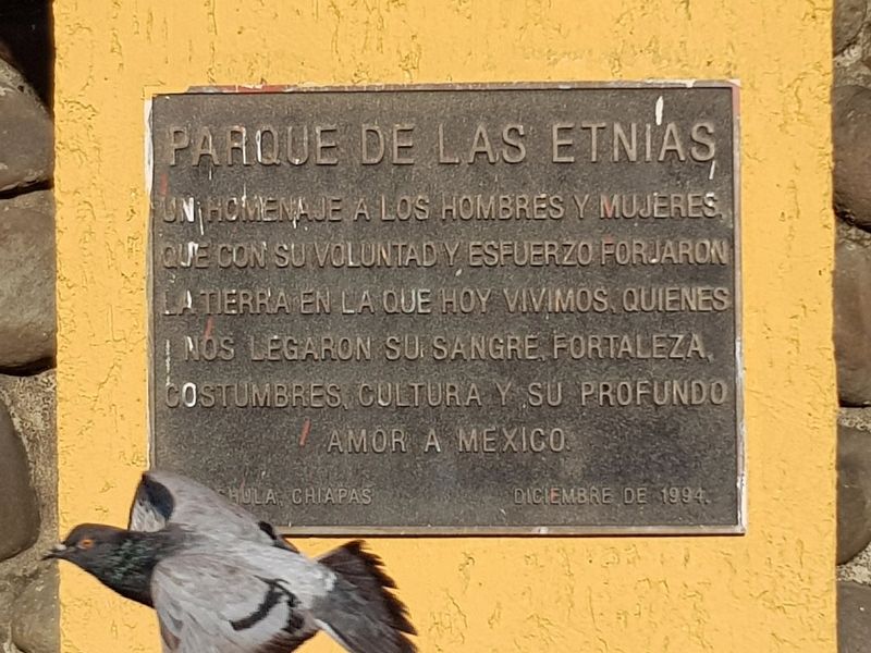
3. An additional marker on the creation of the park
Un homenaje a los hombres y mujeres que con su voluntad y esfuerzo forjaron la tierra en la que hoy vivimos, quienes nos legaron su sangre, Fortaleza, costumbres, cultura y su profundo amor a Mexico.
Tapachula, Chiapas
diciembre de 1994.
Other nearby markers. At least 4 other markers are within 23 kilometers of this marker, measured as the crow flies: The End of Bʼakʼtun 13 (approx. 0.6 kilometers away); Izapa Archaeological Zone (approx. 9.2 kilometers away); Group F at Izapa Archaeological Zone (approx. 9.3 kilometers away); Benito Juárez (approx. 21.4 kilometers away in Guatemala).
Also see . . . Tapachula, Chiapas, Mexico. (Submitted on February 7, 2020, by J. Makali Bruton of Washington, District of Columbia.)
Photographed by J. Makali Bruton, December 19, 2019
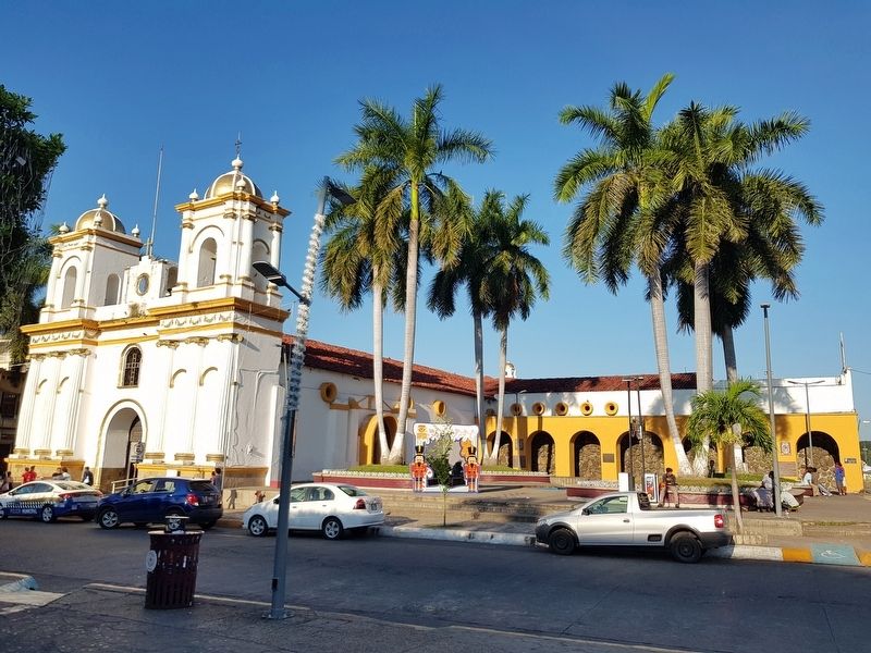
4. Tapachula and Chiapas Markers
The markers can be seen along a yellow wall in this view of a small park next to the Parish of San Agustín Catholic Church.
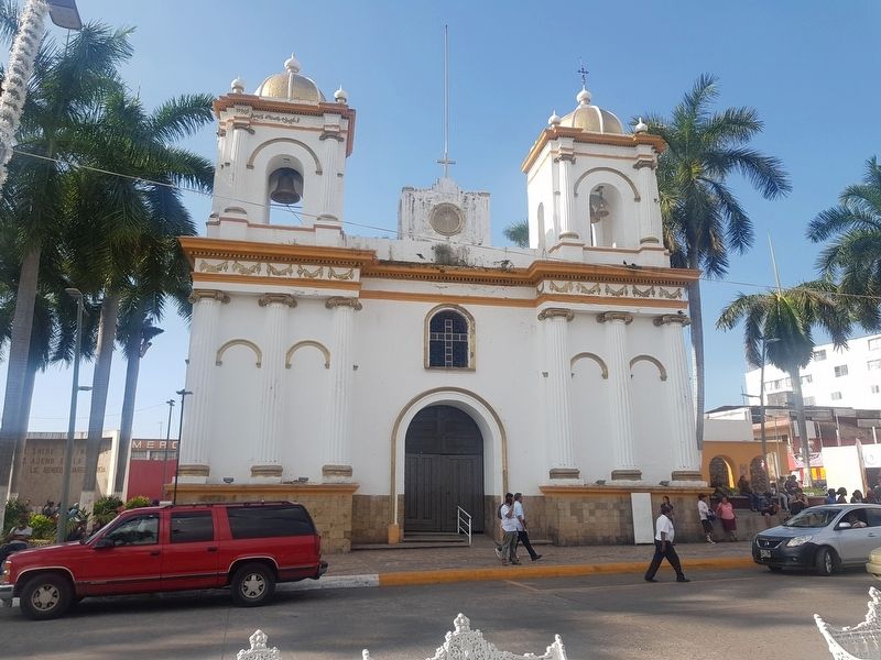
Photographed by J. Makali Bruton, December 19, 2019
5. The nearby San Agustín Catholic Church
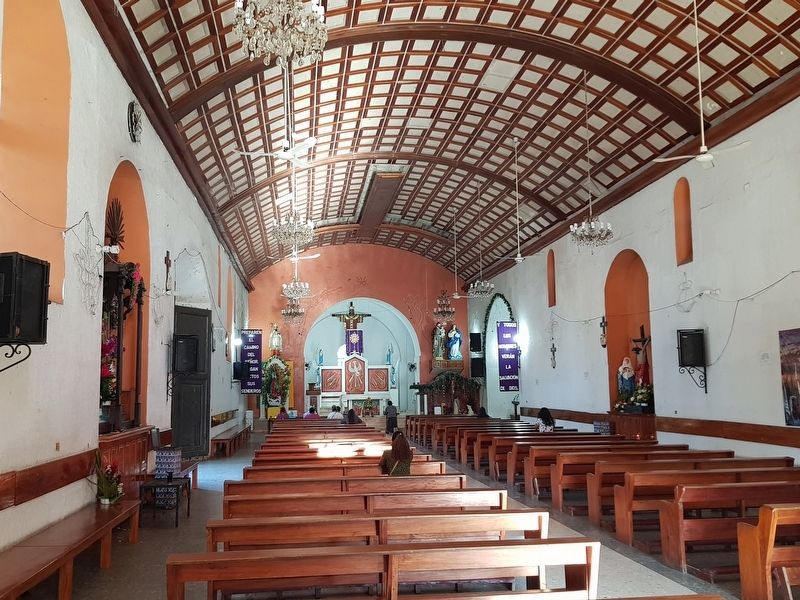
Photographed by J. Makali Bruton, December 20, 2019
6. An interior view of the San Agustín Catholic Church
Credits. This page was last revised on July 5, 2023. It was originally submitted on February 7, 2020, by J. Makali Bruton of Washington, District of Columbia. This page has been viewed 299 times since then and 69 times this year. Photos: 1, 2, 3, 4, 5, 6. submitted on February 7, 2020, by J. Makali Bruton of Washington, District of Columbia.
