Sheet Harbour in Halifax Region, Nova Scotia — The Atlantic Provinces (North America)
Salmon
— Sheet Harbour —
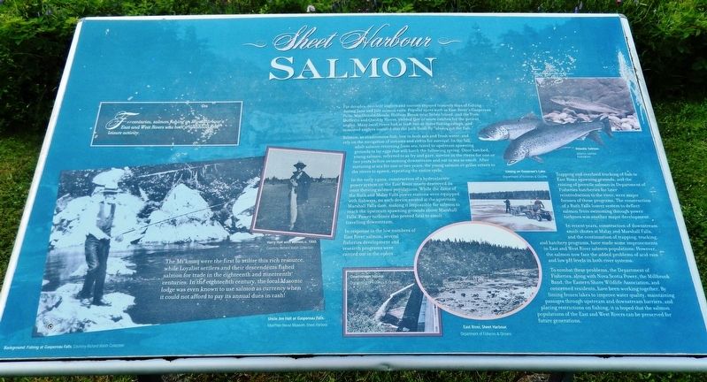
The Mi’kmaq were the first to utilize this rich resource, while Loyalist settlers and their descendents fished salmon for trade in the eighteenth and nineteenth centuries. In the eighteenth century, the local Masonic lodge was even known to use salmon as currency when it could not afford to pay its annual dues in cash!
For decades, resident anglers and tourists enjoyed leisurely days of fishing during June and July salmon runs. Popular spots such as East River's Gaspereau Falls, MacDonald Shoals, Halfway Brook near Sober Island, and the Port Dufferin and Quoddy Rivers, yielded five or more catches for the patient angler. Many local rivers had at least two or three fishing camps, and seasoned anglers insisted that the Jock Scott fly "always got the fish."
Salmon, as anadromous fish, live in both salt and fresh water, and rely on the navigation of streams and rivers for survival. In the fall, adult salmon returning from sea, travel to upstream spawning grounds to lay eggs that will hatch the following spring. Once hatched, young salmon, referred to as fry and parr, survive in the rivers for one or two years before swimming downstream and out to sea as smolt. After maturing at sea for one or two years, the young salmon or grilse return to the rivers to spawn, repeating the entire cycle.
In the early 1920s, construction of a hydroelectric power system on the East River nearly destroyed its once thriving salmon populations. While the dams of the Ruth and Malay Falls power stations were equipped with fishways, no such device existed at the upstream Marshall Falls dam, making it impossible for salmon to reach the upstream spawning grounds above Marshall Falls. Power turbines also proved fatal to smolt travelling downstream.
In response to the low numbers of East River salmon, several fisheries development and research programs were carried out in the 1960s.
Trapping and overland trucking of fish to East River spawning grounds, and the raising of juvenile salmon in Department of Fisheries hatcheries for later reintroduction to the river, were major focuses of these programs. The construction of a Ruth Falls louver system to deflect salmon from swimming through power turbines was another major development.
In recent years, construction of downstream smolt chutes at Malay and Marshall Falls, and the continuation of trapping, trucking, and hatchery programs, have made some improvements in East and West River salmon populations. However, the salmon now face the added problems of acid rain and low pH levels in both river systems.
To combat these problems, the Department of Fisheries, along with Nova Scotia Power, the Millbrook Band, the Eastern Shore Wildlife Association, and concerned residents, have been working together. By liming frozen lakes to improve water quality, maintaining passages through upstream and downstream barriers, and placing restrictions on fishing, it is hoped that the salmon populations of the East and West Rivers can be preserved for future generations.
(photo captions)
• Harry Hall with salmon, c. 1950 [Courtesy Richard Walsh Collection]
• Uncle Jim Hall at Gaspereau Falls. [MacPhee House Museum, Sheet Harbour]
• Atlantic Salmon. [Atlantic Salmon Federation]
• Liming on Governor’s Lake. [Department of Fisheries & Oceans]
• Downstream Bypass. [Department of Fisheries & Oceans]
• East River, Sheet Harbour. [Department of Fisheries & Oceans]
Topics. This historical marker is listed in these topic lists: Environment • Industry & Commerce • Native Americans • Waterways & Vessels.
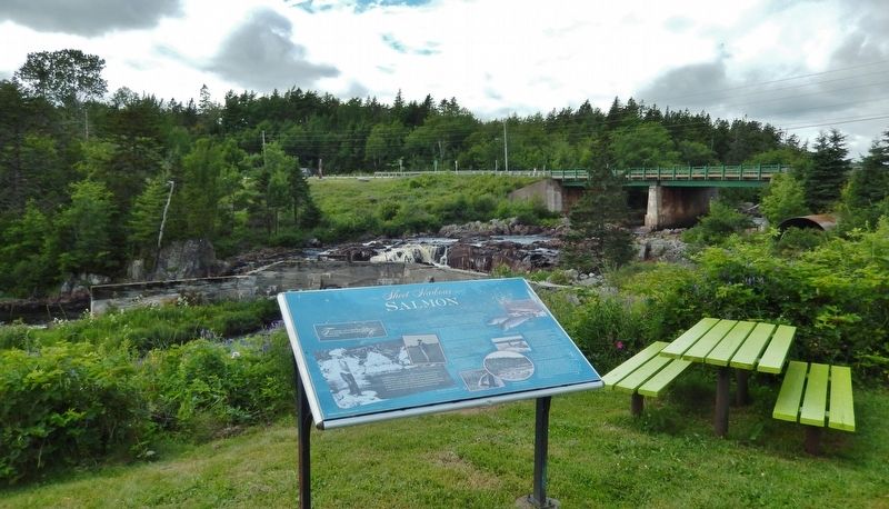
Location. 44° 55.645′ N, 62° 32.65′ W. Marker is in Sheet Harbour, Nova Scotia, in Halifax Region. Marker can be reached from Marine Drive (Nova Scotia Trunk Highway 7), 0.3 kilometers east of Highway 224, on the right when traveling east. Marker is located on the grounds of the MacPhee House Museum & Visitor Centre, along the boardwalk on the north side of the museum. Touch for map. Marker is at or near this postal address: 22404 Nova Scotia Trunk Highway 7, Sheet Harbour NS B0J 3B0, Canada. Touch for directions.
Other nearby markers. At least 8 other markers are within 19 kilometers of this marker, measured as the crow flies. The Community (within shouting distance of this marker); Lumbering & Sawmills (within shouting distance of this marker); The Pulp & Paper Industry (within shouting distance of this marker); Sheet Harbour (within shouting distance of this marker); Shipbuilding & Shipping (approx. 1.6 kilometers away); Hydroelectric Power (approx. 1.6 kilometers away); Early Settlement (approx. 1.6 kilometers away); Prince Alfred Arch / L'Arche Prince Alfred (approx. 18.3 kilometers away). Touch for a list and map of all markers in Sheet Harbour.
Related markers. Click here for a list of markers that are related to this marker. Sheet Harbour, Nova Scotia
Credits. This page was last revised on November 3, 2020. It was originally submitted on March 3, 2020, by Cosmos Mariner of Cape Canaveral, Florida. This page has been viewed 128 times since then and 19 times this year. Photos: 1. submitted on March 3, 2020, by Cosmos Mariner of Cape Canaveral, Florida. 2. submitted on March 6, 2020, by Cosmos Mariner of Cape Canaveral, Florida.

