Near Fredonia in Mohave County, Arizona — The American Mountains (Southwest)
When the Good Grass Goes
| — | Pipe Spring National Monument | — |
Photographed by National Park Service
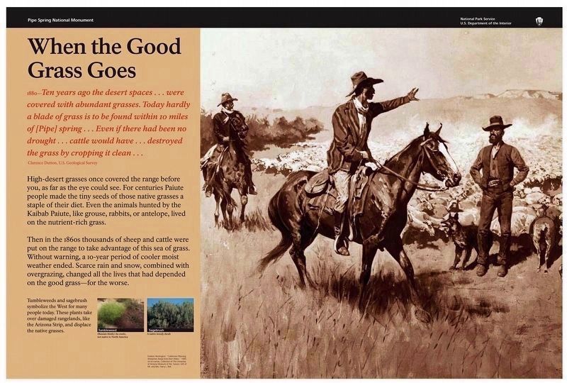
1. When the Good Grass Goes Marker
—Clarence Dutton, U.S. Geological Survey
High-desert grasses once covered the range before you, as far as the eye could see. For centuries Paiute people made the tiny seeds of those native grasses a staple of their diet. Even the animals hunted by the Kaibab Paiute, like grouse, rabbits, or antelope, lived on the nutrient-rich grass.
Then in the 1860s thousands of sheep and cattle were put on the range to take advantage of this sea of grass. Without warning, a 10-year period of cooler moist weather ended. Scarce rain and snow, combined with overgrazing, changed all the lives that had depended on the good grass — for the worse.
Tumbleweeds and sagebrush symbolize the West for many people today. These plants take over damaged rangelands, like the Arizona Strip, and displace the native grasses.
Erected by National Park Service, U.S. Department of the Interior.
this page online
Topics. This historical marker is listed in these topic lists: Environment • Indigenous Peoples and Communities • Settlements & Settlers. A significant historical year for this entry is 1880.
Location. 36° 51.784′ N, 112° 44.423′ W. Marker is near Fredonia, Arizona, in Mohave County. It can be reached from North Pipe Spring Road 0.3 miles north of Arizona Route 389, on the left when traveling north. Marker is located along the park grounds trail in Pipe Spring National Monument, near the west side of West Cabin. Touch for map. Marker is at or near this postal address: 406 North Pipe Spring Road, Fredonia AZ 86022, United States of America. Touch for directions.

Regionally, this marker is in the American Southwest and on the Colorado Plateau. Globally, it is in North America, the Western Hemisphere, the Western World, and the Anglosphere. Historically, it finds itself in what was once New Spain and also Mexico’s Alta California.
Other nearby markers. At least 8 other markers are within walking distance of this marker: 995 Miles of Wire (a few steps from this marker); Yoowuv' (a few steps from this marker); How Can 10 Million Gallons of Water a Year Suddenly Appear in a Stony Desert?
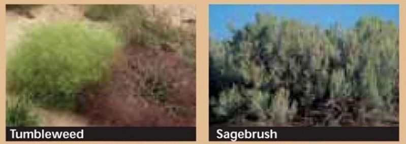
2. Marker detail: Tumbleweed & Sagebrush
(left) Tumbleweed (Russian thistle) — an exotic, not native to North America
(right) Sagebrush — A native woody shrub
(right) Sagebrush — A native woody shrub
Related markers. Click here for a list of markers that are related to this marker. Pipe Spring National Monument
Also see . . . When the Good Grass Goes. (A National Park Service link for this marker.) (Submitted on May 7, 2020, by Cosmos Mariner of Cape Canaveral, Florida.)
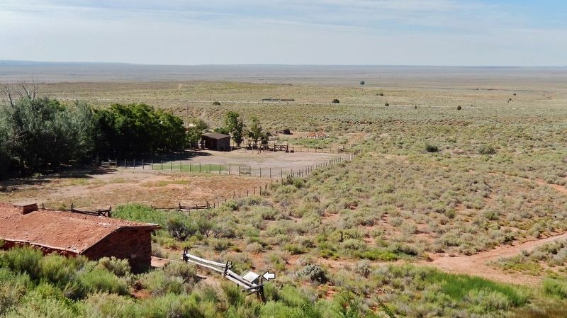
Photographed by Cosmos Mariner, June 10, 2016
3. When the Good Grass Goes Marker

Photographed by Tom Bosse, July 23, 2024
4. When the Good Grass Goes Marker
Credits. This page was last revised on September 21, 2024. It was originally submitted on May 6, 2020, by Cosmos Mariner of Cape Canaveral, Florida. This page has been viewed 345 times since then and 21 times this year. Photos: 1, 2. submitted on May 7, 2020, by Cosmos Mariner of Cape Canaveral, Florida. 3. submitted on May 6, 2020, by Cosmos Mariner of Cape Canaveral, Florida. 4. submitted on September 6, 2024, by Tom Bosse of Jefferson City, Tennessee.
