Upper Shockoe Valley in Richmond, Virginia — The American South (Mid-Atlantic)
Execution of Gabriel
Photographed by Dawn Bowen, July 28, 2007
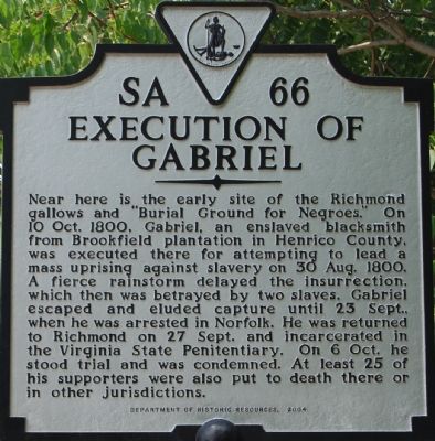
1. Execution of Gabriel Marker
Near here is the early site of the Richmond gallows and “Burial Ground for Negroes.” On 10 Oct. 1800, Gabriel, an enslaved blacksmith from Brookfield plantation in Henrico County, was executed there for attempting to lead a mass uprising against slavery on 30 Aug. 1800. A fierce rainstorm delayed the insurrection, which then was betrayed by two slaves. Gabriel escaped and eluded capture until 23 Sept., when he was arrested in Norfolk. He was returned to Richmond on 27 Sept. and incarcerated in the Virginia State Penitentiary. On 6 Oct. he stood trial and was condemned. At least 25 of his supporters were also put to death there or in other jurisdictions.
Erected 2004 by Department of Historic Resources. (Marker Number SA-66.)
Topics and series. This historical marker is listed in these topic lists: African Americans • Cemeteries & Burial Sites • Heroes • Law Enforcement. In addition, it is included in the Virginia Department of Historic Resources (DHR) series list. A significant historical date for this entry is August 30, 1800.
Location. This marker has been replaced by another marker nearby. It was located near 37° 32.23′ N, 77° 25.665′ W.
this page online

Regionally, this marker was in Central Virginia. It was also in the American South and specifically in the Upper South. Globally, it was in North America, the Western Hemisphere, the Western World, and the Anglosphere. Historically, it found itself in what was once the territory of the Mississippian Culture, one of the original Thirteen Colonies, one of the Confederate States of America, and the Antebellum South.
Other nearby markers. At least 8 other markers are within walking distance of this location: Gabriel's Uprising (a few steps from this marker); Gabriel Prosser Execution Site (within shouting distance of this marker); Richmond's First Municipal African Cemetery (within shouting distance of this marker); Richmond’s African Burial Ground (within shouting distance of this marker); Lumpkin's Jail (about 300 feet away, measured in a direct
Photographed by Dawn Bowen, July 28, 2007
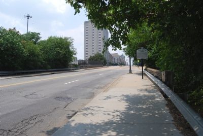
2. Marker along E Broad Street
Other markers no longer nearby. Old Negro Burial Ground (was a few steps from this marker but has been replaced with another marker now near it); a different marker also named Richmond's African Burial Ground (was within shouting distance of this marker but has been replaced with another marker now near it); a different marker also named Lumpkins Jail (was about 400 feet away but has been reported to have been replaced with another marker now near it); The Slave Trade In Richmond (was about 400 feet away but has been reported to have been replaced with another marker now near it).
Related marker. Click here for another marker that is related to this marker. This marker has been replaced with the linked marker.
Also see . . .
1. "The Defenders...'" Gabriel Marker Project. (Submitted on January 7, 2009, by Richard E. Miller of Oxon Hill, Maryland.)
2. Gabriel "Prosser".
Photographed by Evan Dwyer, November 1, 2025
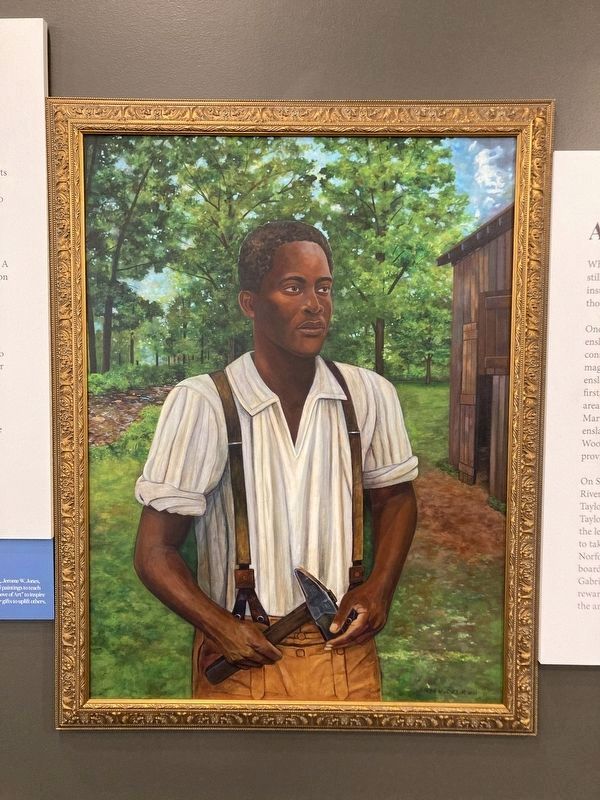
3. Gabriel of Brookfield
Portrait of Gabriel painted in 2021 by Jerome W. Jones, Jr., based on descriptions of Gabriel. Gabriel stood 6'2, had scars on his face, and was missing his two front teeth. This portrait is displayed at Meadow Farm's community center.
Additional commentary.
1. Gabriel's Execution
Prior to 1806, public hangings were done on Gallows Hill - in the vicinity of Cary and 1st Streets. Gabriel was hung there, which was "the usual place" at the time, rather than at the city gallows used from 1806 at 15th & Broad. When scholarship on Gabriel entered the 20th century, historians misunderstood "the usual place" referenced in the 1800-1803 reports on the failed insurrection to mean the city gallows at 15th & Broad without realizing that there was no gallows there until six years after Gabriel was executed.
— Submitted February 11, 2026, by Evan Dwyer of Richmond, Virginia.
Additional keywords. Gabriel's Rebellion, Slave Revolt, Conspiracy
Credits. This page was last revised on October 18, 2026. It was originally submitted on July 29, 2007, by Dawn Bowen of Fredericksburg, Virginia. This page has been viewed 6,980 times since then and 222 times this year. Last updated on January 7, 2009, by Richard E. Miller of Oxon Hill, Maryland. Photos: 1, 2. submitted on July 29, 2007, by Dawn Bowen of Fredericksburg, Virginia. 3. submitted on February 11, 2026, by Evan Dwyer of Richmond, Virginia. • Kevin W. was the editor who published this page.
Editor’s want-list for this marker. Marker scheduled to be replaced Spring 2026 with new text. New marker should have a new entry and this entry marked "permanently removed" with "replacement nearby" • Can you help?
