Green Park in St. Louis County, Missouri — The American Midwest (Upper Plains)
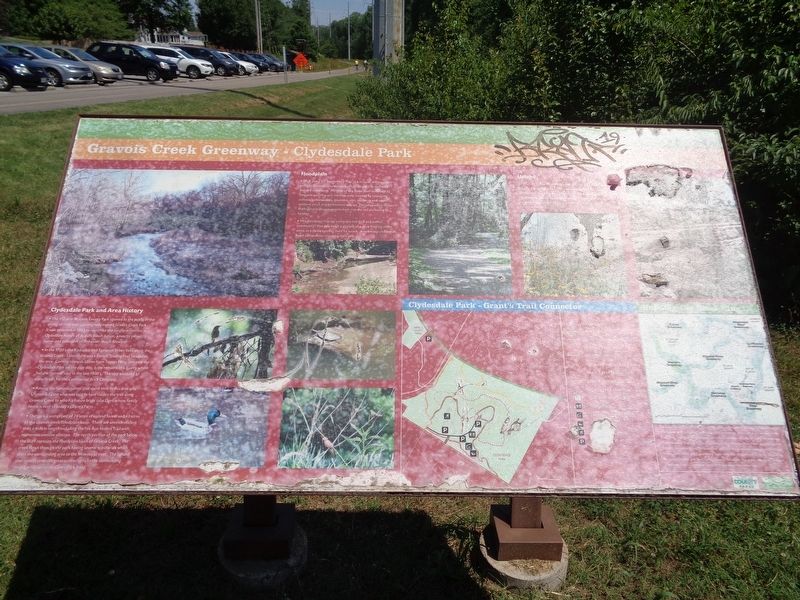
Gravois Creek Greenway - Clydesdale Park
Clydesdale Park and Area History
• The 117 acre St. Louis County Park opened to the public in the spring of 1976 and was originally named Gravois Creek Park. It was renamed in 1983 to recognize the longtime interest in Clydesdale horses of August Busch Junior, a nearby property owner and president of Anheuser-Busch Brewery.
• In the 1700's the Kaskaskia and Tamaron Tribes lived along the Gravois Creek. Later there was a French Trading Post located in the area. Coming towards Union from Tesson Ferry, just past the Clydesdale Park on the east side, is the remains of a quarry where Italians "mined" clay in the late 1800's. The clay was used to make bricks for the Continental Brick Company.
• Among the famous named that spent time in this area was Ulysses S. Grant who was said to have ridden the trail along Gravois Creek to woo his future bride Julia Dent whose family home is next to today's Grant's Farm.
• The park is comprised of 74 acres of upland forest and 43 acres of the Gravois creek floodplain basin. There are seven trails less than a mile in length including the Fox Run Fitness Trail with numerous exercise stations. The north portion of the park below the bluff contains the floodplain basin of Gravois Creek. The creek flows through the park having several tributaries which drain the surrounding area to the Mississippi river. The upland trail system provides great connections to the surrounding neighborhoods across Green Park Road.
Floodplain
• Walk along the Bottomland Trail (0.6 mi) you will see plants living in wetland natural communities adapted to deal with flooded conditions. Portions of this flood plain disturbed by frequent scouring and deposits were invaded by colonizing willows, cottonwoods, sycamore, elm, mulberry and other wetland shrub and herbaceous species. Decomposition renews the habitat putting nutrients back into the soil increasing its fertility.
• This floodplain habitat contains a rich bird and animal community. You may catch a glimpse of a duck floating in the creek or a turtle sunning itself on a rock. Amphibians and insects need wetlands for maturing their young.
Upland
As you hike up the Twin Bridge Trail you will pass a rock bluff and the side of hills filled with a kaleidoscope of colorful wildflowers. Coneflowers, Sunflowers, Black-eyed Susan and many others spread up the hillside to the forest area dominated by oaks, hickories and other tree species surrounding the ball fields on the hill top.
Erected by Great Rivers Greenway and Saint Louis County Parks.
Topics. This historical marker is listed in these topic
lists: Animals • Native Americans • Parks & Recreational Areas • Waterways & Vessels.
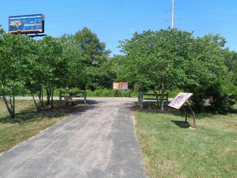
Location. 38° 31.996′ N, 90° 20.361′ W. Marker is in Green Park, Missouri, in St. Louis County. Marker can be reached from Green Park Road, on the right when traveling west. Marker is located at the intersection of two bike paths (Grant's Trail and Twin Bridges Trail), near the northwest corner of Officer Blake C. Snyder Memorial Park. Touch for map. Marker is at or near this postal address: 9801 Green Park Road, Saint Louis MO 63123, United States of America. Touch for directions.
Other nearby markers. At least 8 other markers are within 2 miles of this marker, measured as the crow flies. Evangelical Synod of North America (approx. 1.3 miles away); White Haven (approx. 1.4 miles away); A Slave Plantation (approx. 1.4 miles away); Changes at White Haven / ~150 Years Ago - Grants Horses (approx. 1.4 miles away); Grant's Departure / ~150 Years Ago (approx. 1.4 miles away); A Place Called Home / ~150 Years Ago—Petersburg (approx. 1.4 miles away); Ulysses S. Grant and the Farm at White Haven (approx. 1.4 miles away); Working Plantation / ~150 Years Ago - Emancipation (approx. 1.4 miles away).
Regarding Gravois Creek Greenway - Clydesdale Park. On October 18, 2016, Clydesdale Park was renamed Officer Blake C. Snyder Memorial Park, in honor of a St. Louis County Police officer in the Affton Southwest Precinct who was killed in the line of duty on October 6, 2016.
Three different ways to access the marker, which is not directly from any street or road:
1) from Grant's Trail, which is 8.25 miles long. Is connected to different attractions and areas (see link).
2) from the Snyder Memorial Park parking lots, which are located on Green Park Road. Follow the paved Twin Bridges Trail, which is 0.4 miles long.
3) nearby Tesson Ferry Road goes over the Grant's Trail, but you can park from Tiffany Village Ct. Take Tiffany Square Parkway (at the Circle K intersection) and Tiffany Village Ct will be the first right (it is a private residential street).
Also see . . . Bike Grant's Trail. A list of attractions, including parks, historical sites and other trails. Grant's Farm and Grant Historic Site (a National Park), both popular tourist sites, are nearby. (Submitted on June 16, 2020, by Jason Voigt of Glen Carbon, Illinois.)
Credits. This page was last revised on June 16, 2020. It was originally submitted on June 15, 2020, by Jason Voigt of Glen Carbon, Illinois. This page has been viewed 275 times since then and 38 times this year. Photos: 1, 2. submitted on June 16, 2020, by Jason Voigt of Glen Carbon, Illinois. • Devry Becker Jones was the editor who published this page.

