Fox Point in Providence in Providence County, Rhode Island — The American Northeast (New England)
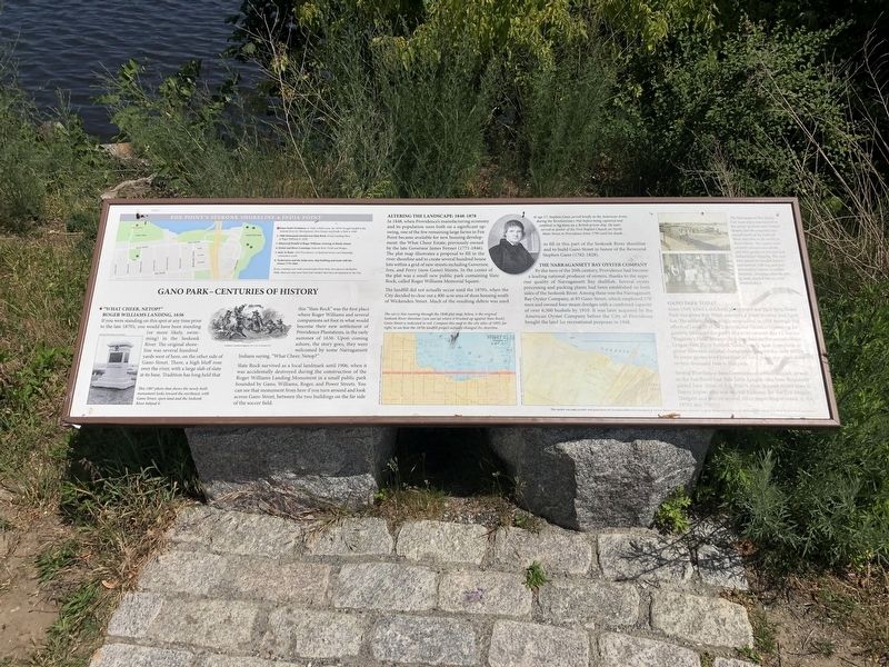
Gano Park - Centuries of History
Fox Point's Seekonk Shoreline & India Point
"What Cheer, Netop?"
Roger Williams Landing, 1636
If you were standing on this spot at any time prior to the late 1870's, you would have been standing (or more likely, swimming) in the Seekonk River. The original shoreline was several hundred yards west of here, on the other side of Gano Street. There, a high bluff rose over the river, with a large slab of slate at its base. Tradition has long held that this "Slate Rock" was the first place where Roger Williams and several companions set foot in what would become their new settlement of Providence Plantations, in the early summer of 1636. Upon coming ashore by some Narragansett Indians saying, "What Cheer, Netop?"
Slate Rock survived as a local landmark until 1906, when it was accidentally destroyed during the construction of the Roger Williams Landing Monument in a small public park bounded by Gano, Williams, Roger, and Power Streets. You can see that monument from here if you turn around and look across Gano Street, between the two buildings on the far side of the soccer field.
Altering the Landscape: 1848-1878
In 1848, when Providence's manufacturing economy and its population were both on a significant upswing, one of the few remaining large farms in Fox Point became available for new housing development: the What Cheer Estate, previously owned by the late Governor James Fenner (1771-1846). The plat map illustrates a proposal to fill in the river shoreline and to create several hundred house lots within a grid of new streets including Governor, Ives, and Ferry (now Gano) Streets. In the center of the plat was a small new public park containing Slate Rock, called Roger Williams Memorial Square.
The landfill did not actually occur until the 1870's, when the City decided to clear out a 400-acre area of slum housing south of Wickenden Street. Much of the resulting debris was used to fill in this part of the Seekonk River shoreline and to built GAno Street in honor of the Reverend Stephen GAno (1762-1828).
The Narragansett Bay Oyster Company
By the turn of the 20th century, Providence had become a leading national producer of oysters, thanks to the superior quality of Narragansett Bay shellfish. Several oyster processing and packing plants had been established on both sides of the Seekonk River. Among these was the Narragansett Bay Oyster Company, at 85 Gano Street, which employed 170 men and owned four steam dredges with a combined capacity of over 6,500 bushels by 1910. It was later acquired by the American Oyster Company before the City of Providence bought the land for recreational purposes in 1948.
Gano Park Today
Since 1949, when a children's playground
Several Providence-based recreational softball leagues, as well as the Fox Point/East Side Little League, also have frequently played here. (One of Fox Point's most famous native sons is Davey Lopes, who was second baseman for the Los Angeles Dodgers and was on several other major league teams in the 1970's and 1980's.)
Erected by Providence/Warwick Convention & Visitors Bureau's Community Relations Fund, the Rhode Island Council for the Humanities and Fox Point Neighborhood Association. (Marker Number 1.)
Topics. This historical marker is listed in these topic lists: Animals • Colonial Era • Industry & Commerce • Native Americans • Parks & Recreational Areas • Settlements & Settlers • Sports • Waterways & Vessels. A significant historical year for this entry is 1636.
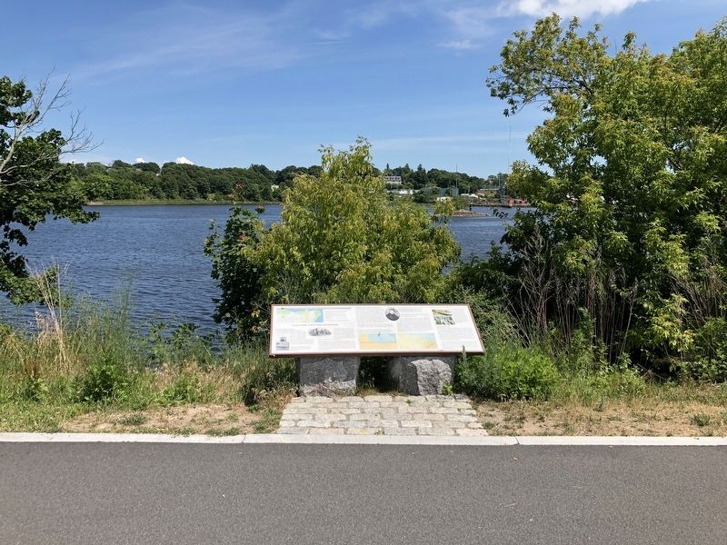
Location. 41° 49.406′ N, 71° 23.27′ W. Marker is in Providence, Rhode Island, in Providence County. It is in Fox Point. Marker is at the intersection of Old Bridge Path and Power Street, on the right when traveling south on Old Bridge Path. Touch for map. Marker is at or near this postal address: 86 Wayland Ave, Providence RI 02906, United States of America. Touch for directions.
Other nearby markers. At least 8 other markers are within walking distance of this marker. The Landing Place of Roger Williams (about 700 feet away, measured in a direct line); West Bank / East Bank / Washington Bridges (approx. 0.3 miles away); Head of Narragansett Bay / Crossing the Seekonk River (approx. 0.3 miles away); Roger Williams Landing 1636 (approx. 0.4 miles away); Washington Bridge (approx. 0.4 miles away); Bridging the Seekonk (approx. 0.4 miles away); Welcome to India Point Park / Welcome to Fox Point (approx. 0.4 miles away); Tockwotton and the Indiamen / Sails to Rails 1835: Providence's First Train Station (approx. 0.4 miles away). Touch for a list and map of all markers in Providence.
Credits. This page was last revised on February 8, 2023. It was originally submitted on June 22, 2020, by Devry Becker Jones of Washington, District of Columbia. This page has been viewed 520 times since then and 108 times this year. Photos: 1, 2. submitted on June 22, 2020, by Devry Becker Jones of Washington, District of Columbia.

