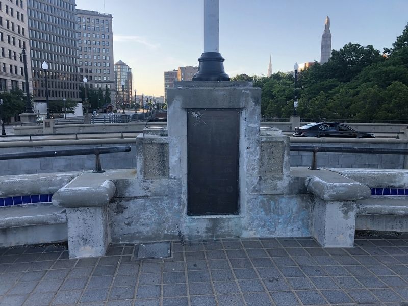
Downtown Providence in Providence County, Rhode Island — The American Northeast (New England)
River Relocation Project and Providence River Park
Dedicated to the Citizens of Providence and the State of Rhode Island
Photographed by Devry Becker Jones (CC0), June 19, 2020
1. River Relocation Project and Providence River Park Marker
Inscription.
River Relocation Project and Providence River Park. Dedicated to the Citizens of Providence and the State of Rhode Island.
History. During the late 1970's, planners began to focus on some of the longstanding urban design issues in Downtown Providence. Elevated railroad tracks and parking lots divided Downtown from the State House and Smith Hill. The Providence River, which flowed between Downtown and the East Side, was covered over with acres of roadway decking. Crosstown traffic, as well as that from interstate access ramps, comerged at the roadway decking and became congested and dangerous because of the highly irregular and ill-defined roadway pattern. Pedestrian circulation under the railroad tracks and across the roadway decking was unpleasant and dangerous., Some of these issues were addressed in 1979, with the completion of a plan to relocate the railroad station and tracks. Also included in the plan was a major Downtown interchange at Route I-95, a boulevard connecting the interchange to the north end of this roadway deck over the Providence River and Capital Center, a 35-acre development district. Financing was secured and construction began in 1982., The remaining issues were addressed in the 1983 Providence Waterfront Study sponsored by the city, State, Providence Foundation and National Endowment for the Arts. Study proposals included removal of the decking known as the World's Widest Bridge, relocation of the confluence of the rivers from under the Old Post Office, construction of a boulevard from Memorial Square south to Crawford Street, dredging of the rivers and lining the rivers with linear parks. In 1984 a bold commitment launched the project which was to change the image of the city for the next century., This project was given the official name of Memorial Boulevard Extension Project because the plan extended Capital Center's Memorial Boulevard from where it ended at Steeple Street (Memorial Square) south to Crawford Street. In time the project became known as the River Relocation Project.,
Major FeaturesMemorial Boulevard Extension. Improve and consolidate traffic patterns by extending Memorial Boulevard from Memorial Square to Crawford Street. The four-lane boulevard is located tight against the curve of the financial district with seven distinct hew bridges designed to accommodate vehicles and five other new bridges dedicated for pedestrian use. It collects and distributes traffic from the core of the city and ties it into the interstate system. Direct road and pedestrian connections now unite Downtown, College Hill, and Capital Center.,
Providence River Park. A "Y" shaped landscaped river corridor has been erected at the center of the city which connects existing parks, accommodates boat traffic and establishes and independent walkway system from Capital Center and the State House to Kennedy Plaza and Crawford Street. This has been accomplished by relocating portions of the Woonasquatucket, Moshassuck and Providence Rivers and removing the old bridges and decking that covered over one-quarter mile of the rivers., Plaques and graphic panels have been incorporated to explain and celebrate the city's waterfront heritage.,
Navigation. Boat traffic has been accommodated by dredging the rivers and establishing uniform clearance under the bridges. Three docking places are provided for boats to discharge and take on passengers. Accessibility for visiting boats along the riverwalks between these boat landings is provided by conveniently spaced boat line cleats.,
Waterplace. A four-acre park defines the western terminus of the walkway system. Some of its elements include a 30-foot high fountain, an amphitheater, several smaller plazas with seating, two pedestrian bridges and a building to accommodate a restaurant and exhibits.,
Project Milestones. November 1984: Federal, State and City funding committed February 1985: Engineering and architectural design begin March 1987: First construction contract let to dismantle the World War I Monument August 1989: Moshassuck River is relocated June 1992: Woonasquatucket River is relocated July 1994: Waterplace Park is dedicated April 1996: Project completed.
History
During the late 1970's, planners began to focus on some of the longstanding urban design issues in Downtown Providence. Elevated railroad tracks and parking lots divided Downtown from the State House and Smith Hill. The Providence River, which flowed between Downtown and the East Side, was covered over with acres of roadway decking. Crosstown traffic, as well as that from interstate access ramps, comerged at the roadway decking and became congested and dangerous because of the highly irregular and ill-defined roadway pattern. Pedestrian circulation under the railroad tracks and across the roadway decking was unpleasant and dangerous.
Some of these issues were addressed in 1979, with the completion of a plan to relocate the railroad station and tracks. Also included in the plan was a major Downtown interchange at Route I-95, a boulevard connecting the interchange to the north end of this roadway deck over the Providence River and Capital Center—a 35-acre development district. Financing was secured and construction began in 1982.
The remaining issues were addressed in the 1983 Providence Waterfront Study
Click or scan to see this page online
sponsored by the city, State, Providence Foundation and National Endowment for the Arts. Study proposals included removal of the decking known as the World's Widest Bridge, relocation of the confluence of the rivers from under the Old Post Office, construction of a boulevard from Memorial Square south to Crawford Street, dredging of the rivers and lining the rivers with linear parks. In 1984 a bold commitment launched the project which was to change the image of the city for the next century.
This project was given the official name of Memorial Boulevard Extension Project because the plan extended Capital Center's Memorial Boulevard from where it ended at Steeple Street (Memorial Square) south to Crawford Street. In time the project became known as the River Relocation Project.
Major Features Memorial Boulevard Extension
Improve and consolidate traffic patterns by extending Memorial Boulevard from Memorial Square to Crawford Street. The four-lane boulevard is located tight against the curve of the financial district with seven distinct hew bridges designed to accommodate vehicles and five other new bridges dedicated for pedestrian
Photographed by Devry Becker Jones (CC0), June 19, 2020
2. River Relocation Project and Providence River Park Marker
use. It collects and distributes traffic from the core of the city and ties it into the interstate system. Direct road and pedestrian connections now unite Downtown, College Hill, and Capital Center.
Providence River Park
A "Y" shaped landscaped river corridor has been erected at the center of the city which connects existing parks, accommodates boat traffic and establishes and independent walkway system from Capital Center and the State House to Kennedy Plaza and Crawford Street. This has been accomplished by relocating portions of the Woonasquatucket, Moshassuck and Providence Rivers and removing the old bridges and decking that covered over one-quarter mile of the rivers.
Plaques and graphic panels have been incorporated to explain and celebrate the city's waterfront heritage.
Navigation
Boat traffic has been accommodated by dredging the rivers and establishing uniform clearance under the bridges. Three docking places are provided for boats to discharge and take on passengers. Accessibility for visiting boats along the riverwalks between these boat landings is provided by conveniently spaced boat line cleats.
Waterplace
A four-acre park defines the western terminus of the walkway system. Some of its elements include a 30-foot high fountain, an amphitheater, several smaller plazas with seating, two pedestrian bridges and a building to accommodate a restaurant and exhibits.
Project Milestones
November 1984: Federal, State and City funding committed February 1985: Engineering and architectural design begin March 1987: First construction contract let to dismantle the World War I Monument August 1989: Moshassuck River is relocated June 1992: Woonasquatucket River is relocated July 1994: Waterplace Park is dedicated April 1996: Project completed.
Location. 41° 49.451′ N, 71° 24.469′ W. Marker has been reported damaged. Marker is in Providence, Rhode Island, in Providence County. It is in Downtown Providence. It is at the intersection of South Water Street (U.S. 44) and Memorial Boulevard (U.S. 44), on the right when traveling east on South Water Street. Touch for map. Marker is in this post office area: Providence RI 02903, United States of America. Touch for directions.

Regionally, this marker is on Rhode Island’s Narragansett Bay. It is also in the American Northeast, in New England, and on the Eastern Seaboard. Globally, it is in the North Atlantic Region, North America, the Western Hemisphere, the Western World, and the Anglosphere. Historically, it finds itself in what was once one of the original Thirteen Colonies.
Credits. This page was last revised on February 8, 2023. It was originally submitted on June 22, 2020, by Devry Becker Jones of Washington, District of Columbia. This page has been viewed 1,061 times since then and 326 times this year. Photos:1, 2. submitted on June 22, 2020, by Devry Becker Jones of Washington, District of Columbia.