Friendsville in Garrett County, Maryland — The American Northeast (Mid-Atlantic)
Native American Visitors and Inhabitants

Photographed By Devry Becker Jones (CC0), July 17, 2020
1. Native American Visitors and Inhabitants Marker
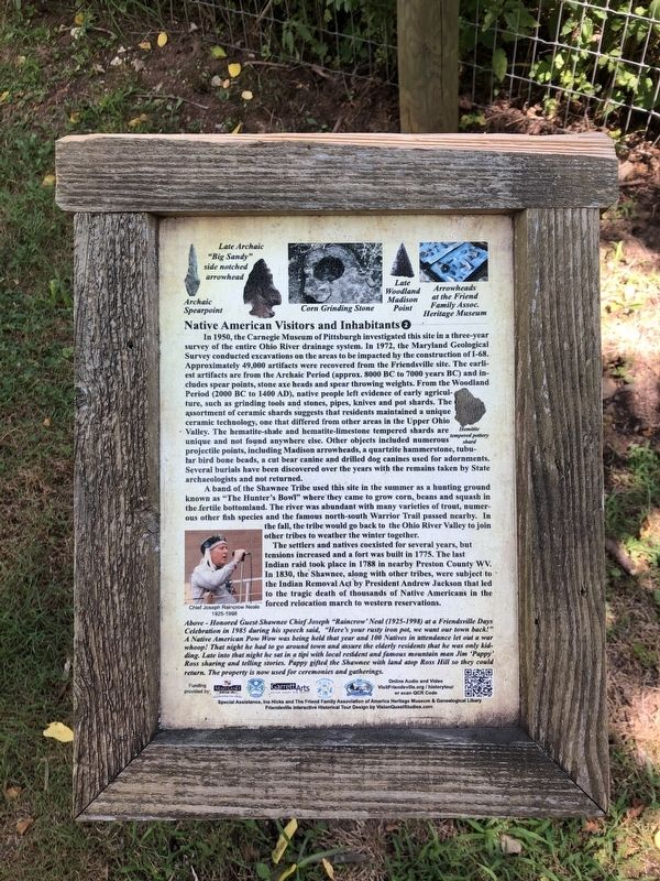
In 1950, the Carnegie Museum of Pittsburgh investigated this site in a three-year survey of the entire Ohio River drainage system. In 1972, the Maryland Geographical Survey conducted excavations on the areas to be impacted by the construction of I-68. Approximately 49,000 artifacts were recovered from the Friendsville site. The earliest artifacts are from the Archaic Period (approx. 8000 BC to 7000 years BC) and includes spear points, stone axe heads and spear throwing weights. From the Woodland Period (2000 BC to 1400 AD), native people left evidence of early agriculture, such as grinding tools and stones, pipes, knives and pot shards. The ceramic technology, one that differed from other areas in the Upper Ohio Valley. The hematite-shale and hematite-limestone tempered shards are unique and not found anywhere else. Other objects included numerous projectile points, including Madison arrowheads, a quartzite hammerstone, tubular bird bone beads, a cut bear canine and drilled dog canines used for adornments. Several burials have been discovered over the years with the remains taken by State archaeologists and not returned.
A band of the Shawnee Tribe used this site in the summer as a hunting ground known as "The Hunter's Bowl" where they came to grow corn, beans and squash in the fertile bottomland. The river was abundant with many varieties of trout, numerous other fish species and the famous north-south Warrior Trail passed nearby. In the fall, the tribe would go back to the Ohio River Valley to join other tribes to weather the winter together.
The settlers and natives coexisted for several years, but tensions increased and a fort was built in 1775. The last Indian raid took place in 1788 in nearby Preston County WV. In 1830, the Shawnee, along with other tribes, were subject to the Indian Removal Act by President Andrew Jackson that led to the tragic death of thousands of Native Americans in the forced relocation march to western reservations.
[Caption:]
Above - Honored Guest Shawnee Chief Joseph "Raincrow' Neal (1925-1998) at a Friendsville Days Celebration in 1985 during his speech said, "Here's your rusty iron pot, we want our town back!" A Native American Pow Wow was being held that year and 100 Natives in attendance let out a war whoop! That night he had to go around town and assure the elderly residents that he was only kidding. Late into that night he sat in a tipi with local resident and famous mountain man Jim 'Pappy' Ross sharing and telling stories. Pappy gifted the Shawnee with land atop Ross Hill so they could return. The property is now used for ceremonies and gatherings.
Erected by Maryland

Photographed By Devry Becker Jones (CC0), July 17, 2020
2. Native American Visitors and Inhabitants Marker
Topics and series. This historical marker is listed in these topic lists: Agriculture • Anthropology & Archaeology • Forts and Castles • Native Americans. In addition, it is included in the Maryland, Friendsville History Tour series list. A significant historical year for this entry is 1950.
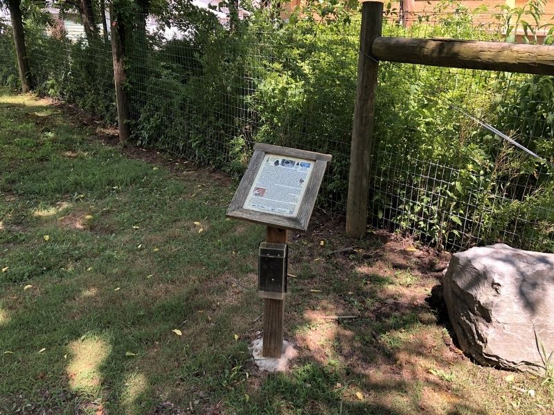
Location. 39° 39.712′ N, 79° 24.555′ W. Marker is in Friendsville, Maryland, in Garrett County. Marker can be reached from Church Lane just west of Water Street, on the left when traveling west. The marker is at the southern tip of parking lot just west of the Methodist Church. Touch for map. Marker is at or near this postal address: 615 Water St, Friendsville MD 21531, United States of America. Touch for directions.
Other nearby markers. At least 8 other markers are within walking distance of this marker. The Lost Settlement of Kendall (about 500 feet away, measured in a direct line); Riverside Hotel & Knights of Pythias (about 700 feet away); The Legend of Johnny Friend (about 700 feet away); Friendsville Commerce, Custer's and Ryland's Stores (approx. 0.2 miles away); The Railroad Era and Hotels (approx. 0.2 miles away); Water Street North, Captain Elijah Monroe Friend (approx. 0.2 miles away); Friend’s Graveyard (approx. 0.2 miles away); Morris Avenue and Maple Street (approx. 0.2 miles away). Touch for a list and map of all markers in Friendsville.
Credits. This page was last revised on July 19, 2020. It was originally submitted on July 19, 2020, by Devry Becker Jones of Washington, District of Columbia. This page has been viewed 346 times since then and 34 times this year. Photos: 1, 2. submitted on July 19, 2020, by Devry Becker Jones of Washington, District of Columbia.