Mission Hills in Los Angeles in Los Angeles County, California — The American West (Pacific Coastal)
Mission Dam
Photographed by Chris English, March 26, 2014
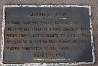
1. Mission Dam Marker
Rubble masonry water storage dam built by San Fernando Mission Indians in 1808. Water flowed to the mission via a tiled pipe.
Erected 1972 by Native Daughters of the Golden West.
Topics and series. This historical marker is listed in these topic lists: Hispanic Americans • Indigenous Peoples and Communities • Man-Made Features • Natural Resources. In addition, it is included in the Native Sons/Daughters of the Golden West series list. A significant historical year for this entry is 1808.
Location. 34° 16.75′ N, 118° 27.401′ W. Marker is in Los Angeles, California, in Los Angeles County. It is in Mission Hills. It is on Rinaldi Street 0.1 miles east of Indian Hills Road, on the left when traveling east. Touch for map. Marker is at or near this postal address: 14801 Rinaldi St, Mission Hills CA 91345, United States of America. Touch for directions.

Regionally, this marker is in The Valley (the San Fernando Valley) and in the Transverse Ranges. It is also on the American Pacific Coast. Globally, it is in North America, on the Ring of Fire, on the Pacific Rim, in the Western Hemisphere, in the
this page online
Other nearby markers. At least 8 other markers are within walking distance of this marker: Armenian History Timeline (approx. 0.4 miles away); Armenian-American Veterans Garden (approx. 0.4 miles away); Khatchkar (approx. 0.4 miles away); Trinity Church (approx. 0.4 miles away); Moai from Easter Island (approx. half a mile away); San Fernando Mission (approx. half a mile away); Mission San Fernando Rey de España (approx. half a mile away); Fray Fermin Francisco de Lasuen, O.F.M. (approx. half a mile away). Touch for a list and map of all markers in Los Angeles.
Regarding Mission Dam. This site is near Indian Hills Road. At the north end of Indian Hills Road are properties planted with Blue Elderberry, large cactus, and shrubs important to the native people of the area. A village or food site was near this location. One elderberry is centuries old. The last sycamore is dying. The land is now situated between two Interstate highways. Like any historical site, this area has some fascinating stories
Photographed by Chris English, March 26, 2014
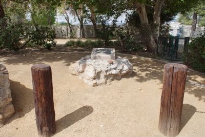
2. Mission Dam Marker
In 2024, expansion of nearby Eden Memorial Park destroyed the village site.
The Mission Dam is all that remains.
Related markers. Click here for a list of markers that are related to this marker. To better understand the relationship, study each marker in the order shown.
Additional keywords. civil engineering, water system, natural resources
Photographed by Chris English, March 26, 2014
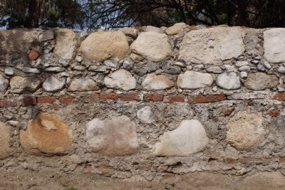
3. Mission Dam Construction
The dam is built of rubble, cement mortar and fired adobe brick.
Photographed by Chris English, March 26, 2014
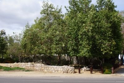
4. Mission Dam
The dam was much larger than what remains.

5. Waterworks Dam
Photo on display inside San Fernando Mission.
Credits. This page was last revised on March 6, 2026. It was originally submitted on March 26, 2014. This page has been viewed 1,967 times since then and 89 times this year. Last updated on September 20, 2020, by Craig Baker of Sylmar, California. Photos: 1. submitted on March 26, 2014, by Chris English of Phoenix, Arizona. 2, 3, 4. submitted on March 27, 2014, by Chris English of Phoenix, Arizona. 5. submitted on March 6, 2026, by Craig Baker of Sylmar, California. • J. Makali Bruton was the editor who published this page.
