Uptown in San Antonio in Bexar County, Texas — The American South (West South Central)
Comanche Lookout
October 13, 2012
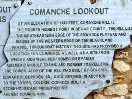
1. Comanche Lookout Marker
Topics and series. This historical marker is listed in these topic lists: Hispanic Americans • Indigenous Peoples and Communities • Roads & Vehicles. In addition, it is included in the El Camino Real de los Tejas National Historic Trail series list. A significant historical year for this entry is 1340.
Location. 29° 34.964′ N, 98° 22.01′ W. Marker is in San Antonio, Texas, in Bexar County. It is in Uptown. It can be reached from the intersection of Nacogdoches Road (Farm to Market Road 2252) and Toepperwein Road, on the right when traveling west. Touch for map. Marker is at or near this postal address: 15551 Nacogdoches Rd, San Antonio TX 78247, United States of America. Touch for directions.

Regionally, this marker is in South Texas. It is also in the American South. Globally, it is in North America, a Gulf of Mexico state, the Western Hemisphere, the Western World, and the Anglosphere. Historically, it finds itself in what was once New Spain, the Republic of Texas, and one of the Confederate States of America.
Other nearby markers. At least 8 other markers are within 4 miles of this marker, measured as the crow flies: Comanche Lookout Park (here, next to this marker); Kings Highway Camino Real — Old San Antonio Road (approx.
this page online
Also see . . .
1. San Antonio Parks and Recreation Website. Discusses history of Comanche Lookout including its location on the Camino Real. (Submitted on October 15, 2012, by Richard Denney of Austin, Texas.)
2. An Archaeological Investigation of Comanche Lookout Park, Northeast Bexar County, Texas (pdf file). University of Texas at San Antonio report available online. (Submitted on October 15, 2012, by Richard Denney of Austin, Texas.)
October 13, 2012
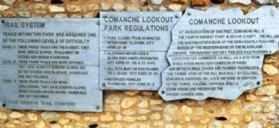
2. Comanche Lookout Marker
Marker in context next to other information the City of San Antonio has provided as part of the park.
Photographed by Richard Denney, May 20, 2003
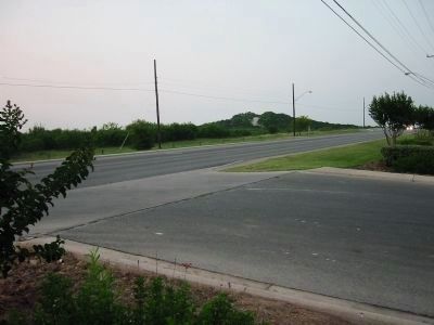
3. Comanche Lookout Hill
Photo from Nacogdoches Road, looking northeast. Nacogdoches Road is part of the old Camino Real leading from this point to Nacogdoches, in east Texas and beyond.
Photographed by Michael Heinich, April 20, 2013
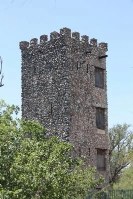
4. Tower
This is the tower up on the hill mentioned in the marker.
Photographed by Richard Denney
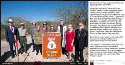
5. El Camino Real de los Tejas National Historic Trail
From the El Camino Real de los Tejas National Historic Trail Facebook page: "National and local officials, private groups and residents attended a ribbon-cutting ceremony [March 2015] for the El Camino Real de los Tejas National Historic Trail. The event took place in front of Comanche Lookout Park; the park’s signature hill once acted as a marker on the original El Camino Real route..."
Credits. This page was last revised on February 2, 2023. It was originally submitted on October 15, 2012. This page has been viewed 3,274 times since then and 230 times this year. Last updated on October 5, 2020, by Richard Denney of Austin, Texas. Photos: 1, 2, 3. submitted on October 15, 2012, by Richard Denney of Austin, Texas. 4. submitted on June 29, 2014, by Michael Heinich of Austin, Texas. 5. submitted on March 5, 2016, by Richard Denney of Austin, Texas. • J. Makali Bruton was the editor who published this page.
