Whose Water Is It?
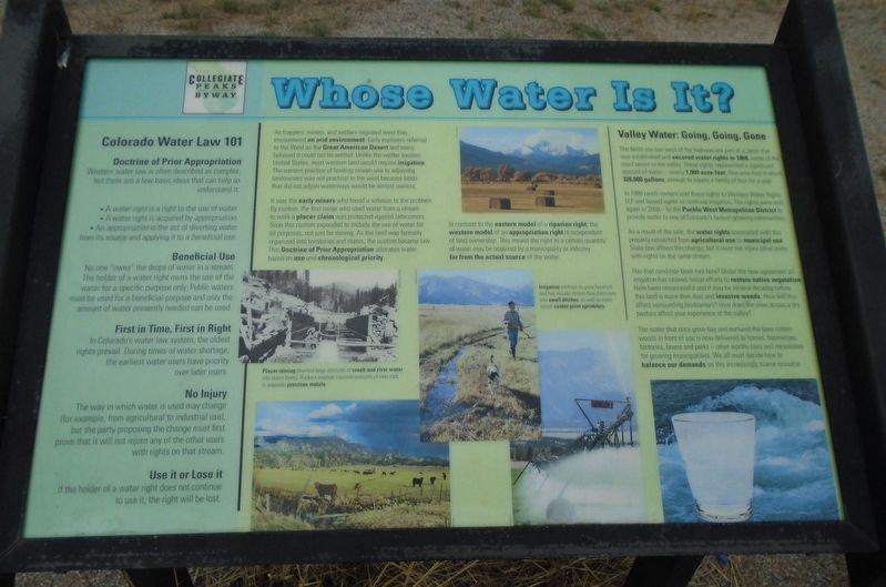
As trappers, miners, and settlers migrated west they encountered an arid environment. Early explorers referred to the West as the Great American Desert and many believed it could not be settled. Unlike the wetter eastern United States, most western land would require irrigation. The eastern practice of limiting stream use to adjoining landowners was not practical in the west because lands that did not adjoin waterways would be almost useless.
It was the early miners who found a solution to the problem. By custom, the first miner who used water from a stream to work a placer claim was protected against latecomers. Soon this custom expanded to include the use of water for all purposes, not just for mining. As the land was formally organized into territories and states, the custom became law. This Doctrine of Prior Appropriation allocates water based on use and chronological priority.
Placer mining diverted large amounts of creek and river water into sluice boxes. Rockers washed massive amounts of river rock to separate precious metals.
In contrast to the eastern model of a riparian right, the western model of an appropriate right is independent of land ownership. This means the right to a certain quantity of water may
be acquired by a municipality or industry far from the actual source of the water.Irrigation methods to grow livestock and hay include stream-flow diversions into small ditches, as well as more recent center-pivot sprinklers.
Valley Water: Going, Going, Gone
The fields you see west of the highway are part of a ranch that was established and secured water rights in 1868, some of the most senior in the valley. These rights represented a significant amount of water—nearly 1,900 acre-feet. One acre-foot is about 326,000 gallons, enough to supply a family of four for a year.
In 1986 ranch owners sold these rights to Western Water Rights LLP and leased water to continue irrigation. The rights were sold again in 2008—to the Pueblo West Metropolitan District to provide water to one of Colorado's fastest-growing communities.
As a result of the sale, the water rights associated with this property converted from agricultural use to municipal use. State law allows this change, but it must not injure other users with rights on the same stream.
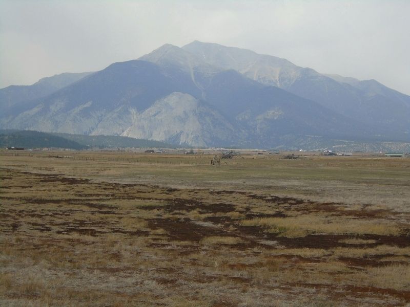
Has that condition been met here? Under the new agreement all irrigation has ceased. Initial efforts to restore native vegetation have been unsuccessful and it may be several decades before this land is more than dust and invasive weeds.
How will this affect surrounding landowners? How does the view across a dry pasture affect your experience of the valleyThe water that once grew hay and nurtured the bare cottonwoods in front of you is now delivered to homes, businesses, factories, lawns and parks—other worthy uses and necessities for growing municipalities. We all must decide how to balance our demands on this increasingly scarce resource.
Colorado Water Law 101
Doctrine of Prior Appropriation
Western water law is often described as complex, but there are a few basic ideas that can help us understand it:
• A water right is a right to the use of water.
• A water right is acquired by appropriation.
• An appropriation is the act of diverting water from its source and applying it to a beneficial use.
Beneficial Use
No one "owns" the drops of water in a stream. The holder of a water right owns the use of the water for a special purpose only. Public waters must be used for a beneficial purpose and only the amount of water presently needed can be used.
First in Time, First in Right
In Colorado's water law system, the oldest rights prevail. During times of water shortage, the earliest water users have priority over later users.
No Injury
The way in which water is used may change (for example, from
Use it or Lose it
If the holder of a water right does not continue to use it, the right will be lost.
Erected 2009 by Collegiate Peaks Byway, National Scenic Byways, and Greater Arkansas River Nature Association.
Topics. This historical marker is listed in these topic lists: Agriculture • Environment • Settlements & Settlers • Waterways & Vessels. A significant historical year for this entry is 1868.
Location. 38° 42.679′ N, 106° 5.517′ W. Marker is near Nathrop, Colorado, in Chaffee County. Marker is on U.S. 285, 2 miles south of Chalk Creek Drive, on the right when traveling south. Touch for map. Marker is in this post office area: Nathrop CO 81236, United States of America. Touch for directions.
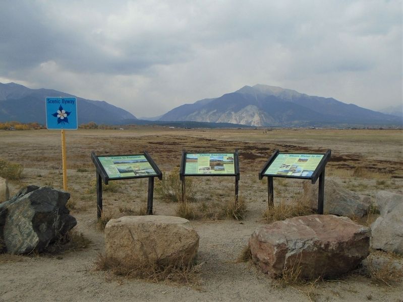
Other nearby markers. At least 7 other markers are within 14 miles of this marker, measured as the crow flies. Valley Ranching (here, next to this marker); Peaks to Pastures (here, next to this marker); Christmas 1806 (approx. 8.2 miles away); Finding Our Roots / New Faces Along the River / Pike Explores the Valley (approx. 8.3 miles away); The Salida Steam Plant (approx. 13.2 miles away); Chaffee County Honor Roll Board (approx. 13.3 miles away); The Jackson Hotel (approx. 13.8 miles away).
Also see . . .
1. The State of Water Rights and Western U.S. Water Markets. Hillsdale College website entry (Submitted on October 24, 2020, by William Fischer, Jr. of Scranton, Pennsylvania.)
2. Collegiate Peaks Byway. Go Colorado website entry (Submitted on July 27, 2021, by Larry Gertner of New York, New York.)
Credits. This page was last revised on July 27, 2021. It was originally submitted on October 24, 2020, by William Fischer, Jr. of Scranton, Pennsylvania. This page has been viewed 175 times since then and 13 times this year. Photos: 1, 2, 3. submitted on October 24, 2020, by William Fischer, Jr. of Scranton, Pennsylvania.


