Near Winchester in Frederick County, Virginia — The American South (Mid-Atlantic)
The Pritchard House
A Family Caught in the Midst of War!
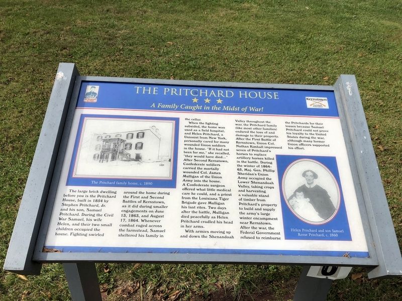
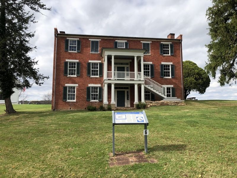
The large brick dwelling before you is the Pritchard House, built in 1854 by Stephen Pritchard, Jr. and his son, Samuel Pritchard. During the Civil War Samuel, his wife Helen, and their two small children occupied the house. Fighting swirled around the home during the First and Second Battles of Kernstown, as it did during smaller engagements on June 13, 1863, and August 17, 1864. Whenever combat raged across the farmstead, Samuel sheltered his family in the cellar.
When the fighting subsided, the home was used as a field hospital, and Helen Pritchard, a Unionist from New York, personally cared for many wounded Union soldiers in the house. "If it had not been for me," she recalled, "they would have died…" After Second Kernstown, Confederate soldiers carried the mortally wounded Col. James Mulligan of the Union Army into the house. A Confederate surgeon offered what little medical care he could, and a priest from the Louisiana Tiger Brigade gave Mulligan his last rites. Two days after the battle, Mulligan died peacefully as Helen Pritchard cradled his head in her arms.
With armies moving up and down the Shenandoah Valley throughout the war, the Pritchard family (like most other families) endured the loss of and damage to their property. After the First Battle of Kernstown, Union Col. Nathan Kimball impressed seven of Pritchard's horses to replace artillery horses killed in the battle. During the winter of 1864-65, Maj. Gen. Phillip Sheridan's Union Army occupied the Lower Shenandoah Valley, taking crops and harvesting a valuable stand of timber from Pritchard's property to build and supply the army's large winter encampment near Kernstown. After the war, the Federal Government refused to reimburse the Pritchards for their losses because Samuel Pritchard could not prove his loyalty to the United States during the war, although many former Union officers supported his effort.
Erected by Shenandoah At War; Kernstown Battlefield Association.
Topics. This historical marker is listed in these topic lists: Science & Medicine • War, US Civil. A significant historical date for this entry is June 13, 1863.
Location. 39° 8.602′ N, 78° 11.8′ W. Marker is near Winchester, Virginia, in Frederick County. Marker can be reached from the intersection of Battlefield Park Drive and Saratoga Drive, on the right when traveling west. Touch for map. Marker is at or near this postal address: 610 Battle Park Dr, Winchester VA 22601, United States of America. Touch for directions.
Other nearby markers. At least 8 other markers are within walking distance of this marker. The Second Battle of Kernstown (within shouting distance of this marker); The First Battle of Kernstown (within shouting distance of this marker); a different marker also named Second Battle of Kernstown
Related marker. Click here for another marker that is related to this marker. This marker has replaced the linked marker.
Credits. This page was last revised on July 7, 2021. It was originally submitted on November 2, 2020, by Devry Becker Jones of Washington, District of Columbia. This page has been viewed 325 times since then and 31 times this year. Last updated on November 2, 2020, by Bradley Owen of Morgantown, West Virginia. Photos: 1, 2. submitted on November 2, 2020, by Devry Becker Jones of Washington, District of Columbia.

